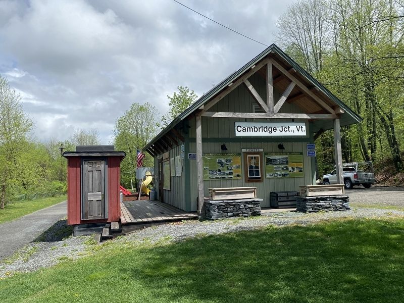
Jeffersonville in Cambridge in Lamoille County, Vermont — The American Northeast (New England)
Cambridge Rail Era History I
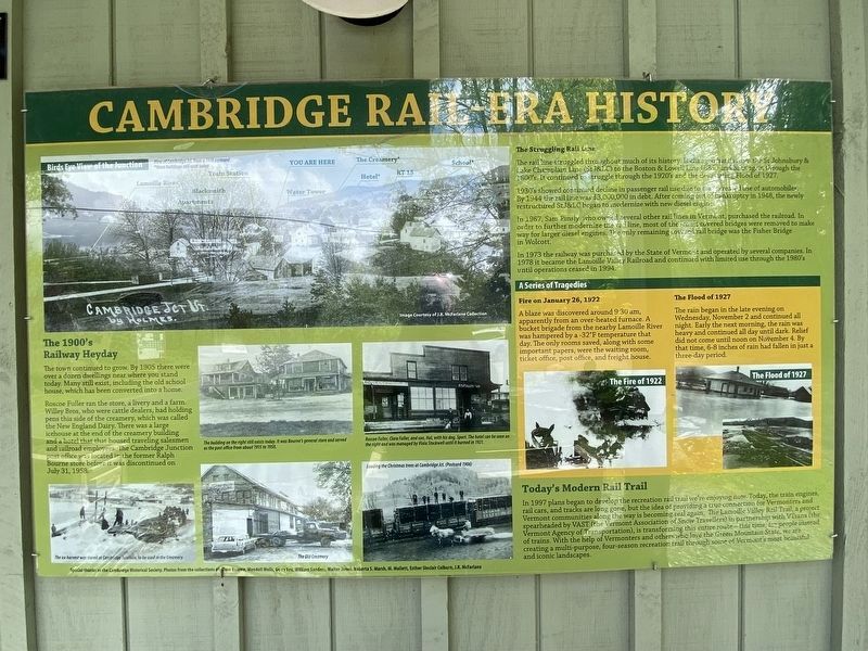
The town continued to grow. By 1905 there were over a dozen dwellings new where you stand today. Many still exist, including the old school house, which has been converted into a home.
Roscoe Fuller ran the store, a livery and a farm. Willey Bros., who were cattle dealers, had holding pens this side of the creamery, which was called the New England Dairy. There was a large icehouse at the end of th creamery building and a hotel that housed traveling salesmen and railroad employees. The Cambridge Junction post office was located in the former Ralph Bourne store before it was discontinued on July 31, 1958.
The Struggling Rail Line
The rail line struggled throughout much of its history. It changed hands from the St. Johnsbury & Lake Champlain Line (StJ&LC) to the Boston & Lowell (B&L) and back again through the 1800's. It continued to struggle through the 1920's and the devastating Flood of 1927.
1930's showed continued decline in passenger rail use due to the increased use of automobiles. By 1944 the rail line was $3,000,000 in debt. After coming out of bankruptcy 1948, the newly restructured StJ&LC began to modernize with new diesel engines.
In 1967, Sam Pinsly who owned several other rail lines in Vermont, purchased the railroad. In order to further modernize the rail line, most of the iconic covered bridges were removed to make way for larger diesel engines. The only remaining covered rail bridge was the Fisher Bridge.
In 1973 the railway was purchased by the State of Vermont and operated by several companies. In 1978 it became the Lamoille Valley Railroad and continued with limited use through the 1980's until operations ceased in 1994.
A series of Tragedies Fire on January 26, 1922
A blaze was discovered around 9:30am, apparently from an over-heated furnace. A bucket brigade from the nearby Lamoille River was hampered by a -32 degree Farhenheit temperature that day. The only rooms saved, along with some important papers, were the waiting room, ticket office, post office, and freight house.
The Flood of 1927
The rain began in the late evening on Wednesday, November 2 and continued all night. Early the next morning, the rain was heavy and continued all day until dark. Relief did not come until noon on November 4. By that time, 6-8 inches of rain had fallen in just a three-day period.
Topics. This historical marker is listed in this topic list: Railroads & Streetcars.
Location. 44° 39.042′ N, 72° 48.85′ W. Marker is in Cambridge, Vermont, in Lamoille County. It is in Jeffersonville. Marker is on Cambridge Junction Road, on the right when traveling north. Touch for map. Marker is at or near this postal address: 31 Cambridge Junction Rd, Jeffersonville VT 05464, United States of America. Touch for directions.
Other nearby markers. At least 8 other markers are within 9 miles of this marker, measured as the crow flies. Cambridge Rail Era History II (here, next to this marker); Cambridge Junction Bridge (within shouting distance of this marker); G.A.R. Cambridge, VT (approx. 3.1 miles away); Julian Scott (approx. 6.3 miles away); Town of Johnson World War and Spanish War Honor Roll (approx. 6.4 miles away); Town of Johnson Civil War Honor Roll (approx. 6˝ miles away); Mount Mansfield Natural Area (approx. 8.4 miles away); George Washington Henderson (approx. 8.7 miles away). Touch for a list and map of all markers in Cambridge.
Credits. This page was last revised on February 16, 2023. It was originally submitted on October 14, 2022, by Darren Jefferson Clay of Duluth, Georgia. This page has been viewed 99 times since then and 27 times this year. Photos: 1, 2. submitted on October 16, 2022, by Darren Jefferson Clay of Duluth, Georgia. • Bill Pfingsten was the editor who published this page.

