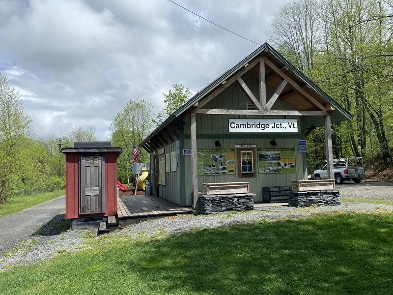
Jeffersonville in Cambridge in Lamoille County, Vermont — The American Northeast (New England)
Cambridge Rail Era History II
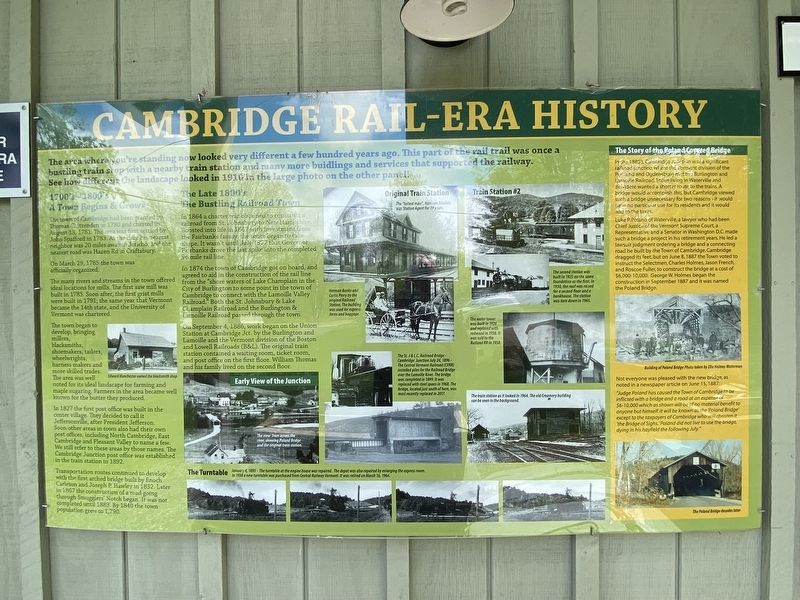
1700's-1800's A Town Begins and Grows
The town of Cambridge had been granted by Thomas Chittenden in 1780 and charted in August 13, 1781. The area was first settled by John Stafford in 1783. At the time his nearest neighbor was 20 miles away in Jericho, and the nearest road was Hazen Rd in Craftsbury.
On March 29, 1785 the town was officially organized.
The many rivers and streams in the town offered ideal locations for mills. The first saw mill was built in 1785. Soon after, the first grist mills were built in 1791; the same year that Vermont became the 14th state, and the University of Vermont was chartered.
The town began to develop, bringing millers, blacksmiths, shoemakers, tailors, wheelwrights, harness makers, and more skilled trades. The area was well noted for its ideal landscape for farming and maple sugaring. Farmers in the area became well known for th butter they produced.
In 1827 the first post office was built in the center village. They decided to call it Jeffersonville, after President Jefferson. Soon other areas in town also had their own post offices, including North Cambridge, East Cambridge, and Pleasant Valley to name a few. We still refer to these areas by those names. The Cambridge Junction post office was established in the train stations in 1892.
Transportation routes continued to develop with the first arched bridge built by Enoch Carleton and Joseph P. Hawley in 1832. Later in 1867 the construction of a road going through Smugglers' Notch began. It was not completed until 1883. By 1840 the town population grew to 1,790.
The Late 1800's The Bustling Railroad Town
In 1864 a charter was obtained to construct a railroad from St. Johnsbury to New Hampshire. Boosted into life in 1867 with investment from the Fairbanks family, the rout began to take shape. It wasn't until July 1877 that Governor Fairbanks drove the last spike into the completed 96 mile rail line.
In 1874 the town of Cambridge got on board, and agreed to aid in the construction of the rail line from the "Shore waters of Lake Champlain in the City of Burlington to some point in the town of Cambridge to connect with the Lamoille Valley Railroad." Both the St. Johnsbury & Lake Champlain Railroad and the Burlington & Lamoille Railroad passed through the town.
On September 4, 1886, work began on the Union Station at Cambridge Jct. by the Burlington and Lamoille and the Vermont division of the Boston and Lowell Railroads (B&L). The original train station contained a waiting room, ticket room, and post office on the first floor. William Thomas and his family lived on the second floor.
The Story of the Poland Covered Bridge
In the 1800's, Cambridge Junction was a significant railroad junction where the Vermont division of the Portland and Ogdensburg met the Burlington and Lamoille Railroad. Those living in Waterville and Belvedere wanted a shorter route to the trains. A bridge would accomplish this, but Cambridge viewed such a bridge unnecessary for two reasons- it would have no particular use for its residents and it would add to the taxes.
Luke P. Poland of Waterville, a lawyer who had been Chief Justice of the Vermont Supreme Court, a Representative and a Senator in Washington D.C. made such bridge a project in his retirement years. He led a lawsuit judgment ordering a bridge and a connecting road be built by the Town of Cambridge. Cambridge dragged its feet, but on June 8, 1887 the town voted to instruct the Selectmen, Charles Holmes, Jason French, and Roscoe Fuller, to construct the bridge at a cost of $6,000-10,000. George W. Holmes began the construction in September 1887 and it was named the Poland Bridge.
Not everyone was pleased with the new bridge, as noted in a newspaper article on June 15, 1887: "Judge Poland has caused the Town of Cambridge to be inflicted with a bridge and a road at an expense of $6-10,000 which as shown will be of no material benefit to anyone but himself. It will be known as the 'Poland Bridge' except to the taxpayers of Cambridge who will christen it 'the Bridge of Sighs.' Poland did not live to use the bridge, dying in his hayfield the following July."
Topics. This historical marker is listed in these topic lists: Bridges & Viaducts • Railroads & Streetcars.
Location. 44° 39.041′ N, 72° 48.85′ W. Marker is in Cambridge, Vermont, in Lamoille County. It is in Jeffersonville. Marker is on Cambridge Junction Road, on the right when traveling north. Touch for map. Marker is at or near this postal address: 31 Cambridge Junction Rd, Jeffersonville VT 05464, United States of America. Touch for directions.
Other nearby markers. At least 8 other markers are within 9 miles of this marker, measured as the crow flies. Cambridge Rail Era History I (here, next to this marker); Cambridge Junction Bridge (within shouting distance of this marker); G.A.R. Cambridge, VT (approx. 3.1 miles away); Julian Scott (approx. 6.3 miles away); Town of Johnson World War and Spanish War Honor Roll (approx. 6.4 miles away); Town of Johnson Civil War Honor Roll (approx. 6˝ miles away); Mount Mansfield Natural Area (approx. 8.4 miles away); George Washington Henderson (approx. 8.7 miles away). Touch for a list and map of all markers in Cambridge.
Credits. This page was last revised on February 16, 2023. It was originally submitted on October 14, 2022, by Darren Jefferson Clay of Duluth, Georgia. This page has been viewed 168 times since then and 58 times this year. Photos: 1, 2. submitted on October 16, 2022, by Darren Jefferson Clay of Duluth, Georgia. • Bill Pfingsten was the editor who published this page.

