Near Marlin in Falls County, Texas — The American South (West South Central)
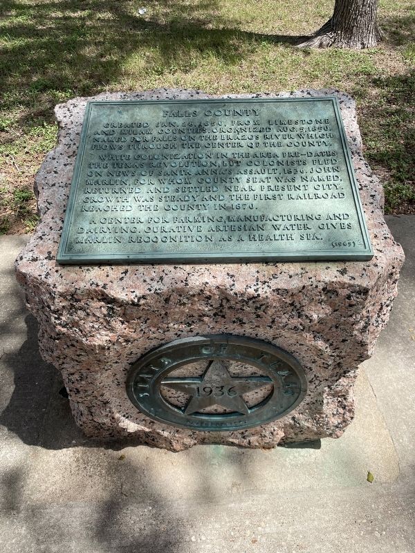
Falls County
White colonization in the area pre-dates the Texas Revolution, but colonists fled on news of Santa Anna's assault, 1836. John Marlin, for whom county seat was named, returned and settled near present city. Growth was steady and the first railroad reached the county in 1870.
A center for farming, manufacturing and dairying. Curative artesian water gives Marlin recognition as a health spa.
Erected 1936 by the State of Texas. (Marker Number 1562.)
Topics and series. This historical marker is listed in this topic list: Political Subdivisions. In addition, it is included in the Texas 1936 Centennial Markers and Monuments series list. A significant historical date for this entry is January 28, 1850.
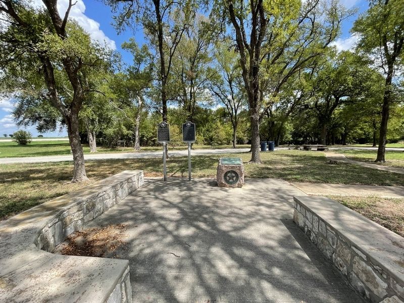
Location. 31° 14.927′ N, 96° 50.842′ W. Marker is near Marlin, Texas, in Falls County. Marker is on State Highway 6, 0.3 miles north of County Road 223, on the right when traveling south. Marker is located in a roadside picnic area. Touch for map. Marker is in this post office area: Marlin TX 76661, United States of America. Touch for directions.
Other nearby markers. At least 8 other markers are within 5 miles of this marker, measured as the crow flies. Sarahville de Viesca (here, next to this marker); General Thomas Harrison (here, next to this marker); Site of Bucksnort (approx. 3.2 miles away); Falls of the Brazos River (approx. 4.3 miles away); Greater Providence Missionary Baptist Church (approx. 4˝ miles away); The Rev. Nelson T. Denson and Marlin Missionary Baptist Church (approx. 4.6 miles away); First United Methodist Church (approx. 4.8 miles away); First Baptist Church of Marlin (approx. 4.9 miles away). Touch for a list and map of all markers in Marlin.
More about this marker. This marker's original 1936 text plate was replaced with a new text plate in 1965.
Also see . . . Falls County - The Handbook of Texas Online. Texas State Historical Association (TSHA) (Submitted on October 22, 2022, by Brian Anderson of Humble, Texas.)
Credits. This page was last revised on October 22, 2022. It was originally submitted on October 22, 2022, by Brian Anderson of Humble, Texas. This page has been viewed 141 times since then and 23 times this year. Photos: 1, 2. submitted on October 22, 2022, by Brian Anderson of Humble, Texas.

