Grandin Village in Roanoke, Virginia — The American South (Mid-Atlantic)
Fire Station No. 7
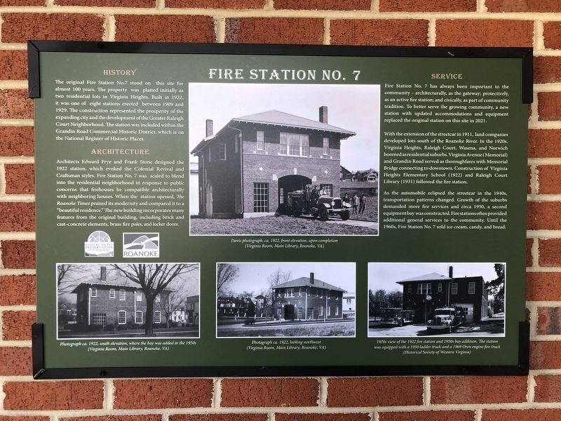
Architecture Architects Edward Frye and Frank Stone designed the 1922 station, which evoked the Colonial Revival and Craftsman styles. Fire Station No. 7 was scaled to blend into the residential neighborhood in response to public concerns that firehouses be compatible architecturally with neighboring houses. When the station opened, The Roanoke Times praised its modernity and compared it to a “beautiful residence.” The new building incorporates many features from the original building, including brick and cast concrete elements, brass fire poles, and locker doors.
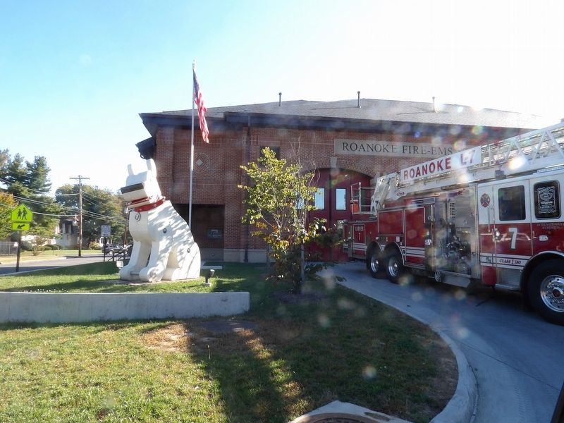
Service Fire Station No. 7 has always been important to the community – architecturally, as the gateway; protectively, as an active fire station; and civically, as part of community tradition. To better serve the growing community, a new station with updated accommodations and equipment replaced the original station on this site in 2021.
With the extension of the streetcar in 1911, land companies developed lots south of the Roanoke River. In the 1920s, Virginia Heights, Raleigh Court, Wasena, and Norwich boomed as residential suburbs. Virginia Avenue (Memorial) and Grandin Road served as thoroughfares with Memorial Bridge connecting to downtown. Construction of Virginia Heights Elementary School (1922) and Raleigh Court Library (1931) followed the fire station.
As the automobile eclipsed the streetcar in the 1940s, transportation patterns changed. Growth of the suburbs demanded more fire services and circa 1950, a second equipment bay was constructed. Fire stations often provided additional general services to the community. Until the 1960s, Fire Station No. 7 sold ice cream, candy, and bread.
[Captions]
(Top) Davis photograph, ca. 1922, front elevation, upon completion (Virginia Room, Main Library, Roanoke, VA)
(Bottom, left to right)
• Photograph ca. 1922, south elevation, where the bay was added in the 1950s (Virginia Room, Main Library, Roanoke, VA)
• Photograph ca. 1922, looking northwest (Virginia Room, Main Library, Roanoke, VA)
• 1970s view of the 1922 fire station and 1950s bay addition. The station was equipped with a 1950 ladder track and a 1969 Oren engine fire truck (Historical Society of Western Virginia)
Erected by Roanoke Valley Preservation Foundation • City of Roanoke.
Topics. This historical marker is listed in this topic list: Notable Buildings. A significant historical year for this entry is 1922.
Location. 37° 15.969′ N, 79° 58.44′ W. Marker is in Roanoke, Virginia. It is in Grandin Village. Marker can be reached from the intersection of Memorial Avenue Southwest and Denniston Avenue Southwest, on the right when traveling east. Touch for map. Marker is at or near this postal address: 1742 Memorial Ave SW, Roanoke VA 24015, United States of America. Touch for directions.
Other nearby markers. At least 8 other markers are within 2 miles of this marker, measured as the crow flies. Roanoke Memorial Bridge (approx. 0.4 miles away); The Norwich Neighborhood (approx. half a mile away); Torteras Village Indian Trail (approx. 0.8 miles away); James Alexander Tract Boundary (approx. 0.8 miles away); Birthplace of Henrietta Lacks (approx. one mile away); 511 Day Ave SW (approx. 1.3 miles away); Virginia Western Community College Memorial (approx. 1.3 miles away); Agatha Strother Lewis/Col. Elijah McClanahan (approx. 1.3 miles away). Touch for a list and map of all markers in Roanoke.
Also see . . . Historic Roanoke fire station 7. Television news report about the original station as its demolition date approached. (WSLS-TV, uploaded June 29, 2019) (Submitted on November 3, 2022, by Duane and Tracy Marsteller of Murfreesboro, Tennessee.)
Credits. This page was last revised on February 1, 2023. It was originally submitted on October 28, 2022, by Duane and Tracy Marsteller of Murfreesboro, Tennessee. This page has been viewed 168 times since then and 55 times this year. Photos: 1, 2. submitted on October 28, 2022, by Duane and Tracy Marsteller of Murfreesboro, Tennessee.

