Goshen in Rockbridge County, Virginia — The American South (Mid-Atlantic)
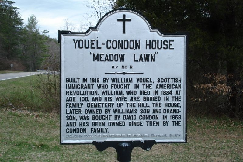
Youel-Condon House
"Meadow Lawn"
— 3.7 Mi N —
Erected by Youel Care Inc. and Rockbridge Historical Society.
Topics. This historical marker is listed in these topic lists: Notable Buildings • War, US Revolutionary. A significant historical year for this entry is 1819.
Location. 37° 57.523′ N, 79° 28.45′ W. Marker is in Goshen, Virginia, in Rockbridge County. Marker is at the intersection of Virginia Route 39 and Virginia Route 601, on the right when traveling west on State Route 39. Touch for map. Marker is in this post office area: Goshen VA 24439, United States of America. Touch for directions.
Other nearby markers. At least 8 other markers are within 8 miles of this marker, measured as the crow flies. Goshen First Aid Crew Inc. (approx. 2.1 miles away); Bath County / Rockbridge County (approx. 4˝ miles away); Pierre Daura (approx. 5.6 miles away); Rockbridge County / Augusta County (approx. 6.9 miles away); T. C. Walker School (approx. 7.1 miles away); Millboro (approx. 7.1 miles away); Kerr’s Creek (approx. 7.6 miles away); The Massacre of Kerr's Creek (approx. 7.7 miles away). Touch for a list and map of all markers in Goshen.
Credits. This page was last revised on November 7, 2022. It was originally submitted on December 10, 2020, by Roger Dean Meyer of Yankton, South Dakota. This page has been viewed 318 times since then and 71 times this year. Last updated on November 5, 2022, by Carl Gordon Moore Jr. of North East, Maryland. Photo 1. submitted on December 10, 2020, by Roger Dean Meyer of Yankton, South Dakota. • Bernard Fisher was the editor who published this page.
Editor’s want-list for this marker. Wide shot of marker and its surroundings. • Can you help?
