Columbia in Maury County, Tennessee — The American South (East South Central)
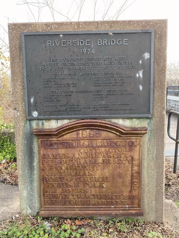
Riverside Bridge
1974
City Council Accepting Bridge 1974
J.A. (Buddy) Morgan - Mayor, Barbara Harwood - Vice Mayor, Councilmen: James L. Bailey - 1st Ward, Athel A. Hickman - 2nd Ward, James S. Harris - 3rd Ward, Charles P. Smith - 4th Ward, Hershel White - 5th Ward
City Council Commissioning Bridge 1973
J.J. Underwood - Mayor, Clement Marshall - Vice Mayor, Councilmen: J.A. Morgan, Charles West, Ray Woody
M.C. Stone - Public Works Dir., W.M. Albright - City Engineer, Jarrett H. Jones - City Manager, Ross H. Bryan, Inc. - Engineers, Oman Construction, Nashville
Old Bridge Plaque
1889
Pittsburgh Bridge Co
Contractors: James Andrews , Chr, P.H. Southhall, Jr., Secy, J.H. Courtney, A.L. Thomas, Robt. C. Church, Lucius E. Polk, W.J. Jones, Edwin Thacher, Ch'Eng, E.H. Scofield, Res'd't Eng
Topics. This historical marker is listed in this topic list: Bridges & Viaducts.
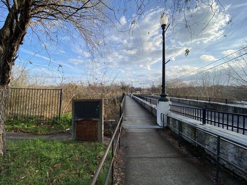
Location. 35° 37.061′ N, 87° 1.976′ W. Marker is in Columbia, Tennessee, in Maury County. Marker is on East 5th Street, on the left when traveling east. Touch for map. Marker is at or near this postal address: 104 E 5th St, Columbia TN 38401, United States of America. Touch for directions.
Other nearby markers. At least 8 other markers are within walking distance of this marker. The Duck River and Columbia (about 300 feet away, measured in a direct line); Greenwood (about 500 feet away); Camille Leonie Herndon (about 500 feet away); The Polk Family (about 600 feet away); Jane Knox Polk Chapter (about 600 feet away); Freedmen's Savings Bank and Trust Company (about 600 feet away); Nelson House Hotel (about 700 feet away); Nathan Vaught (approx. 0.2 miles away). Touch for a list and map of all markers in Columbia.
Credits. This page was last revised on November 14, 2022. It was originally submitted on November 7, 2022, by Darren Jefferson Clay of Duluth, Georgia. This page has been viewed 97 times since then and 15 times this year. Photos: 1, 2, 3. submitted on November 7, 2022, by Darren Jefferson Clay of Duluth, Georgia. • Bill Pfingsten was the editor who published this page.


