Montreat in Buncombe County, North Carolina — The American South (South Atlantic)
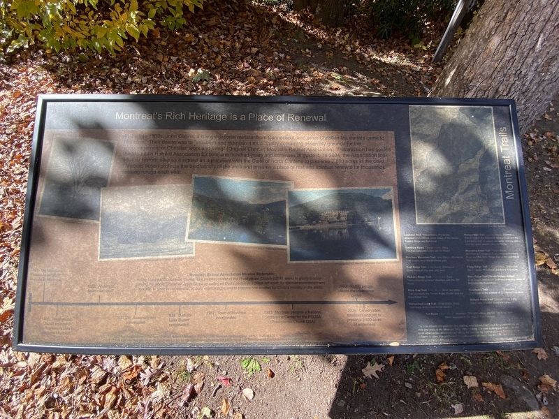
Montreat's Rich Heritage is a Place of Renewal
Inscription.
In the late 1800s, John Collins, a Congregational minister from Connecticut, and other Christian lay leaders came to this cove. Their desire was to "establish and maintain a municipality containing assembly grounds for the encouragement of Christian work and living" (Original Charter , Mountain Retreat Association). This mission has guided the Mountain Retreat Association for over one hundred years and continues to guide it. In 2004, the Association took another historic step as it signed an agreement with the State of North Carolina to preserve 2,500 acres in the cove. This bold action protects the biodiversity of the area and ensures a place of rest and spiritual renewal for thousands seeking refuge each year.
Montreat Trails
Lookout Trail: Yellow Blaze, Moderate: Mountain summit has great views of the Seven Sisters Ridge and Montreat.
Rainbow Road: Orange Blaze, Easy: This trail connects to the old Toll Road.
Rainbow Mountain Trail: Gray Blaze, Strenuous: Trail begins near the Montreat gate.
East Ridge Trail: Gray Blaze, Strenuous: Good views to the east and west.
Hickory Ridge Trail: Blue Blaze, Easy: Trail connects Lookout Mountain and the Toll Road.
Buck Gap Trail: Blue Blaze, Short but steep: Trail connects the Trestle Road Shelter and the East Ridge Trail.
Horseshoe Loop Trail: White Blaze, Easy: Trail loops around the horse stables.
Rocky Head Trail: Orange Blaze, Strenuous: Trail connects the Montreat campground and the East Ridge trail. It passes old water holding pond used for hydroelectric plant in the 1920s.
Stomping Knob Trail: Yellow Blaze, Moderately Strenuous: Trail connects Harmony Road and the West Ridge Trail at the summit of Stomping Knob.
Piney Ridge Trail: Orange Blaze, Strenuous: Good views of Montreat and Black Mountain.
West Ridge Trail (Seven Sisters Ridge): Gray Blaze, Strenuous: Trail has beautiful views of the Asheville Watershed.
Graybeard trail: Blue Blaze, Strenuous: Trail leads to the summit of Graybeard Mountain.
Walkers Knob Trail: Orange Blaze, Easy: Great view of entire Montreat Valley.
Toll Road: Green Blaze, Moderate: This trail follows the Old Toll Road from Black Mountain to the Blue Ridge Parkway.
Topics. This historical marker is listed in this topic list: Churches & Religion.
Location. 35° 38.793′ N, 82° 17.977′ W. Marker is in Montreat, North Carolina, in Buncombe County. Marker is on Lookout Road, on the right when traveling east. Touch for map. Marker is at or near this postal address: 301 Lookout Rd, Montreat NC 28757, United States of America. Touch for directions.
Other nearby markers. At least 8 other markers are within 3 miles of this marker, measured as the crow flies. Boone Trail Highway (within shouting distance of this marker); Lake Susan (about 300 feet away, measured in a direct line); Beetles Bring Hope for Hemlock Survival (approx. 0.2 miles away); Mount Mitchell Railroad (approx. 1.9 miles away); Stoneman's Raid (approx. 2.2 miles away); Montreat College (approx. 2.3 miles away); Swannanoa Gap Engagement (approx. 2.3 miles away); Swannanoa Tunnel (approx. 2.3 miles away). Touch for a list and map of all markers in Montreat.
Credits. This page was last revised on November 22, 2022. It was originally submitted on November 9, 2022, by Darren Jefferson Clay of Duluth, Georgia. This page has been viewed 88 times since then and 13 times this year. Photo 1. submitted on November 10, 2022, by Darren Jefferson Clay of Duluth, Georgia. • Bill Pfingsten was the editor who published this page.
