Boonesboro in Madison County, Kentucky — The American South (East South Central)
Boone Trace
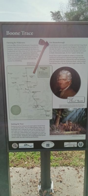
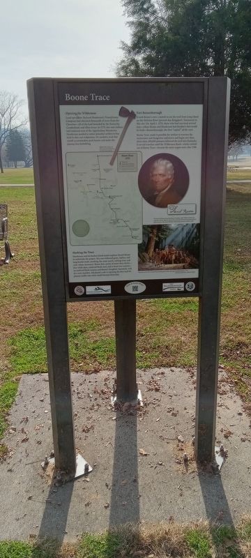
Land speculator Richard Henderson's Transylvania Company had obtained thousands of acres from the Cherokee-all of the land bounded by the Kentucky, Cumberland, and Ohio rivers. In 1775, few non-Indians had ventured west of the Appalachian Mountains. Henderson needed to entice potential settlers to buy land in this vast wilderness. He needed a trail that would accommodate pack horses and make the journey less forbidding.
Fort Boonesborough
It took Boone's crew a month to cut the trail from Long Island on the Holston River (present-day Kingsport, Tennessee) to this site. On April 1, 1775, those who had survived arrived here-where Boone and Henderson had decided a fort would be built-Boonesborough, the first "capital” of the west.
Boone Trace made it possible for settlers to traverse the mysterious and dangerous unknown and begin new lives. More than 200,000 pioneers followed the trail into Kentucky. It served travelers until the Wilderness Road-which evolved out of Boone Trace-became the main wagon route after 1796.
Marking the Trace
Henderson and his backers hired noted explorer Daniel Boone to undertake the project. His crew followed game, Indian, and long hunter trails, marking the route north, cutting trees and cane where necessary. Boone led a party of more than thirty- free white men, enslaved black men, and at least two women- an enslaved black woman and Boone's daughter, Susannah, wife of a crew member. All played a role in opening the first trail for pioneer traffic into what would become Kentucky.
Topics. This historical marker is listed in these topic lists: Exploration • Forts and Castles. A significant historical date for this entry is April 1, 1775.
Location. 37° 53.964′ N, 84° 15.949′ W. Marker is in Boonesboro, Kentucky, in Madison County. Marker is on Ford Hampton Road, on the right when traveling north. Touch for map. Marker is at or near this postal address: 835 Ford Hampton Rd, Winchester KY 40391, United States of America. Touch for directions.
Other nearby markers. At least 8 other markers are within walking distance of this marker. Building Fort Boonesborough (here, next to this marker); Fort Boonesborough Revealed (here, next to this marker); The Revolutionary War on the Frontier (here, next to this marker); A Legacy Preserved (here, next to this marker); A Frontier Kidnapping (here, next to this marker); Pioneer National Monument Association (a few steps from this marker); The First Christian Service in Kentucky (within shouting distance of this marker); "Divine Elm" (within shouting distance of this marker). Touch for a list and map of all markers in Boonesboro.
Credits. This page was last revised on November 22, 2022. It was originally submitted on November 18, 2022, by Craig Doda of Napoleon, Ohio. This page has been viewed 114 times since then and 28 times this year. Photos: 1, 2, 3. submitted on November 18, 2022, by Craig Doda of Napoleon, Ohio. • Bill Pfingsten was the editor who published this page.


