Moundsville in Marshall County, West Virginia — The American South (Appalachia)
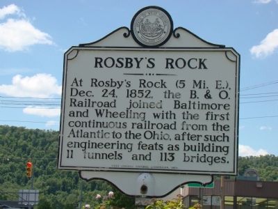
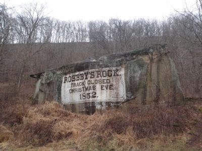
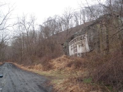
Rosby’s Rock
At Rosby’s Rock (5 Mi. E.) Dec. 24, 1852, the B. & O. Railroad joined the Baltimore and Wheeling with the first continuous railroad from the Atlantic to the Ohio, after such engineering feats as building 11 tunnels and 113 bridges.
Erected 1964 by West Virginia Historic Commission.
Topics and series. This historical marker is listed in this topic list: Railroads & Streetcars. In addition, it is included in the Baltimore and Ohio Railroad (B&O), and the West Virginia Archives and History series lists. A significant historical month for this entry is December 1814.
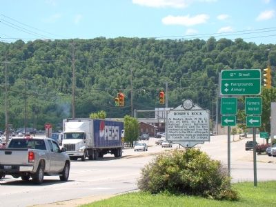
Location. 39° 54.822′ N, 80° 44.88′ W. Marker is in Moundsville, West Virginia, in Marshall County. Marker is at the intersection of Lafayette Avenue (West Virginia Route 2) and 12th Street, on the right when traveling south on Lafayette Avenue. It is at the foot of the Ohio River bridge. Touch for map. Marker is in this post office area: Moundsville WV 26041, United States of America. Touch for directions.
Other nearby markers. At least 8 other markers are within walking distance of this marker. Thomas H. Trainer (approx. ¼ mile away); West Virginia Penitentiary (approx. 0.3 miles away); Grave Creek Mound (approx. 0.3 miles away); Moundsville / Capt. James Harrod (approx. 0.4 miles away); Benjamin C. Criswell (approx. 0.4 miles away); Civil War Cannons (approx. 0.4 miles away); Marshall County Commemorates Service Men and Women (approx. 0.4 miles away); Civil War Memorial (approx. 0.4 miles away). Touch for a list and map of all markers in Moundsville.
Also see . . . Rosby's Rock. West Virginia Department of Tourism website entry (Submitted on January 31, 2022, by Larry Gertner of New York, New York.)
Additional keywords. Baltimore and Ohio Railroad; B&O; Roseby’s Rock; Rosbys Rock, Rosbby's Rock
Credits. This page was last revised on January 31, 2022. It was originally submitted on July 25, 2009, by J. J. Prats of Powell, Ohio. This page has been viewed 2,363 times since then and 69 times this year. Photos: 1, 2. submitted on July 25, 2009, by J. J. Prats of Powell, Ohio. 3, 4. submitted on January 18, 2015, by Mike Wintermantel of Pittsburgh, Pennsylvania.


