Near Hillsboro in Jefferson County, Missouri — The American Midwest (Upper Plains)
History of Sandy Creek Covered Bridge
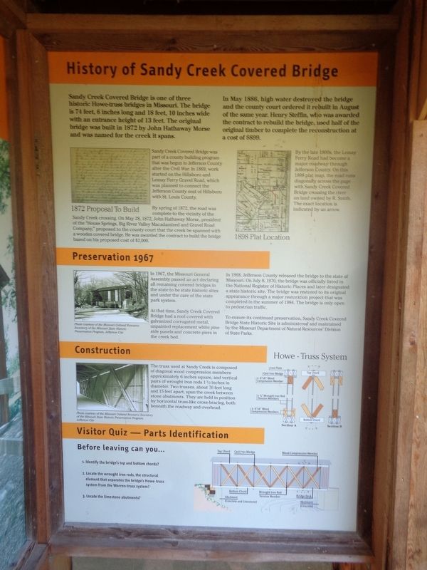
In May 1886, high water destroyed the bridge and the county court ordered it rebuilt in August of the same year. Henry Steffin, who was awarded the contract to rebuild the bridge, used half of the original timber to complete the reconstruction at a cost of $899.
Sandy Creek Covered Bridge was part of a county building program that was begun in Jefferson County after the Civil War. In 1869, work started on the Hillsboro and Lemay Ferry Gravel Road, which was planned to connect the Jefferson County seat of Hillsboro with St. Louis County.
By spring of 1872, the road was complete to the vicinity of the Sandy Creek crossing. On May 28, 1872, John Hathaway Morse, president of the "House Springs, Big River Valley Macadamized and Gravel Road Company," proposed to the county court that the creek be spanned with a wooden bridge. He was awarded the contract to build the bridge based on his proposed cost of $2,000.
By the late 1800s, the Lemay Ferry Road had become a major roadway through Jefferson County. On this 1898 plat map, the road runs diagonally across the page with Sandy Creek Covered Bridge crossing the river on land owned by R. Smith. The exact location is indicated by an arrow.
Preservation 1967
In 1967, the Missouri General Assembly passed an act declaring all remaining covered bridges in the state to be state historic sites and under the care of the state park system.
At that time, Sandy Creek Covered Bridge had a roof covered with galvanized corrugated metal, unpainted replacement white pine side panels and concrete piers in the creek bed.
In 1968, Jefferson County released the bridge to the state of Missouri. On July 8, 1970, the bridge was officially listed in the National Register of Historic Places and later designated a state historic site. The bridge was restored to its original appearance through a major restoration project that was completed in the summer of 1984. The bridge is only open to pedestrian traffic.
To ensure its continued preservation, Sandy Creek Covered Bridge State Historic Site is administered and maintained by the Missouri Department of Natural Resources' Division of State Parks.
Construction
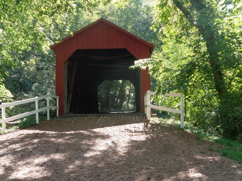
The truss used at Sandy Creek is composed of diagonal wood compression members approximately 6 inches square, and vertical pairs of wrought iron rods 1 1/2 inches in diameter.
Two trusses, about 76 feet long and 15 feet apart, span the creek between stone abutments. They are held in position by horizontal truss-like cross-bracing, both beneath the roadway and overhead.
Visitor Quiz - Parts Identification
Before leaving can you…
1. Identify the bridge's top and bottom chords?
2. Locate the wrought iron rods, the structural element that separates the bridge's Howe-truss system from the Warren-truss system?
3. Locate the limestone abutments?
Erected by Missouri State Parks.
Topics and series. This historical marker is listed in this topic list: Bridges & Viaducts. In addition, it is included in the Covered Bridges series list. A significant historical month for this entry is May 1886.
Location. 38° 17.65′ N, 90° 31.562′ W. Marker is near Hillsboro, Missouri, in Jefferson County. Marker can be reached from Old Lemay Ferry Road. Marker is located at Sandy Creek Covered Bridge State Historic Site park. Touch for map. Marker is at or near this postal address: 9090 Old Lemay Ferry Rd, Hillsboro MO 63050, United States of America. Touch for directions.
Other nearby markers. At least 8 other markers are within 5 miles of this marker, measured as the crow flies. Covered Bridges in Missouri (here, next to this marker); Restoration of Sandy Creek Covered Bridge (here, next to this marker); History of Covered Bridges in America (a few steps from
this marker); Jefferson County (approx. 4.8 miles away); To Commemorate the Removal Of the County Seat From Herculaneum (approx. 4.8 miles away); Jefferson County Veterans Memorial (approx. 4.8 miles away); The Veterans of all Wars From Jefferson County (approx. 4.8 miles away); Governor Thomas C. Fletcher House (approx. 4.9 miles away). Touch for a list and map of all markers in Hillsboro.
Also see . . . Sandy Creek Covered Bridge State Historic Site (MO State Parks). (Submitted on November 29, 2022, by Jason Voigt of Glen Carbon, Illinois.)
Credits. This page was last revised on November 29, 2022. It was originally submitted on November 29, 2022, by Jason Voigt of Glen Carbon, Illinois. This page has been viewed 248 times since then and 77 times this year. Photos: 1, 2, 3, 4. submitted on November 29, 2022, by Jason Voigt of Glen Carbon, Illinois.


