Corpus Christi in Nueces County, Texas — The American South (West South Central)
Ward Island
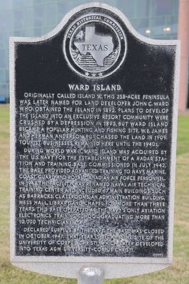
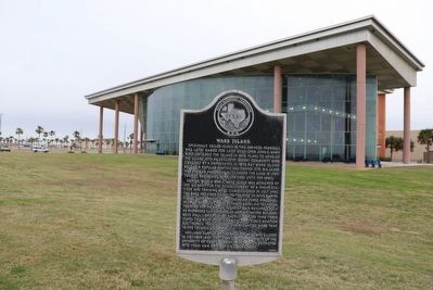
Originally called Island 'A', this 258 acre peninsula was later named for land developer John C. Ward who obtained the island in 1892. Plans to develop the island into an exclusive resort community were crushed by a depression in 1893, but Ward Island became a popular hunting and fishing site. W.E. James and Herman Anderson purchased the land in 1909. Tourist businesses remained here until the 1940s.
During World War II, Ward Island was acquired by the U.S. Navy for the establishment of a radar station and training base. Commissioned in July 1942, the base provided advanced training to Navy, Marine, Coast Guard and Royal Canadian Air Force personnel. In 1943 the facility was renamed Naval Air Technical Training Center and included 67 main buildings such as barracks, classrooms, and administration building, mess hall, library, and chapel. For more than three years this base operated as the Navy's only aviation electronic training school, graduating more than 10,000 technicians.
Declared surplus by the Navy, the base was closed in October 1947. That year it became the site of the University of Corpus Christi, which later developed into Texas A & M University-Corpus Christi.
Erected 1997 by Texas Historical Commission. (Marker Number 5716.)
Topics. This historical marker is listed in these topic lists: Education • Settlements & Settlers • War, World II. A significant historical year for this entry is 1892.
Location. 27° 42.898′ N, 97° 19.37′ W. Marker is in Corpus Christi, Texas, in Nueces County. Marker is on Ocean Drive, 0.2 miles east of Island Boulevard, on the right when traveling east. Touch for map. Marker is at or near this postal address: 6300 Ocean Dr, Corpus Christi TX 78412, United States of America. Touch for directions.
Other nearby markers. At least 8 other markers are within 5 miles of this marker, measured as the crow flies. Karankawa Indians (approx. one mile away); American Flag Memorial (approx. 2.7 miles away); Rabbi Sidney A. Wolf (approx. 3 miles away); General W.W. Sterling (approx. 3 miles away); Sunshine Cemetery (approx. 3.1 miles away); Flour Bluff (approx. 4.2 miles away); Naval Air Station Corpus Christi (approx. 4.2 miles away); German POW Camp at NAS Corpus Christi (approx. 4.2 miles away). Touch for a list and map of all markers in Corpus Christi.
Credits. This page was last revised on December 9, 2022. It was originally submitted on December 5, 2022, by Dave W of Co, Colorado. This page has been viewed 170 times since then and 46 times this year. Photos: 1, 2. submitted on December 5, 2022, by Dave W of Co, Colorado. • Devry Becker Jones was the editor who published this page.

