Battleford in Battle River No. 438, Saskatchewan — The Prairie Region (North America)
Land Registry Office
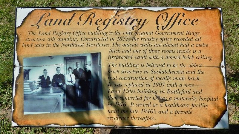
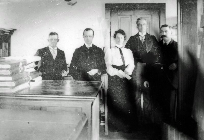
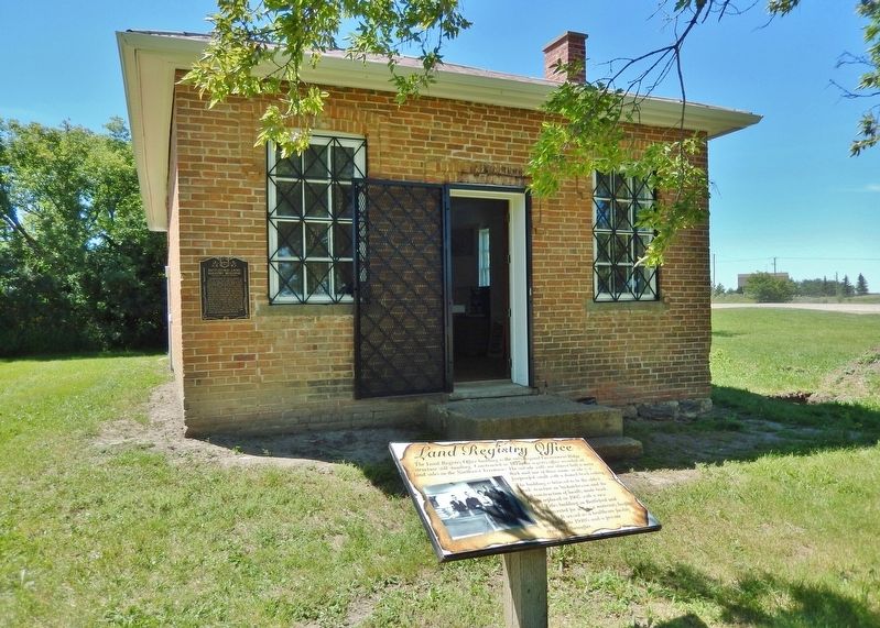
The Land Registry Office building is the only original Government Ridge structure still standing. Constructed in 1877, the registry office recorded all land sales in the Northwest Territories. The outside walls are almost half a metre thick and one of three rooms inside is a fireproofed vault with a domed brick ceiling.
The building is believed to be the oldest brick structure in Saskatchewan and the first construction of locally made brick. It was replaced in 1907 with a new Land Titles building in Battleford and then converted for use as a maternity hospital in 1916. It served as a healthcare facility until the late 1940's and a private residence thereafter.
Topics. This historical marker is listed in these topic lists: Architecture • Notable Buildings. A significant historical year for this entry is 1877.
Location. 52° 42.874′ N, 108° 18.938′ W. Marker is in Battleford, Saskatchewan, in Battle River No. 438. Marker is on Old Saskatchewan Highway 4 (Provincial Highway 658) 1.1 kilometers west of Provincial Highway 4, on the left when traveling west. Marker is located directly in front of the subject building. Touch for map. Marker is in this post office area: Battleford SK S0M 0E0, Canada. Touch for directions.
Other nearby markers. At least 8 other markers are within walking distance of this marker. Battleford Land Registry Building (here, next to this marker); Seat of the Territorial Government 1878-1883 (approx. 0.6 kilometers away); Government House, Battleford (approx. 0.6 kilometers away); Government House Battleford (approx. 0.6 kilometers away); a different marker also named Government House (approx. 0.6 kilometers away); Indian Industrial School (approx. 0.6 kilometers away); Seventh Day Adventists Academy (approx. 0.6 kilometers away); Oblate Seminary (approx. 0.6 kilometers away). Touch for a list and map of all markers in Battleford.
Regarding Land Registry Office. Canadian Register of Historic Places (2005/01/31).
Also see . . . Battleford Land Registry Office.
The Land Registry Office is a Provincial Heritage Property located on Government Ridge overlooking the junction of the Battle and North Saskatchewan Rivers. The property features a small, red-brick building constructed in 1877-78, nestled in a small grove of trees and shrubs. Though land registrations were initially conducted through offices in Winnipeg, the government anticipated a rapid and massive settlement of the recently acquired western region. To meet this need, it commissioned Chief Dominion Architect Thomas Scott to design a permanent facility for the storage and administration of land ownership records. With Battleford's new status as the official capital of the North-West Territories, the decision was made to locate the Land Registry Office within the complex of other Territorial government buildings on Government Ridge, which overlooked the townsite.(Submitted on December 5, 2022, by Cosmos Mariner of Cape Canaveral, Florida.)
Credits. This page was last revised on December 5, 2022. It was originally submitted on December 5, 2022, by Cosmos Mariner of Cape Canaveral, Florida. This page has been viewed 57 times since then and 14 times this year. Photos: 1, 2, 3, 4. submitted on December 5, 2022, by Cosmos Mariner of Cape Canaveral, Florida.


