Faribault in Rice County, Minnesota — The American Midwest (Upper Plains)
Faribault W.P.A. Projects
Inscription.
Stylish & Functional Structures
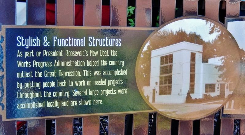
As part of President Roosevelt's New Deal, the Works Progress Administration helped the country outlast the Great Depression. This was accomplished by putting people back to work on needed projects throughout the country. Several large projects were accomplished locally and are shown here.
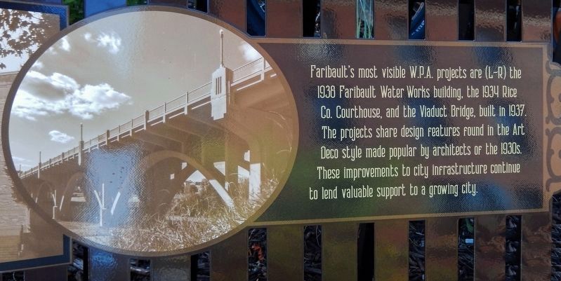
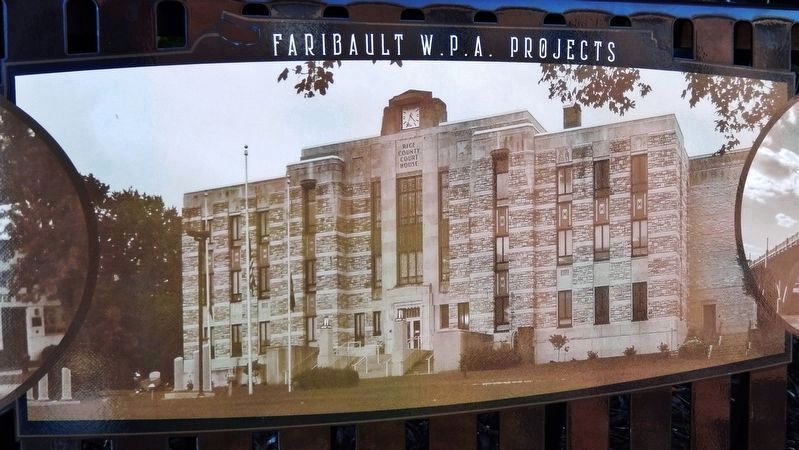
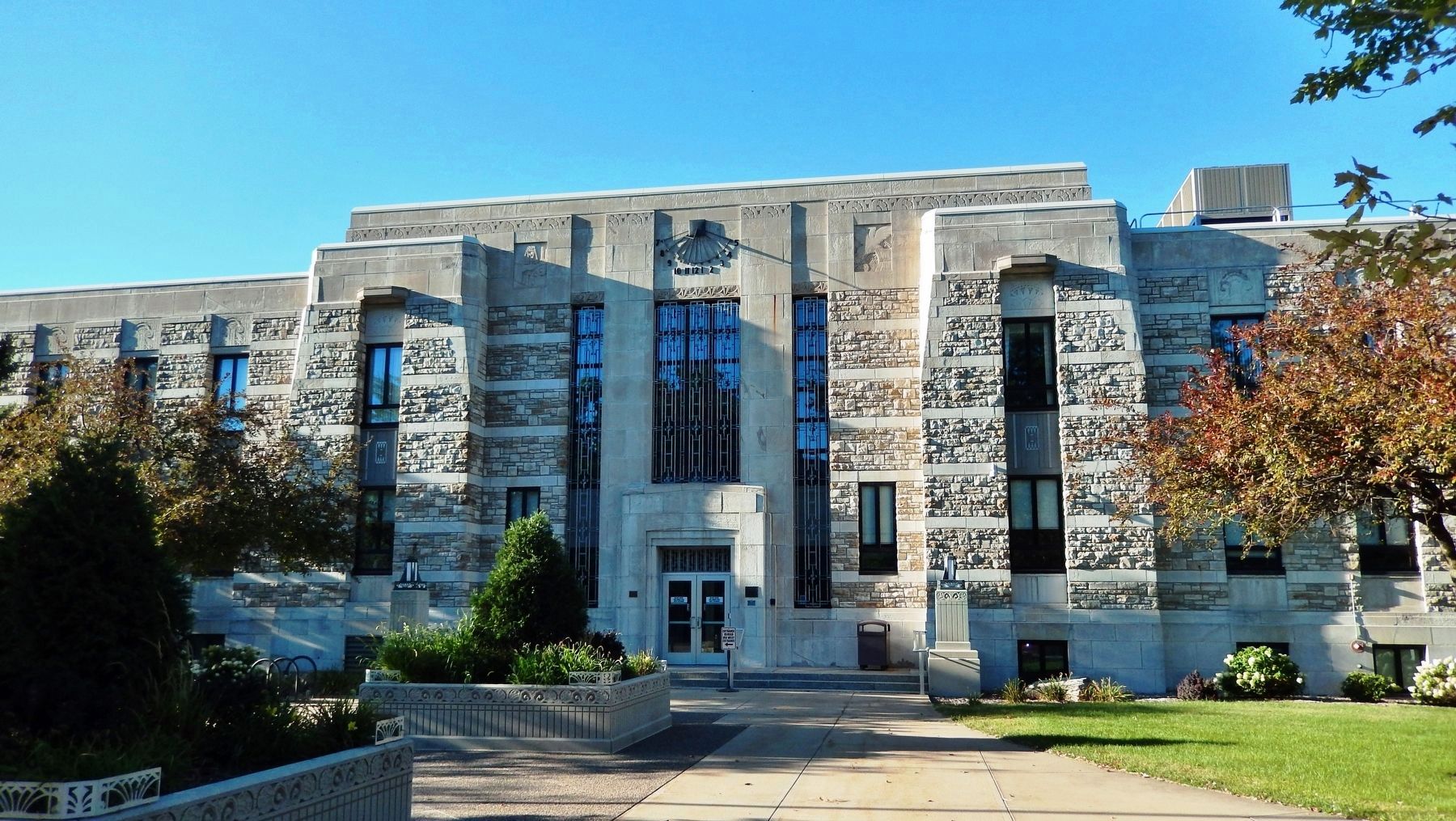
Faribault’s most visible W.P.A. projects are (L—R) the 1938 Faribault Water Works building, the 1934 Rice Co. Courthouse, and the Viaduct Bridge, built in 1937. The projects share design features found in the Art Deco style made popular by architects of the 1930s. These improvements to city infrastructure continue to lend valuable support to a growing city.
Topics and series. This historical marker is listed in these topic lists: Architecture • Bridges & Viaducts • Charity & Public Work. In addition, it is included in the Works Progress Administration (WPA) projects series list. A significant historical year for this entry is 1934.
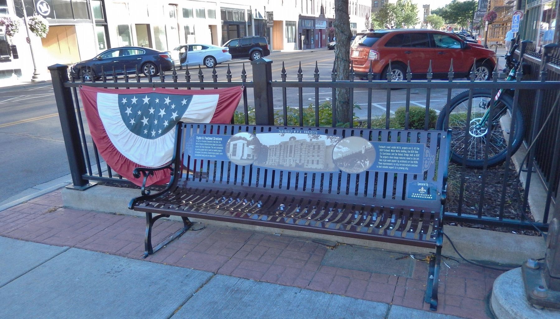
Location. 44° 17.626′ N, 93° 16.097′ W. Marker is in Faribault, Minnesota, in Rice County. Marker is at the intersection of 3rd Street Northeast and Central Avenue North, on the right when traveling west on 3rd Street Northeast. Marker is mounted on a bench at the northeast corner of the intersection. Touch for map. Marker is at or near this postal address: 301 Central Avenue North, Faribault MN 55021, United States of America. Touch for directions.
Other nearby markers. At least 8 other markers are within walking distance of this marker. Brand Nursery of Faribault (here, next to this marker); Farmer Seed & Nursery 1888 (within shouting distance of this marker); Government in Faribault (about 300 feet away, measured in a direct line); Buckham Memorial Library (about 400 feet away); Faribault Supports the Military (about 400 feet away); Faribault's Talented Artisans (about 400 feet away); Bishop Whipple & St. Mary's School for Girls (about 500 feet away); Faribault: Home of the Tilt-A-Whirl (about 500 feet away). Touch for a list and map of all markers in Faribault.
Also see . . .
1. Faribault Water Works - National Register of Historic Places #82003012.
The water works consist of two buildings (constructed in 1883 and 1938) and a reservoir. The structure nearest Seventh Street was constructed in 1938 and displays a simple and functional design in what has come to be known as WPA Moderne. The plan is symmetrical and consists of three rectangular sections, a central horizontally placed section with flanking vertical sections. The building is of poured concrete construction with a surface pattern of alternating horizontal and vertical rectangles (from the molds for the concrete). Inset horizontal bands of multi-paned windows flank a central door; the building’s name is mounted over the doorway. The interior is a large open area housing two wells and three booster pumps which essentially control the distribution of the city’s water between the wells, treatment reservoir, and general system.(Submitted on December 7, 2022, by Cosmos Mariner of Cape Canaveral, Florida.)
2. Faribault Viaduct Bridge - National Register of Historic Places #89001848.
The Faribault Viaduct is a reinforced concrete highway bridge which carries Minnesota State Highway 60 over the Straight River in Faribault, Minnesota, United States. It was constructed in 1937 by the Works Progress Administration with Art Deco/Classical Revival ornamentation, one of the last major examples in the state. The bridge has also been described as Moderne in style. The bridge was rebuilt in 2008-09 and the decks widened, but the original piers and the three arches over the river remain.(Submitted on December 7, 2022, by Cosmos Mariner of Cape Canaveral, Florida.)
3. Rice County Courthouse - National Register of Historic Places #82003016.
The Rice County Courthouse was designed by St. Cloud architect Naire Fisher in the Art Deco style and was constructed in 1934. The rectangular structure is constructed of light colored Faribault stone in alternating horizontal bands of rock-faced and smooth-faced stone. St. Cloud granite is utilized for additional highlighting. The plan is symmetrical with a higher center section and flanking side sections; the bays flanking the entries are slightly projecting. The center entry bays on the north and south facades feature double doors with stone framing and ornamental polished aluminum grills in transoms above the doors. Interior features include the utilization of black and grey polished marble; floors are pastel with black borders and inlaid designs. In the central rotunda area is a small dome with steel supports and glass designs in leaded bars.(Submitted on December 7, 2022, by Cosmos Mariner of Cape Canaveral, Florida.)
Credits. This page was last revised on December 10, 2022. It was originally submitted on December 6, 2022, by Cosmos Mariner of Cape Canaveral, Florida. This page has been viewed 191 times since then and 63 times this year. Photos: 1, 2, 3, 4, 5. submitted on December 7, 2022, by Cosmos Mariner of Cape Canaveral, Florida.
