Ocracoke in Hyde County, North Carolina — The American South (South Atlantic)
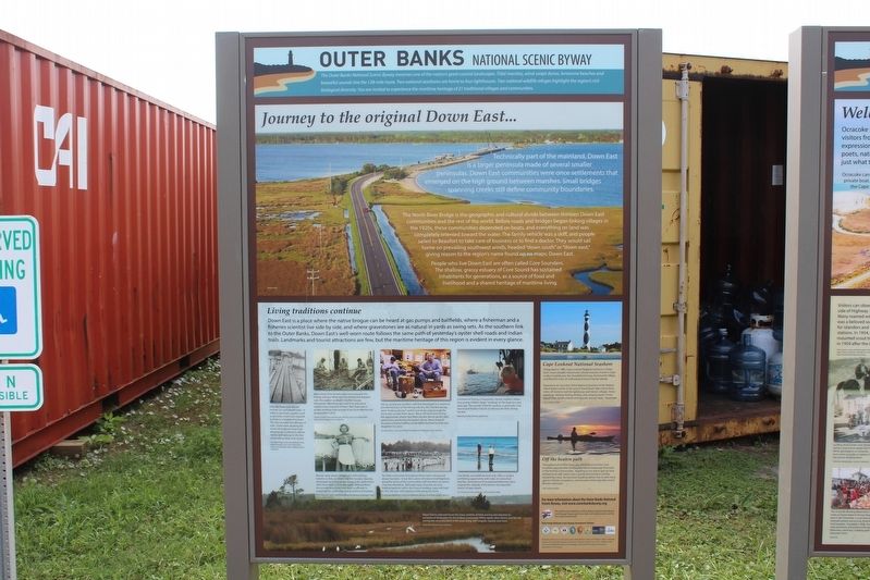
Journey to the original Down East…
— Outer Banks National Scenic Byway —
Technically part of the mainland, Down East is a larger peninsula made of several smaller peninsulas. Down East communities were once settlements that emerged on the high ground between marches. Small bridges spanning creeks still define community boundaries.
The North River Bridge is the geographic and cultural dived between thirteen Down East communities and the rest of the world. Before roads and bridges began linking villages in the 1920s, these communities depended on boats, and everything on land was completely oriented toward the water. The family vehicle was a skiff, and people sailed to Beaufort to take care of business or to find a doctor. They would sail home on prevailing southwest winds, headed “down south” or “down east”, giving reason to the region’s name found on no maps: Down East.
People who live Down East are often called Core Sounders. The shallow, grassy estuary of Core Sound has sustained inhabitants for generations, as a source of food and livelihood and a shared heritage of maritime living.
Living traditions continue
Down East is a place where the native brogue can be heard at gas pumps and ballfields, where a fisherman and a fisheries scientist live side by side, and where gravestones are as natural in yards as swing sets. As the southern link to the Outer Banks, Down East’s well-worn route follows the same path of yesterday’s oyster shell roads and Indian trails. Landmarks and tourist attractions are few, but the maritime heritage of this region is evident in every glance.
(captions)
Early life Down East did not include cars and paved roads. In order to purchase supplies, such as groceries, travel was required by boat to a neighboring town. This also included the delivery of mail. Docks were all along the shores throughout Down East allowing the mailboat to deliver mail as well as to go to the few stores along Down East shores. Cleveland Davis Store and Mailboat Dock, Harkers island – Core Sound Waterfowl Museum & Heritage Center, Madge Guthrie Collection
Many Down East families had connections to the fishing industry. While the men fished and mended nets, the women worked in the fish houses themselves. Mending nets took time and was a regular chore required of them. Nets that were in proper working order proved to be more effective for an abundant “catch”. Clayton Fulcher Fish House Dock, Atlantic - Core Sound Waterfowl Museum & Heritage Center Collection
Women were always a huge part of the fishing industry as they worked in the fish houses, cleaning and preparing fish, scallops, clams, crabs, and various other food coming from the water. Without them, the process would
not have been as efficient in preparing the seafood for transportation to markets. Polly “Mammy” Lewis - Core Sound Waterfowl Museum & Heritage Center, Nancy Lewis Collection
Decoy carving was another craft that developed as a means to provide food just as the fishing industry did. The first decoys were “working decoys” used to lure ducks close enough for the hunter to take them down. Many still duck hunt during the appropriate season; but there are also decoy carvers who spend hours perfecting the perfect decoy. Many times, it becomes a family tradition as the father teaches his sons and daughters to carve. Carving Demo - Core Sound Waterfowl Museum & Heritage Center, Madge Guthrie Collection
The faith community throughout Down East is strong and always has been. It was the customer of many to hold baptisms along the shore of the communities with members of various churches attending. Although many churches are now holding baptisms with the church building, many still hold to the “old way” with baptisms held along the shore. Community Baptizing - Core Sound Waterfowl Museum & Heritage Center Collection
Commercial fishing is frequently a family tradition where very young children begin “working” on the boat at a very early age. The sounds of North Carolina, in particular Core Sound and Pamlico Sound, are famous for their shrimp harvest. Watching Daddy Shrimp – Cathy Rose
Core Banks, accessible by boat only, offers a unique surf fishing opportunity with miles of untouched beaches. Generations of recreational fisherman have enjoyed the solitude of this barren, but beautiful stretch of open beach. Surf Fishing on East’ard Beach – Lillie Chadwick Miller
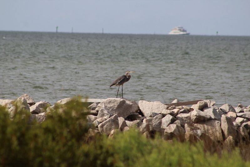
Down East is a blessed haven for many varieties of birds and has also become an exceptional destination for the birding community. White egrets, blue herons, and ibis are among the most prevalent in the area, along with seagulls, ospreys and more. North River Marsh – Susan M. Mason
Cape Lookout National Seashore
Designated in 1966, the Cape Lookout National Seashore is Down East’s most valuable natural and cultural resource, home to Cape Lookout Lighthouse, the Shackleford horses, Portsmouth Village, and fifty-five mile of undeveloped natural barrier islands.
Experience an overview of the National Seashore at the Harkers Island Visitors Center at the end of Island Road. Take a ferry three miles off-shore to visit the lighthouse and historic villages. Horse watching, shelling, fishing, birding, and camping await. Ferries depart from Harkers Island and typically operate April – November. Lillie Chadwick Miller
Off the Beaten Path
Throughout all of Down East, you will find some of the most excellent opportunities to enjoy the natural landscape that exists in the thirteen communities. Kayaking is one way to get up close and personal with nature and is quickly becoming an activity enjoyed by many. An excursion kayaking allows one to view many species of birds, ecosystems, and estuaries which typically cannot be seen otherwise. Lillie Chadwick Miller
The Outer Banks National Scenic Byway
The Outer Banks National Scenic Byway traverses one of the nation's great coastal landscapes. Tidal marshes, wind-swept dunes, lonesome beaches and beautiful sounds line the 138-mile route. Two national seashores are home to four lighthouses. Two national wildlife refuges highlight the region's rich biological diversity. You are invited to experience the maritime heritage of 21 traditional villages and communities.
Erected by Federal Highway Administration National Scenic Byways Program; Dare, Hyde, and Carteret Counties; Dare County Tourism Board.
Topics and series. This historical marker is listed in this topic list: Notable Places. In addition, it is included in the Outer Banks National Scenic Byway series list. A significant historical year for this entry is 1966.
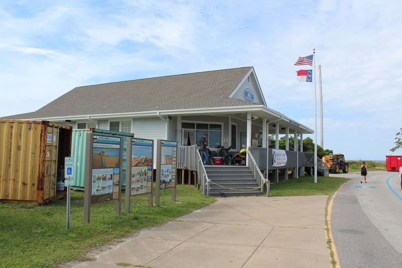
Location. 35° 6.98′ N, 75° 59.226′ W. Marker is in Ocracoke , North Carolina, in Hyde County. Marker is on Pilottown Circle north of State Highway 12, on the right when traveling south. Touch for map. Marker is at or near this postal address: 130 Pilottown Circle, Ocracoke NC 27960, United States of America. Touch for directions.
Other nearby markers. At least 8 other markers are within walking distance of this marker. Welcome to picturesque Ocracoke Island… (here, next to this marker); Harboring Change (about 400 feet away, measured in a direct line); Fort Ocracoke (about 500 feet away); Lt. Robert Maynard (about 500 feet away); USRC Mercury (about 600 feet away); Late 19th Century Cistern (about 700 feet away); Welcome to Ocracoke… (about 700 feet away); Ocracoke Windmills (about 700 feet away). Touch for a list and map of all markers in Ocracoke.
Credits. This page was last revised on December 10, 2022. It was originally submitted on December 10, 2022, by Tom Bosse of Jefferson City, Tennessee. This page has been viewed 236 times since then and 78 times this year. Photos: 1, 2, 3, 4. submitted on December 10, 2022, by Tom Bosse of Jefferson City, Tennessee. • Bernard Fisher was the editor who published this page.


