Thalia in Virginia Beach, Virginia — The American South (Mid-Atlantic)
History of Thalia / Aunt Penny's Park
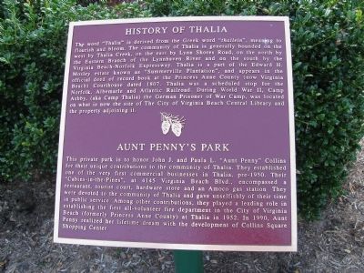
History of Thalia. The word “Thalia” is derived from the Greek “thallein”, meaning to flourish and bloom. The community of Thalia is generally bounded on the west by Thalia Creek, on the east by Lynn Shores Road, on the north by the Eastern Branch of the Lynnhaven River and on the south by the Virginia Beach-Norfolk Expressway. Thalia is a part of the Edward H. Mosley estate known as “Summerville Plantation”, and appears in the official deed of record book at the Princess Anne County (now Virginia Beach) Courthouse dated 1807. Thalia was a scheduled stop for the Norfolk, Albemarle and Atlantic Railroad. During World War II, Camp Ashby, (aka Camp Thalia) the German Prisoner of War Camp, was located on what is now the site of The City of Virginia Beach Central Library and the property adjoining it.
Aunt Penny’s Park. This private park is to honor John J. and Paula L. “Aunt Penny” Collins for their unique contributions to the community of Thalia. They established one of the very first commercial businesses in Thalia, pre-1950. Their “Cabins-in-the-Pines”, at 4145 Virginia Beach Blvd., encompassed a restaurant, tourist court, hardware store and an Amoco gas station They were devoted to the community of Thalia and gave unselfishly of their time in public service. Among other contributions, they played a leading role in establishing the first all-volunteer fire department in the City of Virginia Beach (formerly Princess Anne County) at Thalia in 1952. In 1990, Aunt Penny realized her lifetime dream with the development of Collins Square Shopping Center.
Topics. This historical marker is listed in these topic lists: Settlements & Settlers • War, World II. A significant historical year for this entry is 1807.
Location. 36° 50.495′ N, 76° 6.963′ W. Marker is in Virginia Beach, Virginia. It is in Thalia. Marker is on Thalia Station Drive south of Virginia Beach Boulevard (U.S. 58), on the right when traveling south. Touch for map. Marker is in this post office area: Virginia Beach VA 23452, United States of America. Touch for directions.
Other nearby markers. At least 8 other markers are within 2 miles of this marker, measured as the crow flies. Camp Ashby (approx. ¼ mile away); Lake Trashmore Bank Stabilization (approx. 0.9 miles away); Seal of the City of Virginia Beach (approx. 0.9 miles away); The Pembroke Manor House (approx. 1.2 miles away); Founders and Veterans of Lynnhaven Parish Church (approx. 1.9 miles away); Old Donation Church (approx. 1.9 miles away); “The Brick Church” (approx. 1.9 miles away); The Trial of 1706 (approx. 1.9 miles away). Touch for a list and map of all markers in Virginia Beach.
Credits. This page was last revised on February 1, 2023. It was originally submitted on July 29, 2009, by Kristin Rollins of Portsmouth, Virginia. This page has been viewed 1,869 times since then and 69 times this year. Photo 1. submitted on July 29, 2009, by Kristin Rollins of Portsmouth, Virginia. • Bill Pfingsten was the editor who published this page.
