Santa Cruz in Santa Cruz County, California — The American West (Pacific Coastal)
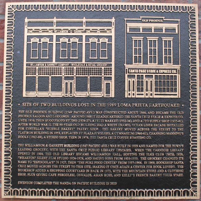
Site of Two Buildings Lost in the 1989 Loma Prieta Earthquake
Inscription.
The old Phoenix Building (1549 Pacific Ave.) was constructed about 1866, and became the old Phoenix Saloon and lodgings. Around 1900 it headquartered the Santa Cruz Stage & Express Co. until 1910, then Hugo Photo Studio (1924-27), a fruit market (1932-34), and auto supply shop (1935-41). After World War II, the 80-year-old building had a white enamel ocean liner facade installed for Costella’s “Bubble Bakery” pastry shop. The bakery moved across the street to the Flatiron Building in 1955, replaced by Plaza Jewelers, a gymnasium (1960-61), Channing Manning’s Books (1962-69), a stereo shop, then in 1978, the Santa Cruz Coffee Roasting Co.
The Williamson & Garrett Building (1547 Pacific Ave.) was built in 1899 and named for the town’s leading grocery, with the Santa Cruz Public Library upstairs. When the Carnegie Library opened in 1904, the old library became Williamson Hall, hosting the Elks Club until 1920, “Wharton” silent film studio 1926-1928, and Native Sons from 1935-1950. The grocery changed its name to “Espindola’s” in 1927, then “The Pure Food Center” from 1937-1964. In 1969, Bookshop Santa Cruz moved across the street to this site, making it once again a center for book lovers. The bookshop added a shopping courtyard in back in 1975, with the Mountain Store and Clothing Shop, plus giving Cafe Pergolesi, Oswalds, Asian Rose, and Kelly’s French Bakery their start.
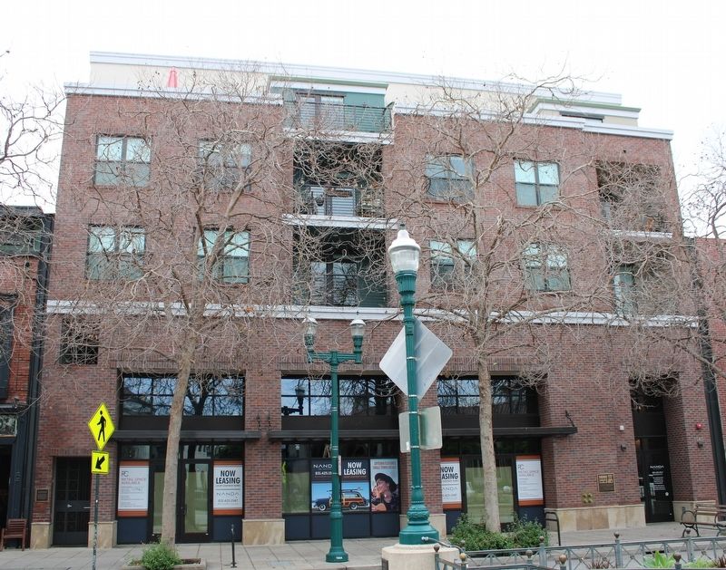
Swenson completed the nanda on Pacific Building in 2020
Topics. This historical marker is listed in these topic lists: Fraternal or Sororal Organizations • Industry & Commerce. A significant historical year for this entry is 1866.
Location. 36° 58.594′ N, 122° 1.625′ W. Marker is in Santa Cruz, California, in Santa Cruz County. Marker is at the intersection of Pacific Avenue and Front Street, on the right when traveling south on Pacific Avenue. The plaque is mounted on the right side of the building. Touch for map. Marker is at or near this postal address: 1549 Pacific Avenue, Santa Cruz CA 95060, United States of America. Touch for directions.
Other nearby markers. At least 8 other markers are within walking distance of this marker. A different marker also named Site of Two Buildings Lost in the 1989 Loma Prieta Earthquake (a few steps from this marker); Alfred Baldwin's Building (a few steps from this marker); Santa Cruz County World War Memorial (within shouting distance of this marker); Santa Cruz Main Post Office (within shouting distance of this marker); Town Clock (within shouting distance of this marker); St. George Building (about 300 feet away, measured in a direct line); St. George Hotel (about 300 feet away); People's Bank (about 400 feet away). Touch for a list and map of all markers in Santa Cruz.
Additional commentary.
1. Santa Cruz Historic Building Survey, Volume 1, 1976, Page 87
”1547 Pacific Avenue, Commercial Italianate, 1899
A commercial Italianate building with very nicely detailed bracketed pediments over the windows. The Santa Cruz Public Library was once located on the second floor.”
[Architectural Significance as an Example of its Style:] “Excellent”
— Submitted December 11, 2022, by Joseph Alvarado of Livermore, California.
Credits. This page was last revised on December 11, 2022. It was originally submitted on December 11, 2022, by Joseph Alvarado of Livermore, California. This page has been viewed 83 times since then and 11 times this year. Photos: 1, 2. submitted on December 11, 2022, by Joseph Alvarado of Livermore, California.

