Mariahilf in Wien, Austria — Central Europe (Eastern Alps)
St. Josef ob der Laimgrube Church
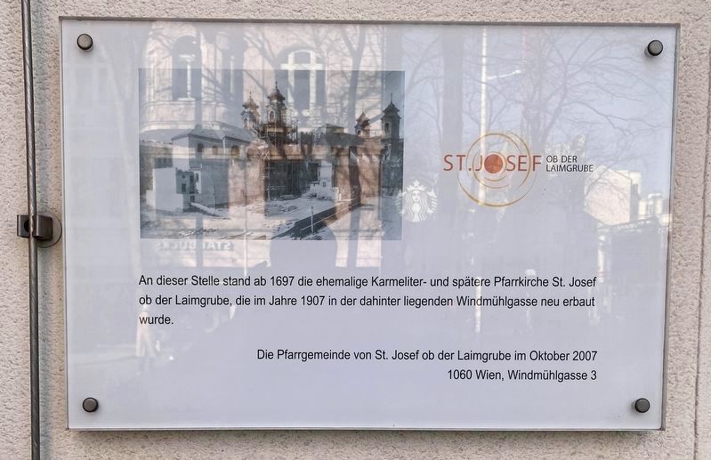
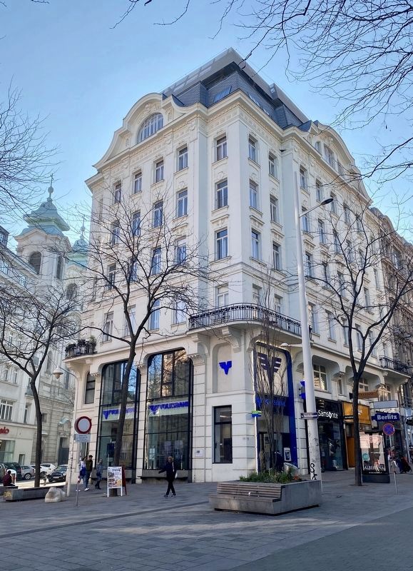
An dieser Stelle stand ab 1697 die ehemalige Karmeliter- und spätere Pfarrkirche St. Josef ob der Laimgrube, die im Jahre 1907 in der dahinter liegenden Windmühlgasse neu erbaut wurde.
On the site from 1697 onwards stood the former Carmelite- and later parish church of St. Josef ob der Laimgrube, which in 1907 was newly rebuilt on the Windmühlgasse (located behind you).
Erected 2007 by Die Pfarrgemeinde von St. Josef on der Laimgrube.
Topics. This historical marker is listed in this topic list: Churches & Religion.
Location. 48° 12.041′ N, 16° 21.491′ E. Marker is in Wien. It is in Mariahilf. Marker is at the intersection of Mariahilferstraße and Theobaldgasse, on the left when traveling west on Mariahilferstraße. Touch for map. Marker is at or near this postal address: Theobaldgasse 21, Wien 1070, Austria. Touch for directions.
Other nearby markers. At least 8 other markers are within walking distance of this marker. Robert Stolz (approx. 0.6 kilometers away); Weinheber- Memorial/Denkmal (approx. 0.6 kilometers away); Karl and Charlotte Bühler (approx. 0.6 kilometers away); Die Sowjetische Militärkommandtur für Wien / Former Soviet Military Headquarters (approx. 0.7 kilometers away); Grete-Rehor-Park (approx. 0.7 kilometers away); Erich Kleiber (approx. 0.7 kilometers away); Österreichische Widerstandsbewegung / Austrian Resistance Movement (approx. 0.8 kilometers away); Rudolf Jeremias Kreutz (approx. 0.8 kilometers away). Touch for a list and map of all markers in Wien.
Also see . . . Laimgrubenkirche (Wikipedia, in German).
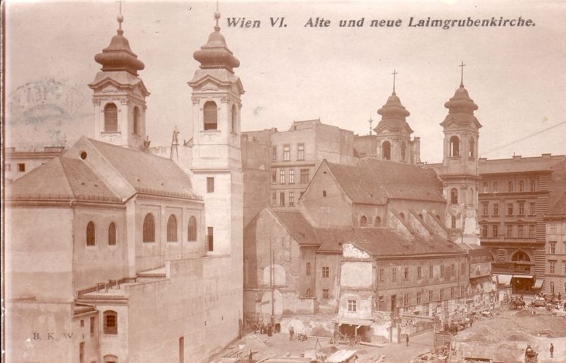
Excerpt (in translation): …In 1687 the Carmelites began building a new monastery and church, St. Josef ob der Laimgrube, again at today's Mariahilfer Strasse 27, dedicated to St. Joseph, which was consecrated in 1692. In 1783 it was made a parish church. In the following year, 1784, the monastery was dissolved as part of the Josephine monastery reform and in 1804 it was converted into an educational institution for young nobles. In 1867 the building was thoroughly renovated, and from 1881-1905 it was a police prison (which was then moved to the Rossauer Lände police building).(Submitted on December 17, 2022.)
Since the monastery church represented an obstacle to traffic during the expansion of the Mariahilfer Street and because the building site on the street promised great profit to speculators, it was decided in 1904 to demolish it. First, in 1905, the monastery was demolished. Then in 1906-1907 a neo-baroque replica of the Laimgrubenkirche was built in the neighboring Windmühlgasse, and the old church was demolished in 1907. During that year the two churches stood one behind the other for a short time. The baroque furnishings, especially the high altar painting "St. Josef” by Joseph Schönmann (1866) was largely transferred to the new church.
Credits. This page was last revised on December 17, 2022. It was originally submitted on December 17, 2022, by Andrew Ruppenstein of Lamorinda, California. This page has been viewed 67 times since then and 12 times this year. Photos: 1, 2. submitted on December 17, 2022, by Andrew Ruppenstein of Lamorinda, California. 3. submitted on December 17, 2022.


