Fort York-Liberty Village in Toronto, Ontario — Central Canada (North America)
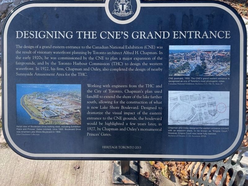
Designing The CNE's Grand Entrance
Working with engineers from the THC and the City of Toronto, Chapman's plan used landfill to extend the shore of the lake farther south, allowing for the construction of what is now Lake Shore Boulevard. Designed to dramatize the visual impact of the eastern entrance to the CNE grounds, the boulevard would be highlighted a few years later, in 1927, by Chapman and Oxley's monumental Princes' Gates.
(captions)
Aerial view of Boulevard Drive looking west, including Exhibition Place and Princes' Gates (circled), circa 1950. Boulevard Drive was renamed Lake Shore Boulevard in 1959. John Chuckman Collection
CNE postcard, 1950. The CNE's grand eastern entrance is recognized as one of Toronto's most photogenic vistas. Canadian National Exhibition Archives, C25, File 41, Item 29
Chapman and Oxley designed the eastern entrance (circled) with an adjacent plaza, to be known as "Empire Court." However, Empire Court was never fully realized. Archives of Ontario, C-18, Accession 48506
Erected 2013 by Heritage Toronto.
Topics. This historical marker is listed in this topic list: Landmarks.
Location. 43° 38.09′ N, 79° 24.599′ W. Marker is in Toronto, Ontario. It is in Fort York-Liberty Village. Marker can be reached from the intersection of Princes' Boulevard and Canada Boulevard. Touch for map. Marker is in this post office area: Toronto ON M6K 3C3, Canada. Touch for directions.
Other nearby markers. At least 8 other markers are within walking distance of this marker. The Princes' Gates (within shouting distance of this marker); a different marker also named The Princes' Gates (within shouting distance of this marker); The Warriors' Day Parade (within shouting distance of this marker); Queen's Wharf Lighthouse (approx. 0.4 kilometers away); Ben Dunkelman (approx. 0.6 kilometers away); The Battle of York 1813 (approx. 0.6 kilometers away); North and South Soldiers' Barracks (approx. 0.6 kilometers away); Well and Well House (approx. 0.7 kilometers away). Touch for a list and map of all markers in Toronto.
Credits. This page was last revised on March 25, 2023. It was originally submitted on December 25, 2022, by Bernard Fisher of Richmond, Virginia. This page has been viewed 83 times since then and 18 times this year. Photos: 1, 2. submitted on December 25, 2022, by Bernard Fisher of Richmond, Virginia.

