Straits in Carteret County, North Carolina — The American South (South Atlantic)
Welcome to Straits…
— The Outer Banks National Scenic Byway —
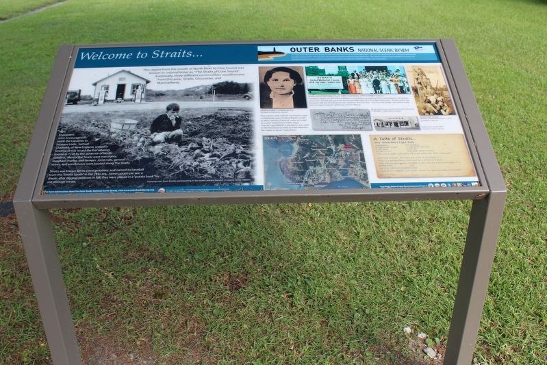
New Englanders were encouraged to settle the Carolinas to increase trade. Samuel Chadwick, of New England, settled in Straits and was issued the first whaling license in 1726 by the governor of North Carolina. Men of the Straits were merchants, merchant marine, and farmers. Grist mills, general stores, and warehouses were locate along The Straits.
Straits was known for its sweet potatoes, and named its baseball team the “Straits Spuds” in the 1930 era. Sweet potato pie was a staple; after digging potatoes in fall, they were placed in a “potato bank” for use through winter.
Two women with a Straits connection were Confederate spies; Emeline Pigott, as well as Mary Frances Chadwick, were recruited by cousin Josiah Francis Bell. Mary Frances’s grandfather’s plantation was used in the Revolutionary War and War Between the States as base of operations.
Located in Straits was the Richard Whitehurst Plantation, granted by The Lords Proprietors of George I, circa 1717. On that site was built the second Methodist Church in the community. Straits School was also built near the church across the road from the brick kiln. Clay from the Straits was used to make brick for Cape Lookout Lighthouse and Fort Macon.
(captions)
A young man from Straits participating in the sweet potato harvest. | Chadwick Family Collection
Emeline Pigott, Confederate Spy. | Carteret County History Museum
Straits United Methodist Church 200th Anniversary, 1978 | CSWM&HC Collection
Whaling license issued to Samuel Chadwick, 1726 (left) | CSWM&HC Collection
Straits High School Women’s Basketball Team, 1919 | CSWM&HC Collection
Chadwick’s Store (left) | Chadwick Family Collection
A Taste of Straits…
Mrs. Genevieve’s Light Rolls Ingredients:
2 cups warm water
1 tsp yeast
2 cups Crisco
Mix together:
4 cups sifted AP flour
1 tsp salt
The water / yeast mixture
‘* Mix warm water with yeast while you ready the other ingredients
Work the mixture – the more you work it, the better it is.
Place in a greased bowl, cover and let it sit for 2-3 hours.
When the dough doubles or triples in size, roll into biscuits and place in a greased pan.
Let rolls rise until doubled in size.
Cook at 375 degrees until golden brown for approximately 20 minutes.
Genevieve Long The Outer Banks National Scenic Byway The Outer Banks National Scenic Byway traverses one of the nation's great coastal landscapes. Tidal marshes, wind-swept dunes, lonesome beaches and beautiful sounds line the 138-mile route. Two national seashores are home to four lighthouses. Two national wildlife refuges highlight the region's rich biological diversity. You are invited to experience the maritime heritage of 21 traditional villages and communities.
Erected by Federal Highway Administration National Scenic Byways Program; Dare, Hyde, and Carteret Counties; Dare County Tourism Board.
Topics and series. This historical marker is listed in this topic list: Notable Places. In addition, it is included in the Outer Banks National Scenic Byway series list. A significant historical year for this entry is 1726.
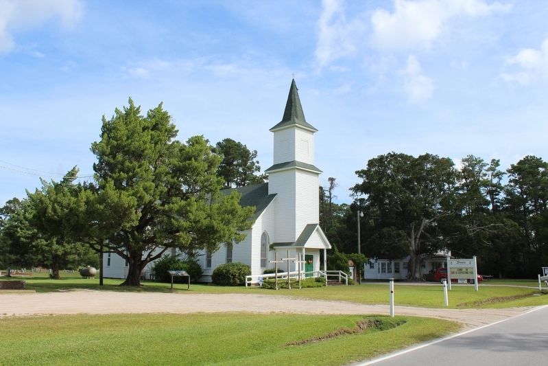
Location. 34° 44.202′ N, 76° 33.184′ W. Marker is in Straits, North Carolina, in Carteret County. Marker is at the intersection of Straits Road and Black Bear Lane, on the right when traveling south on Straits Road. Located in front of the Straits United Methodist Church. Touch for map. Marker is at or near this postal address: 311 Straits Road, Beaufort NC 28516, United States of America. Touch for directions.
Other nearby markers. At least 8 other markers are within 3 miles of this marker, measured as the crow flies. Welcome to Gloucester… (approx. one mile away); Marshallberg Harbor (approx. 2.2 miles away); Welcome to Marshallberg… (approx. 2.2 miles away); Welcome to Otway… (approx. 2.3 miles away); Welcome to Harkers Island… (approx. 2.4 miles away); In Honor and Rememberance (approx. 3 miles away); In Honor of Our Veterans (approx. 3 miles away); Welcome to Smyrna… (approx. 3 miles away).
Credits. This page was last revised on January 2, 2023. It was originally submitted on December 27, 2022, by Tom Bosse of Jefferson City, Tennessee. This page has been viewed 181 times since then and 61 times this year. Photos: 1, 2. submitted on December 27, 2022, by Tom Bosse of Jefferson City, Tennessee. • Bernard Fisher was the editor who published this page.

