
Sneads in Jackson County, Florida — The American South (South Atlantic)
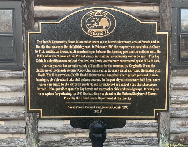
Sneads Community House
Photographed by Tim Fillmon, December 9, 2022
1. Sneads Community House Marker
Over the years it has served a variety of functions for the community. Originally it was the clubhouse of the Sneads Women's Civic Club and a center for many social activities. Beginning with World War II it served as a Public Health Center as well as a place where people gather to make bandages, give blood and take civil defense courses. In the past city elections were held here; court cases were heard by the Mayor on Sundays; and it functioned as a school when the schoolhouse burned. It has provided space for Boy Scouts and many other civic and social groups. It continues to be a place for gathering. In 2017 this building was placed on the
this page online
Erected 2018 by Sneads Town Council and Jackson County Tourist Development Council.
Topics. This historical marker is listed in these topic lists: Architecture • Charity & Public Work • Women. A significant historical year for this entry is 1936.
Location. 30° 42.465′ N, 84° 55.52′ W. Marker is in Sneads, Florida, in Jackson County. It is at the intersection of Old Spanish Trail and Taylor Street, on the right when traveling east on Old Spanish Trail. The Old Spanish Trail through Sneads was the original route of US 90 before it bypassed the downtown area to the north. Touch for map. Marker is at or near this postal address: 8025 Old Spanish Trail, Sneads FL 32460, United States of America. Touch for directions.

Regionally, this marker is on the Florida Panhandle. It is also in the American South and specifically in the Deep South. Globally, it is in the North Atlantic Region, North America, a Gulf of Mexico state, the Western Hemisphere, the Western World, and the Anglosphere. Historically, it finds itself in what was once

Photographed by Tim Fillmon, December 9, 2022
2. Sneads Community House Marker
Other nearby markers. At least 8 other markers are within 5 miles of this marker, measured as the crow flies: Sneads (within shouting distance of this marker); The Apalachicola River - A Florida Blueway (approx. 4.1 miles away); Chattahoochee Landing Mound Group (approx. 4.1 miles away); Nicolls' Outpost (approx. 4.1 miles away); a different marker also named The Chattahoochee Landing Mound Group (approx. 4.1 miles away); a different marker also named Nicoll's Outpost (approx. 4.1 miles away); The Scott Battle of 1817 (approx. 4.1 miles away); The Scott Massacre (approx. 4.1 miles away).
Credits. This page was last revised on November 28, 2024. It was originally submitted on January 1, 2023, by Tim Fillmon of Webster, Florida. This page has been viewed 746 times since then and 64 times this year. Photos: 1, 2. submitted on January 1, 2023, by Tim Fillmon of Webster, Florida.
