Fort Myer near Arlington in Arlington County, Virginia — The American South (Mid-Atlantic)
Platforms of Power
Arlington House, The Robert E. Lee Memorial
— George Washington Memorial Parkway —
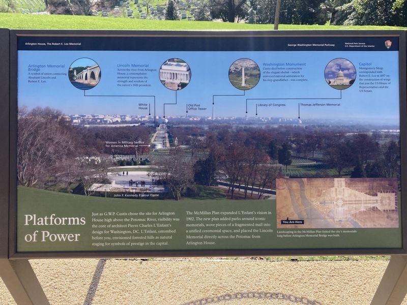
Just as G.W.P. Custis chose the site for Arlington House high above the Potomac River, visibility was the core of architect Pierre Charles L'Enfant's design for Washington, DC. L'Enfant, entombed before you, envisioned forested hills as natural staging for symbols of prestige in the capital.
The McMillan Plan expanded L'Enfant's vision in 1902. The new plan added parks around iconic memorials, wove pieces of a fragmented mall into a unified ceremonial space, and placed the Lincoln Memorial directly across the Potomac from Arlington House.
(captions)
Arlington Memorial Bridge
A symbol of union connecting Abraham Lincoln and Robert E. Lee.
Lincoln Memorial
Across the river from Arlington House, a contemplative memorial represents the strength and wisdom of the nation's 16th president.
Washington Monument
Custis died before construction of the elegant obelisk—which conveyed national admiration for his step-grandfather—was complete.
Capitol
Montgomery Meigs corresponded with Robert E. Lee in 1857 on the construction of wings that join the US House of Representatives and the US Senate
White House
Old Post Office Tower
Library of Congress
Thomas Jefferson Memorial
Women in Military Service for America Memorial
John F. Kennedy Eternal Flame
Landscaping in the McMillan Plan linked the city's memorials long before Arlington Memorial Bridge was built.
Erected by National Park Service, U.S. Department of the Interior.
Topics. This historical marker is listed in this topic list: Architecture. A significant historical year for this entry is 1902.
Location. 38° 52.863′ N, 77° 4.344′ W. Marker is near Arlington, Virginia, in Arlington County. It is in Fort Myer. Marker can be reached from Sheridan Drive, 0.2 miles south of Lincoln Drive, on the left when traveling south. Touch for map. Marker is at or near this postal address: 32 Sheridan Dr, Fort Myer VA 22211, United States of America. Touch for directions.
Other nearby markers. At least 8 other markers are within walking distance of this marker. Pierre Charles L’Enfant (here, next to this marker); Evolving Vision (a few steps from this marker); Arlington Estate, 1860 (a few steps from this marker); Trophy of War (within shouting distance of this marker); Paying Tribute (within shouting distance of this marker); A Place of Division and Reunification (within shouting distance of this marker); Garden to Graves (within shouting distance of this marker); The Gray Family (within shouting distance of this marker). Touch for a list and map of all markers in Arlington.
Credits. This page was last revised on February 1, 2023. It was originally submitted on March 28, 2022, by Connor Olson of Kewaskum, Wisconsin. This page has been viewed 144 times since then and 16 times this year. Last updated on January 7, 2023, by Bruce Guthrie of Silver Spring, Maryland. Photo 1. submitted on March 28, 2022, by Connor Olson of Kewaskum, Wisconsin. • Bernard Fisher was the editor who published this page.
