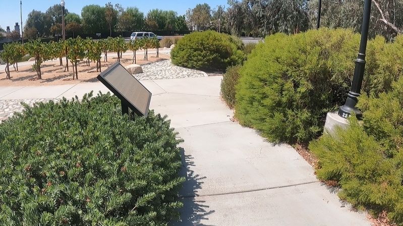
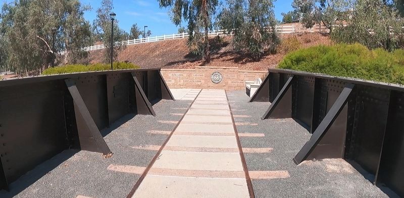
Rancho Cucamonga in San Bernardino County, California — The American West (Pacific Coastal)
Pacific Electric Railroad
The San Bernardino line, completed in 1914, was the Pacific Electric Railroad's longest line. Stations were located in Claremont, Upland, Alta Loma, Etiwanda, Fontana and Rialto. From Rialto, an adjoining line ran south via Bloomington into Riverside. And by the mid 1920s, the main San Bernardino line had been extended to Redlands.
The construction of the Alta Loma and Etiwanda depots in present day Rancho Cucamonga, in 1915, spurred the development of each community as businesses sprouted up around the depots. These communities, along with the Cucamonga community, would later combine to form the City of Rancho Cucamonga.
The San Bernardino line was crucial to the development of the Inland Empire because it provided a dual service. During daytime hours, the Red Line transported passengers between Los Angeles and San Bernardino counties. A Red Line passenger could travel from the corner of 6th and Main Streets in downtown Los Angeles and San Bernardino station in less than 2 hours. Travel between these two regions was no longer an arduous trip requiring multiple days to complete.
During the evening hours, the movement of freight became the Red Line's primary function. Trains would take local products, such as citrus, east to the major train shipping yards in San Bernardino. From there, products could be transported to the rest of the nation and/or the world. On its return trip, the freight train would bring much needed supplies like cement, oil and manufactured products to the towns along the way.
For more than 25 years, the Pacific Electric Railroad was a success. However, after the end of World War II, use of the Red Line began to decline. It could not compete against the rise of both the personal automobile and the trucking industry. Cars allowed people in a level of flexibility in start times and travel destinations that the Red Line could not match. Likewise with freight trucks, growers could ship any amount of their product to any part of the United states at any time. The same was true for importing supplies, people were no longer dependent on rigid train schedules. By 1953, the Pacific Electric Company had ended its passenger service. As of 2010, only 2 miles of the once busy San Bernardino line was still being used to transport freight.
Today, only a few of
the Pacific Electric rail cars remain either in museums or in the possession of railroad enthusiasts. Most of the Pacific (marker text was cut off)
Topics. This historical marker is listed in these topic lists: Industry & Commerce • Railroads & Streetcars. A significant historical year for this entry is 1914.
Location. 34° 6.323′ N, 117° 37.129′ W. Marker is in Rancho Cucamonga, California, in San Bernardino County. Marker can be reached from Foothill Boulevard east of Baker Avenue. Marker is located at Route 66 Trailhead Park. Touch for map. Marker is at or near this postal address: 8476 Foothill Blvd, Rancho Cucamonga CA 91730, United States of America. Touch for directions.
Other nearby markers. At least 8 other markers are within walking distance of this marker. Historic Pavement (a few steps from this marker); 1977 (within shouting distance of this marker); 1887 (within shouting distance of this marker); 1881 (about 300 feet away, measured in a direct line); 1870s (about 400 feet away); 1880s (about 400 feet away); 1864 (about 500 feet away); 1858 (about 500 feet away). Touch for a list and map of all markers in Rancho Cucamonga.
Also see . . . Pacific Electric on Wikipedia. (Submitted on January 20, 2023, by Jason Voigt of Glen Carbon, Illinois.)
Credits. This page was last revised on January 26, 2023. It was originally submitted on January 20, 2023, by Jason Voigt of Glen Carbon, Illinois. This page has been viewed 136 times since then and 33 times this year. Photos: 1, 2, 3. submitted on January 20, 2023, by Jason Voigt of Glen Carbon, Illinois.


