Roxbury in Boston in Suffolk County, Massachusetts — The American Northeast (New England)
Nineteenth and Twentieth Centuries

Photographed By Devry Becker Jones (CC0), January 27, 2023
1. Nineteenth and Twentieth Centuries Marker
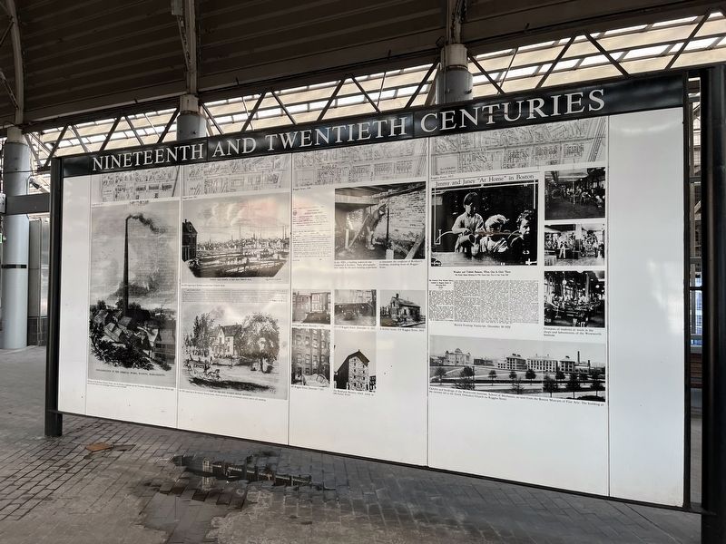
Chimney of the Roxbury Chemical Works, near the Roxbury highlands and the Providence Railroad. the chimney was 210 feet high and was built early in the nineteenth century at a cost of $5,000.
An 1851 engraving of the General Warren house, which was built in the seventeenth century and is still standing.
In the 1920's, a building inspection was completed in Roxbury. These photographs were taken by the city's building department to document the condition of Roxbury's buildings, including those on Ruggles Street.
Campus and buildings of the Wentworth Institute, School of Mechanics, as seen from the Boston Museum of Fine Arts. The building at the extreme left is the Greek Orthodox Church on Ruggles Street.
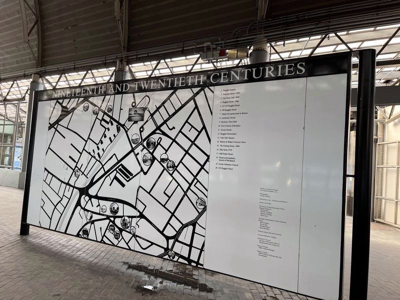
1. Ruggles Station
2. Tremont Street - 1853
3. The Stone Jail - 1830
4. Ruggles Street - 1886
5. 117-119 Ruggles Street
6. 105 Ruggles Street
7. Oldest dry goods store in Boston
8. Auchmuty House
9. Roxbury Town Hall
10. First Church of Roxbury
11. Turner House
12. Ruggles Homestead
13. John Eliot Square
14. Blaney & Baker's Grocery Store
15. The Parting Stone - 1844
16. Mile Stone 1729
17. 640 Parker Street
18. Wentworth Institute, School of Mechanics
19. Greek Orthodoxy Church
20. 315 Ruggles Street
Erected by Coco Raynes/Graphics, Inc.
Topics. This historical marker is listed in these topic lists: Education • Industry & Commerce • Notable Places. A significant historical year for this entry is 1851.
Location. 42° 20.189′ N, 71° 5.343′ W. Marker is in Boston, Massachusetts, in Suffolk County. It is in Roxbury. Marker can be reached from Ruggles Street north of Tremont Street (Massachusetts Route 28), on the right when traveling north. The marker stands in the open-air section of Ruggles station. Touch for map. Marker is at or near this postal address: 1163 Tremont St, Roxbury Crossing MA 02120, United States of America. Touch for directions.
Other nearby markers. At least 8 other markers are within walking distance of this marker. Eighteenth and Nineteenth Centuries (within shouting distance of this marker); Seventeenth and Eighteenth Centuries (within shouting distance of this marker); Four Letters Home (about 300 feet away, measured in a direct line); Roxbury (about 500 feet away); Sgt. William E. Carter Playground (approx. 0.2 miles away); Gen. Henry Knox Trail (approx. 0.4 miles away); Gardner Museum (approx. half a mile away); Titus Sparrow (approx. 0.7 miles away). Touch for a list and map of all markers in Boston.

Photographed By Devry Becker Jones (CC0), January 27, 2023
2. Nineteenth and Twentieth Centuries Marker
Credits. This page was last revised on January 29, 2023. It was originally submitted on January 29, 2023, by Devry Becker Jones of Washington, District of Columbia. This page has been viewed 90 times since then and 21 times this year. Photos: 1, 2. submitted on January 29, 2023, by Devry Becker Jones of Washington, District of Columbia.