Coloma in El Dorado County, California — The American West (Pacific Coastal)
California Stamp Mill
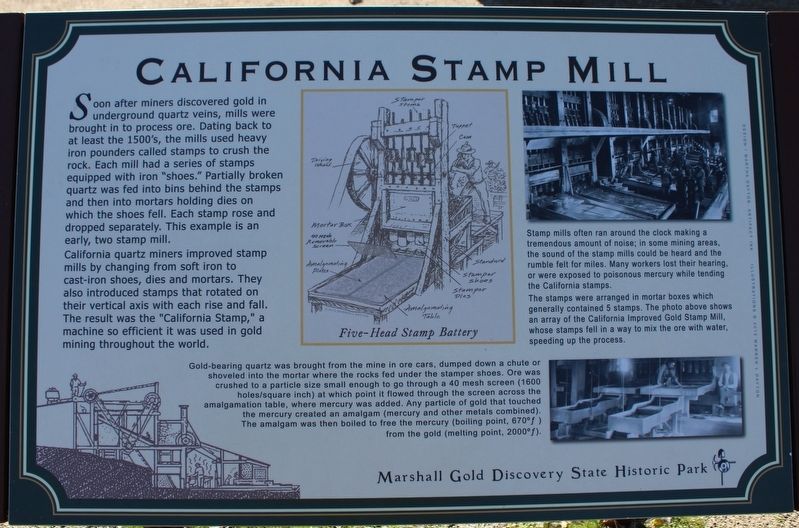
California quartz miners improved stamp mills by changing from soft iron to cast-iron shoes, dies and mortars. They also introduced stamps that rotated on their vertical axis with each rise and fall. The result was the “California Stamp,” a machine so efficient it was used in gold mining throughout the world.
Stamp mills often ran around the clock making a tremendous amount of noise; in some mining areas, the sound of the stamp mills could be heard and the rumble felt for miles. Many workers lost their hearing, or were exposed to poisonous mercury while tending the California stamps.
The stamps were arranged in mortar boxes which generally contained 5 stamps. The photo above shows an array of the California Improved Gold Stamp Mill, whose stamp fell in a way to mix the ore and water, speeding up the process.
Gold-bearing quartz was brought from the mine in ore carts, dumped down a chute or shoveled into the mortar where the rocks fed under the stamper shoes. Ore was crushed to a particle size small enough to go through a 40 mesh screen (1600 holes/square inch) at which point it flowed through the screen across the amalgamation table, where mercury was added. Any particle of gold that touched the mercury created an amalgam (mercury and other metals combined). The amalgam was then boiled to free the mercury (boiling point, 670°f) from the gold (melting point, 2000°f).
Marshall Gold Discovery State Historic Park
Erected by California Department of Parks & Recreation.
Topics. This historical marker is listed in this topic list: Industry & Commerce.
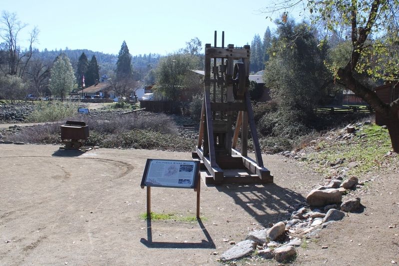
Location. 38° 48.059′ N, 120° 53.538′ W. Marker is in Coloma, California, in El Dorado County. Marker can be reached from Coloma Road (California Route 49) north of Mt Murphy Road. The resin marker is mounted to a metal stand on the Gold Discovery Loop Trail, in front of an example of the California Stamp Mill. Touch for map. Marker is in this post office area: Coloma CA 95613, United States of America. Touch for directions.
Other nearby markers. At least 8 other markers are within walking distance of this marker. Nelson Bell (a few steps from this marker); James W. Marshall (within shouting distance of this marker); Arrastre (within shouting distance of this marker); Hydraulic Mining (within shouting distance of this marker); Chinese Stores (within shouting distance of this marker); Site of Wintermantel's Miner's Hotel (within shouting distance of this marker); Chinese Miners of the Mother Lode (within shouting distance of this marker); Chile Mill (within shouting distance of this marker). Touch for a list and map of all markers in Coloma.
Credits. This page was last revised on January 29, 2023. It was originally submitted on January 29, 2023, by Joseph Alvarado of Livermore, California. This page has been viewed 166 times since then and 49 times this year. Photos: 1, 2. submitted on January 29, 2023, by Joseph Alvarado of Livermore, California.

