Montjuïc in Barcelona, Catalonia, Spain — Southwestern Europe (Iberian Peninsula)
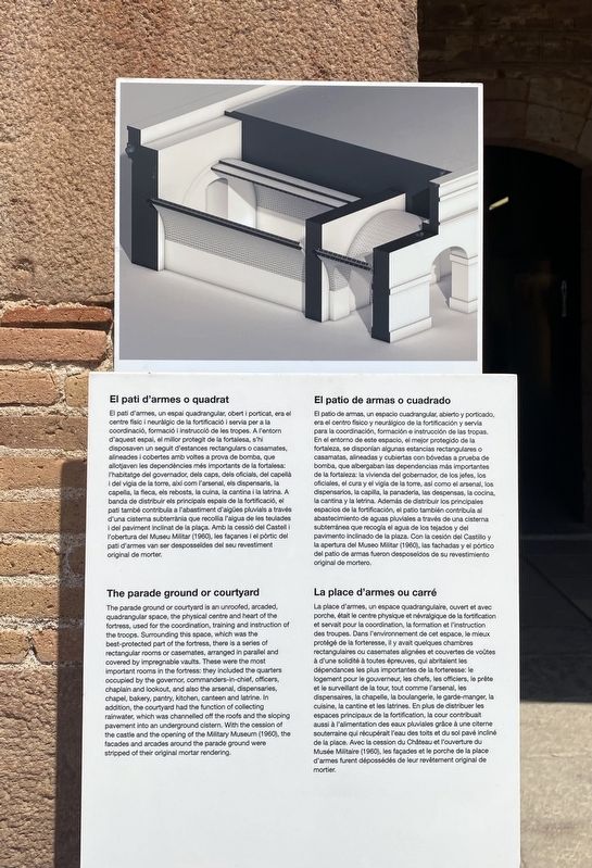
El pati d’armes o quadrat / The parade ground or courtyard
El patio de armas o cuadrado / La place d'armes ou carré
Inscription.
El pati d'armes, un espai quadrangular, obert i porticat, era el centre físic i neuràlgic de la fortificació i servia per a la coordinació, formació i instrucció de les tropes. A l'entorn d'aquest espai, el millor protegit de la fortalesa, s'hi disposaven un seguit d'estances rectangulars o casamates, alineades i cobertes amb voltes a prova de bomba, que allotjaven les dependències més importants de la fortalesa: l'habitatge del governador, dels caps, dels oficials, del capellà i del vigia de la torre, així com l'arsenal, els dispensaris, la capella, la fleca, els rebosts, la cuina, la cantina i la latrina. A banda de distribuir els principals espais de la fortificació, el pati també contribuïa a l'abastiment d'aigües pluvials a través d'una cisterna subterrània que recollia l'aigua de les teulades. i del paviment inclinat de la plaça. Amb la cessió del Castell i l'obertura del Museu Militar (1960), les façanes i el pòrtic del pati d'armes van ser desposseïdes del seu revestiment original de morter.
The parade ground or courtyard
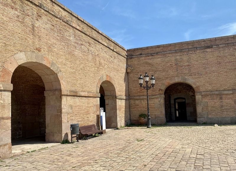
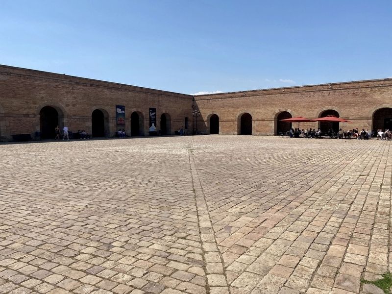
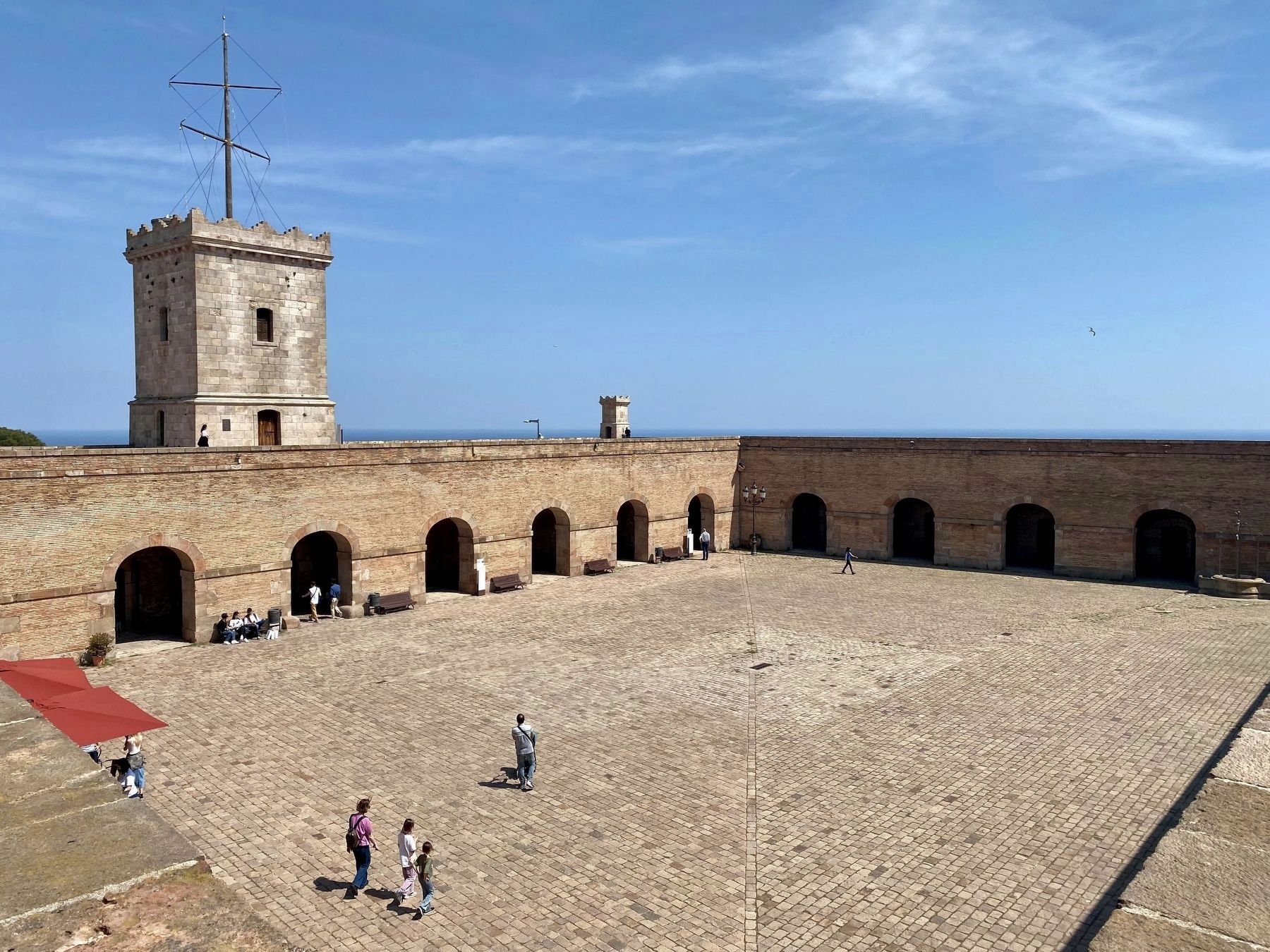
The parade ground or courtyard is an unroofed, arcaded, quadrangular space, the physical centre and heart of the fortress, used for the coordination, training and instruction of the troops. Surrounding this space, which was the best-protected part of the fortress, there is a series of rectangular rooms or casemates, arranged in parallel and covered by impregnable vaults. These were the most important rooms in the fortress: they included the quarters occupied by the governor, commanders-in-chief, officers, chaplain and lookout, and also the arsenal, dispensaries, chapel, bakery, pantry, kitchen, canteen and latrine. In addition, the courtyard had the function of collecting rainwater, which was channelled off the roofs and the sloping pavement into an underground cistern. With the cession of the castle and the opening of the Military Museum (1960), the facades and arcades around the parade ground were stripped of their original mortar rendering.
El patio de armas, un espacio cuadrangular, abierto y porticado, era el centro físico y neurálgico de la fortificación y servía para la coordinación, formación e instrucción de las tropas. En el entorno de este espacio, el mejor protegido de la fortaleza, se disponían algunas estancias rectangulares o casamatas, alineadas y cubiertas con bóvedas a prueba de bomba, que albergaban
las dependencias más importantes
de la fortaleza: la vivienda del gobernador, de los jefes, los
oficiales, el cura y el vigía de la torre, así como el arsenal, los
dispensarios, la capilla, la panadería, las despensas, la cocina,
la cantina y la letrina. Además de distribuir los principales
espacios de la fortificación, el patio también contribuía al
abastecimiento de aguas pluviales a través de una cisterna
subterránea que recogía el agua de los tejados y del
pavimento inclinado de la plaza. Con la cesión del Castillo y
la apertura del Museo Militar (1960), las fachadas y el pórtico
del patio de armas fueron desposeídos de su revestimiento
original de mortero.
La place d'armes, un espace quadrangulaire, ouvert et avec porche, était le centre physique et névralgique de la fortification et servait pour la coordination, la formation et l'instruction des troupes. Dans l'environnement de cet espace, le mieux protégé de la forteresse, il y avait quelques chambres rectangulaires ou casemates alignées et couvertes de voûtes à d'une solidité à toutes épreuves, qui abritaient les dépendances les plus importantes de la forteresse: le logement pour le gouverneur, les chefs, les officiers, le prête et le surveillant de la tour, tout comme l'arsenal, les dispensaires, la chapelle, la boulangerie, le garde-manger,
la
cuisine, la cantine et les latrines. En plus de distribuer les
espaces principaux de la fortification, la cour contribuait
aussi à l'alimentation des eaux pluviales grâce à une citerne
souterraine qui récupérait l'eau des toits et du sol pavé incliné
de la place. Avec la cession du Château et l'ouverture du
Musée Militaire (1960), les façades et le porche de la place
d'armes furent dépossédés de leur revêtement original de
mortier.
Topics. This historical marker is listed in this topic list: Forts and Castles.
Location. 41° 21.8′ N, 2° 9.986′ E. Marker is in Barcelona, Cataluña (Catalonia). It is in Montjuïc. Marker can be reached from Carretera de Montjuïc. The marker is located in the southeast corner of the courtyard of Montjuïc Castle. Touch for map. Marker is in this post office area: Barcelona, Cataluña 08038, Spain. Touch for directions.
Other nearby markers. At least 8 other markers are within walking distance of this marker. El juidici del President Lluís Companys / The Trial of President Lluís Companys (a few steps from this marker); La torre de guaita / The Watchtower / La torre vigia / La tour de guet (within shouting distance of this marker); Méchain Etablí les Coordenades de Barcelona / Méchain Establishes the Coordinates of Barcelona (within shouting distance of this marker); L'antic fortí / The early fort (within shouting distance of
this marker); Els calabossos del Castell / The Castle Dungeons / Los Calabozos del Castillo (within shouting distance of this marker); El segon recinte / The outer ward (within shouting distance of this marker); El baluard de Sant Carles / The Sant Carles Bastion / El baluarte de Sant Carles (within shouting distance of this marker); Gaspar de Portolà (within shouting distance of this marker). Touch for a list and map of all markers in Barcelona.
Also see . . . Montjuïc Castle (Wikipedia).
Overview: Montjuïc Castle (Catalan: Castell de Montjuïc, Spanish: Castillo de Montjuich) is an old military fortress, with roots dating back from 1640, built on top of Montjuïc hill in Barcelona, Catalonia, Spain. It currently serves as a Barcelona municipal facility.(Submitted on February 15, 2023.)
Credits. This page was last revised on February 15, 2023. It was originally submitted on February 14, 2023, by Andrew Ruppenstein of Lamorinda, California. This page has been viewed 124 times since then and 14 times this year. Photos: 1, 2, 3, 4. submitted on February 14, 2023, by Andrew Ruppenstein of Lamorinda, California.


