Middlesex Township near Carlisle in Cumberland County, Pennsylvania — The American Northeast (Mid-Atlantic)
Welcome to the World War I Trench System Exhibit

Photographed By Devry Becker Jones (CC0), February 25, 2023
1. Welcome to the World War I Trench System Exhibit Marker
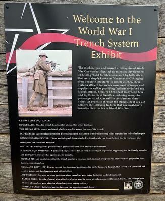
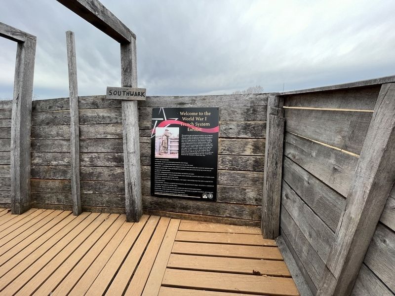
The machine gun and massed artillery fire of World War One combat dictated an extensive development of below-ground fortifications, used by both sides, that were simply known as "the trenches." Ranging from concrete structures to simple ditches, these systems allowed for secure movement of troops and supplies as well as providing facilities to defend and launch attacks. Soldiers often spent many long days and nights in these trenches, enduring enemy fire, poison gas attacks, as well as the elements themselves. As you walk through the trench, see if you can identify the following features that would have been found in the trenches in World War One.
A Front Line Dictionary:
Duckboard: Wooden trench flooring that allowed for water drainage.
The firing step: A seat and stand platform used to access the top of the trench.
Sniper nest: A camouflaged position where designated marksmen armed with scoped rifles searched for individual targets.
Communications wire: Phone and telegraph lines attached to trench walls ran from the first line to rear areas and throughout the command network.
Dug outs: Underground positions that provided shelter from shell fire and weather.
Machine gun position: A dedicated emplacement for a heavy machine gun to provide supporting fire in friendly assaults, and destructive defensive fire against enemy assaults.
Mortar pit: An emplacement for the trench mortar, a close support, indirect firing weapon that could arc projectiles into narrow enemy trenches.
Command Post: (CP) First or second line improved position, often in the form of a dugout, that served as a command and control point, unit headquarters, and officer billets.
Aid station: Dug outs or other positions where casualties were taken for initial medical treatment.
Barbed wire: Strands of metal wire with sharp barbs, used in single strands, on moveable trench blocks, and in large belts in front of trenches, were effective obstacles against enemy infantry.
No Man's Land: Battlefield section between two opposing trench lines.
Erected by The United States Army War College; United States Army Heritage and Education Center.
Topics. This historical marker is listed in this topic list: War, World I.
Location. 40° 12.393′ N, 77° 9.468′ W. Marker is near Carlisle, Pennsylvania, in Cumberland County. It is in Middlesex Township. Marker is on Army Heritage Trail south of Soldiers Drive, on the right when traveling south. Touch for map.

Photographed By Devry Becker Jones (CC0), February 25, 2023
2. Welcome to the World War I Trench System Exhibit Marker
Other nearby markers. At least 8 other markers are within walking distance of this marker. Meet Mechanic Donald D. Kyler (here, next to this marker); The Front (a few steps from this marker); Sniper's Nest (a few steps from this marker); The Mortar Pit (a few steps from this marker); Splinter Proof (a few steps from this marker); Machine Gun Post (a few steps from this marker); No Man's Land (a few steps from this marker); Command Post (within shouting distance of this marker). Touch for a list and map of all markers in Carlisle.
Related marker. Click here for another marker that is related to this marker. — The original marker at this location.
Credits. This page was last revised on December 18, 2023. It was originally submitted on February 28, 2023, by Devry Becker Jones of Washington, District of Columbia. This page has been viewed 59 times since then and 6 times this year. Photos: 1, 2. submitted on February 28, 2023, by Devry Becker Jones of Washington, District of Columbia.