Weesp in Amsterdam, North Holland, Netherlands — Northwestern Europe
Fort aan de Ossenmarkt
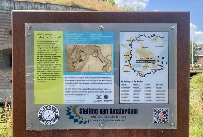
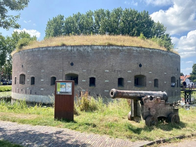
De vesting Weesp behoorde vanaf 1854 tot de Nieuwe Hollandse Waterlinie, maar werd in 1892 bij de Stelling van Amsterdam gevoegd. Het torenfort aan de Ossenmarkt dateert uit 1861. Het is een van de laatste torenforten waarmee men de Nieuwe Hollandse Waterlinie trachtte te versterken. Tevergeefs; het metselwerk was door de komst van de brisant- granaat niet meer bomvrij. Daarom werd in 1876 aan de oostkant een dekkingswal aangebracht en de gracht gedempt. In 1983-1985 werd deze wal afgegraven en de gracht en brug hersteld. Het fort werd gerestaureerd. Bij de ingang is het ophaalmechanisme van de vroegere brug nog aanwezig. Op het voormalige genieterrein is nu een tuinwinkel en de houten artillerieloods uit 1877 is in gebruik als expositieruimte.
Fortress Weesp, Fort on the Ossenmarkt
The Weesp fortress belonged to the New Dutch Waterline defense system from 1854, and was incorporated into the Defense Line of Amsterdam in 1892. The tower fort on the Ossenmarkt dates from 1861. It is one of the last tower forts that were used to strengthen the New Dutch Waterline, but in vain, as the masonry was no longer bombproof due to the arrival of high-explosive shells. That is why in 1876 a protective wall was built on the east side and the moat filled in. In 1983-1985 this embankment was excavated and the canal and bridge repaired. The fortress was then restored. At the entrance, the lifting mechanism of the former bridge is still present. There is now a garden shop on the former engineering grounds and the wooden artillery shed from 1877 is used as an exhibition space.
Stelling van Amsterdam / Defence Line of Amsterdam
Erected by Stelling van Amsterdam, Provincie Noord-Holland, UNESCO.
Topics. This historical marker is listed in this topic list: Forts and Castles. A significant historical year for this entry is 1854.
Location. 52° 18.469′ N, 5° 2.779′ E. Marker is in Weesp, Noord-Holland (North Holland), in Amsterdam. Marker is on Ossenmarkt, on the left when traveling north. Touch for map. Marker is at or near this postal address: Ossenmarkt 32, Weesp, Noord-Holland 1381 LW, Netherlands. Touch for directions.
Other nearby markers. At least 8 other markers are within 6 kilometers of this marker, measured as the crow flies. Bastion de Nieuwe Achtkant (about 150 meters away, measured in a direct line); Soldaat en Geschut / Soldiers and Artillery (about 150 meters away); Stadhuis / City Hall (approx. 0.3 kilometers away); Weesp Jewish Deportation Memorial (approx. 0.3 kilometers away); Annie Romein (approx. 5.4 kilometers away); Harriët Freezer (approx. 5.5 kilometers away); Nana Yaa Adu-Ampoma (approx. 5.5 kilometers away); Efua Sutherland (approx. 5.6 kilometers away). Touch for a list and map of all markers in Weesp.
Also see . . . Stelling van Amsterdam (Stelling van Amsterdam). A website providing an overview of the Amsterdam defense system, mostly oriented to those wishing to visit parts of the system.
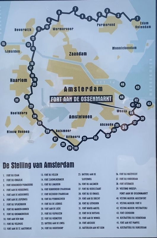
Excerpt: A remarkable defensive ring made up of 46 forts and batteries as well as a multitude of dikes and sluices encircles the Dutch capital of Amsterdam. It’s the Defence Line (or ‘Stelling’) of Amsterdam. A Dutch historical monument, the Defence Line is listed as a UNESCO World Heritage site since 1996. A large portion of this monument is open to the public and makes for a great day out for people young and old.(Submitted on March 4, 2023.)
Credits. This page was last revised on December 31, 2023. It was originally submitted on March 4, 2023, by Andrew Ruppenstein of Lamorinda, California. This page has been viewed 50 times since then and 11 times this year. Photos: 1, 2, 3. submitted on March 4, 2023, by Andrew Ruppenstein of Lamorinda, California.


