Millersburg in Bourbon County, Kentucky — The American South (East South Central)
Millersburg Military Institute
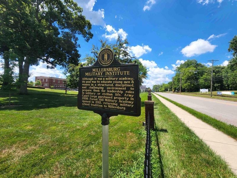
Although it was a military academy, its goal was to educate young men & women in a structured, disciplined, and challenging environment to prepare them for leadership roles in military or civilian life. Army Cadet Corps purchased property in 2008: Forest Hill Military Academy opened in 2012, returning military school tradition to Millersburg.
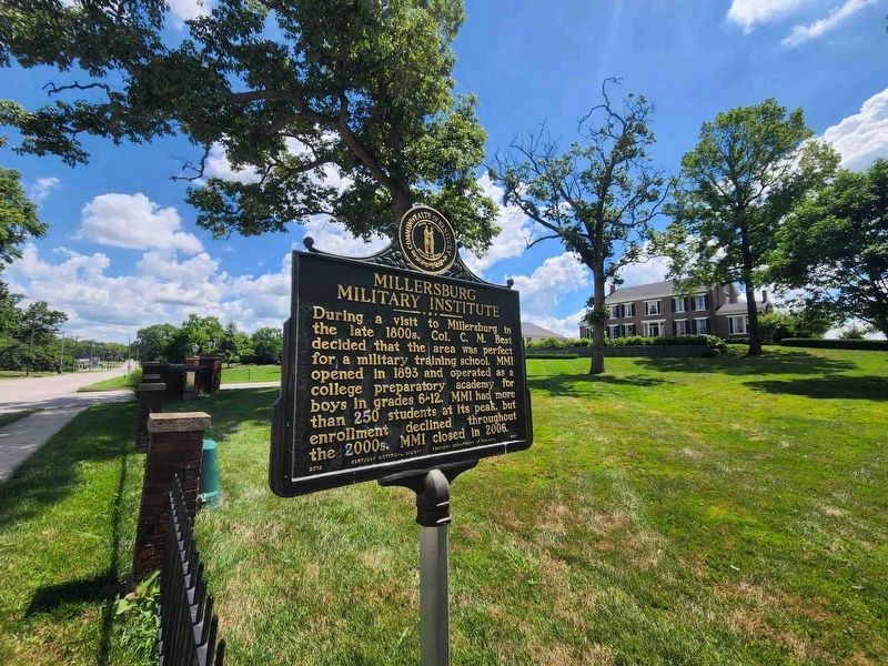
During a visit to Millersburg in the late 1800s, Col. C. M. Best decided that the area was perfect for a military training school. MMI opened in 1893 and operated as a college preparatory academy for boys in grades 6-12. MMI had more than 250 students at its peak, but enrollment declined throughout the 2000s. MMI closed in 2006.
Erected 2013 by Kentucky Historical Society, Kentucky Department of Highways. (Marker Number 2407.)
Topics. This historical marker is listed in this topic list: Education. A significant historical year for this entry is 1893.
Location. 38° 18.342′ N, 84° 8.668′ W. Marker is in Millersburg, Kentucky, in Bourbon County. Marker is on Main Street, 0.1 miles north of East 11th Street, on the right when traveling north. Touch for map. Marker is at or near this postal address: 1122 Main Street, Millersburg KY 40348, United States of America. Touch for directions.
Other nearby markers. At least 8 other markers are within 6 miles of this marker, measured as the crow flies. Mae Street Kidd (approx. 0.4 miles away); Tollgate House (approx. 0.6 miles away); Major John Miller / Millersburg, Kentucky (approx. 0.6 miles away); Colville Covered Bridge / Covered Bridges (approx. 3.4 miles away); Col. Daniel Boone (approx. 4.6 miles away); Forest Retreat (approx. 5 miles away); Ruddells Mills (approx. 5.1 miles away); Site of 1792 Church (approx. 5.4 miles away).
Credits. This page was last revised on March 12, 2023. It was originally submitted on March 9, 2023, by Carolyn Sanders of Plano, Texas. This page has been viewed 119 times since then and 37 times this year. Photos: 1. submitted on March 9, 2023, by Carolyn Sanders of Plano, Texas. 2, 3. submitted on March 9, 2023. • James Hulse was the editor who published this page.


