Near Currie in Pender County, North Carolina — The American South (South Atlantic)
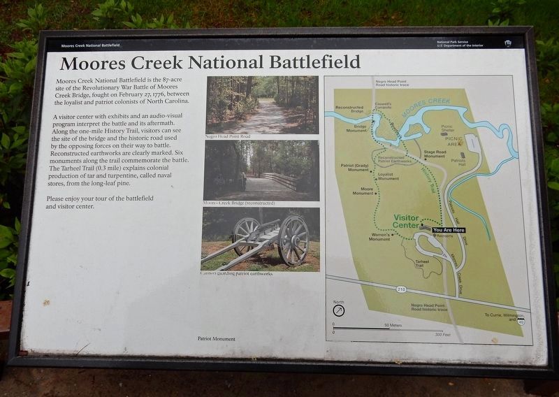
Moores Creek National Battlefield
A visitor center with exhibits and an audio-visual program interpret the battle and its aftermath. Along the one-mile History Trail, visitors can see the site of the bridge and the historic road used by the opposing forces on their way to battle. Reconstructed earthworks are clearly marked. Six monuments along the trail commemorate the battle. The Tarheel Trail (0.3 mile) explains colonial production of tar and turpentine, called naval stores, from the long-leaf pine.
Please enjoy your tour of the battlefield and visitor center.
[Captions (top to bottom)] Negro Head Point Road • Moores Creek Bridge (reconstructed) • Cannon guarding patriot earthworks
Erected by National Park Service.
Topics. This historical marker is listed in this topic list: War, US Revolutionary. A significant historical date for this entry is February 27, 1776.
Location. 34° 27.473′ N, 78° 6.587′ W. Marker is near Currie, North Carolina, in Pender County. Marker can be reached from Moores Creek Drive, 0.2 miles west of North Carolina Route 210. Marker is behind the Moores Creek National Battlefield Visitor Center. Touch for map. Marker is in this post office area: Currie NC 28435, United States of America. Touch for directions.
Other nearby markers. At least 8 other markers are within walking distance of this marker. Brave Patriots (a few steps from this marker); Road to Independence (a few steps from this marker); Tarheel Trail (within shouting distance of this marker); We Women Have...To Let Our Voices Be Heard (about 300 feet away, measured in a direct line); Trees for a Navy (about 400 feet away); Women's Monument (about 400 feet away); Blackwater Highways (about 400 feet away); Ghosts of an Industry (about 400 feet away). Touch for a list and map of all markers in Currie.
Also see . . . Moores Creek National Battlefield. National Park Service (Submitted on June 25, 2023.)
Credits. This page was last revised on June 25, 2023. It was originally submitted on March 19, 2023, by Duane and Tracy Marsteller of Murfreesboro, Tennessee. This page has been viewed 76 times since then and 10 times this year. Photo 1. submitted on March 19, 2023, by Duane and Tracy Marsteller of Murfreesboro, Tennessee.
Editor’s want-list for this marker. Wide shot of marker and surrounding area in context. • Can you help?
