Near Currie in Pender County, North Carolina — The American South (South Atlantic)
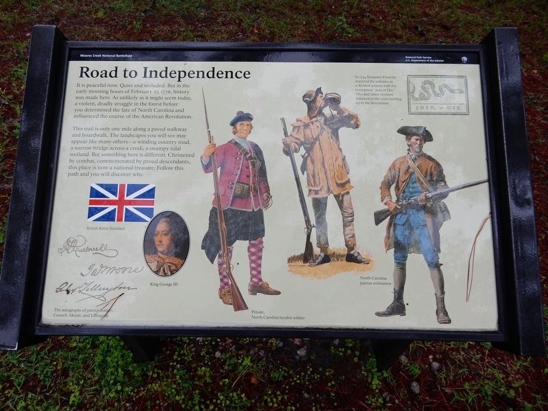
Road to Independence
— Moores Creek National Battlefield —
This trail is only one mile along a paved walkway and boardwalk. The landscapes you will see may appear like many others – a winding country road, a narrow bridge across a creek, a swampy tidal wetland. But something here is different. Christened by combat, commemorated by proud descendants, this place is now a national treasure. Follow this path and you will discover why.
[Captions (left to right)]
• The autographs of patriot leaders Caswell, Moore, and Lillington.
• British Battle Standard
• King George III
• Private, North Carolina loyalist soldier
• North Carolina patriot militiamen
• In 1754 Benjamin Franklin depicted the colonies as a divided serpent with the inscription “Join or Die.” This and other versions followed in the years leading up to the Revolution.
Erected by National Park Service.
Topics. This historical marker is listed in this topic list: War, US Revolutionary. A significant historical date for this entry is February 27, 1776.
Location. 34° 27.482′ N, 78° 6.593′ W. Marker is near Currie, North Carolina, in Pender County. Marker can be reached from Moores Creek Drive, 0.2 miles west of North Carolina Route 210. Marker is on the Moores Creek National Battlefield History Trail. Touch for map. Marker is in this post office area: Currie NC 28435, United States of America. Touch for directions.
Other nearby markers. At least 8 other markers are within walking distance of this marker. Moores Creek National Battlefield (a few steps from this marker); Brave Patriots (a few steps from this marker); Tarheel Trail (about 300 feet away, measured in a direct line); We Women Have...To Let Our Voices Be Heard (about 400 feet away); Women's Monument (about 400 feet away); Trees for a Navy (about 400 feet away); Blackwater Highways (about 500 feet away); Ghosts of an Industry (about 500 feet away). Touch for a list and map of all markers in Currie.
Credits. This page was last revised on March 19, 2023. It was originally submitted on March 19, 2023, by Duane and Tracy Marsteller of Murfreesboro, Tennessee. This page has been viewed 61 times since then and 4 times this year. Photo 1. submitted on March 19, 2023, by Duane and Tracy Marsteller of Murfreesboro, Tennessee.
Editor’s want-list for this marker. Wide shot of marker and surrounding area in context. • Can you help?
