Yerba Buena Island in San Francisco City and County, California — The American West (Pacific Coastal)
Defending the Bay for 150 Years
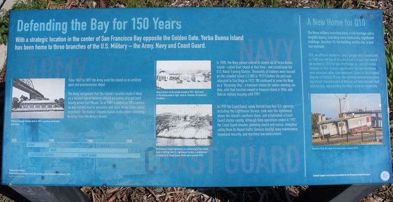
With a strategic location in the center of the San Francisco Bay opposite the Golden Gate, Yerba Buena Island has been home to three branches of the U.S. Military – the Army, Navy and Coast Guard.
From 1867 to 1897 the Army used the island as an artillery post and quartermaster depot.
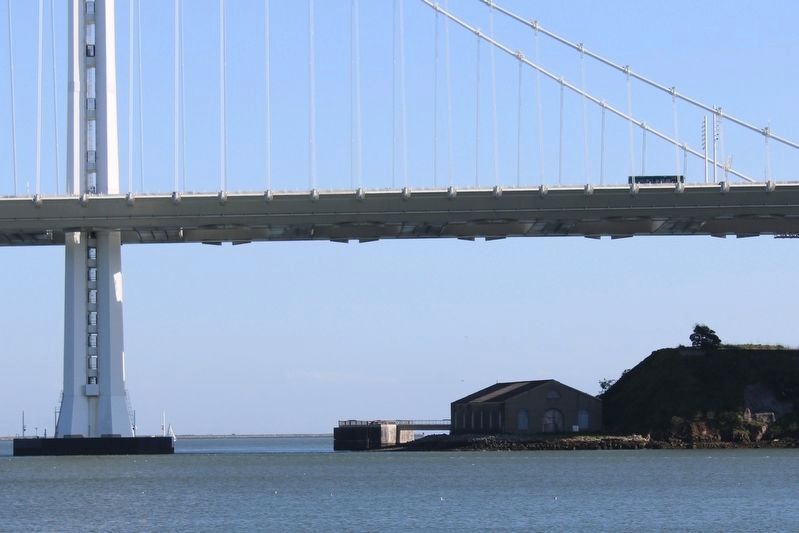
The Army recognized the island’s location made it ideal as a second line of defense should an enemy ship get past heavily armed Fort Mason. So in 1891 a station on YBI’s eastern tip was established to assemble and store mines (then called torpedoes). The historic Torpedo Station is the oldest remaining building from the Army’s tenure.
Inset Image:
Historic Torpedo Station, built 1891, awaiting restoration and reuse.
In 1898, the Navy gained control of almost all of Yerba Buena Island – called Goat Island at that time – and established the U.S. Naval Training Station. Thousands of trainees were housed on the crowded island (13,000 in 1917!) before the post was relocated to San Diego in 1923. YBI continued to serve the Navy as a “Receiving Ship,” a transient station for sailors awaiting sea duty, until that function moved to Treasure Island in 1946, and then as military housing until 1997.
Inset Image:
Navy trainees on the parade ground in 1921. Note tents in the background at right, used as ‘housing’ for hundreds of sailors.
In 1939 the Coast Guard, newly formed from four U.S. agencies, including the Lighthouse Service, took over the lighthouse above the island’s southern shore, and established a Coast Guard station nearby. Although Navy operations ended in 1997, the Coast Guard remains, providing search and rescue, navigation safety (from its Vessel Traffic Service facility), buoy maintenance, homeland security, and maritime law enforcement.
Inset Image:
Yerba Buena Island Lighthouse at southern tip of the island, built in 1875 by the U.S. Lighthouse Service, a predecessor to today’s U.S. Coast Guard. Photo taken around 1910.
A New Home for Q10
The three military branches leave a rich heritage and a tangible legacy, including many historically significant buildings. Quarters 10, the building on this site, is just one example.
Q10, an officer’s residence, and a garage were constructed in 1948 near the top of Macalla Road in a spot that would be needed in 2015 for new Bay Bridge on- and off-ramps. Because of their historic significance the two structures were relocated rather than destroyed. Listed on the National Register of Historic Places, the buildings demonstrate many significant characteristics of Modern and International Style architecture, representing
the Navy’s drive for modernity.
Inset Image:
Quarters 10 on the move to its new home, January 2015.
Erected by Treasure Island Museum.
Topics and series. This historical marker is listed in these topic lists: Architecture • Bridges & Viaducts • Communications. In addition, it is included in the Lighthouses series list. A significant historical year for this entry is 1867.
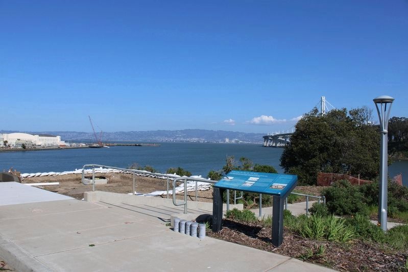
Location. 37° 48.815′ N, 122° 22.233′ W. Marker is in San Francisco, California, in San Francisco City and County. It is on Yerba Buena Island. Marker is on Treasure Island Road north of Macalla Road, on the right when traveling north. The resin marker is located in the parking lot at the south end of the causeway leading to Treasure Island. Touch for map. Marker is in this post office area: San Francisco CA 94130, United States of America. Touch for directions.
Other nearby markers. At least 8 other markers are within 2 miles of this marker, measured as the crow flies. Islands of the Pacific (approx. ¼ mile away); Treasure Island (approx. 0.7 miles away); Signal (approx. 0.7 miles away); Pier 1, Working Waterfront: Geography & Rail (approx. 1.6 miles away); Pier 1, Working Waterfront: The 1934 Strike (approx. 1.7 miles away); Pier 1, Working Waterfront: Ferry Service (approx. 1.7 miles away); Stephan C. Leonoudakis
(approx. 1.7 miles away); Pier 1, Working Waterfront: Design and Construction (approx. 1.7 miles away). Touch for a list and map of all markers in San Francisco.
Also see . . . Historic California Posts, Camps, Stations and Airfields: Coast Guard Station, San Francisco. California National Guard: California State Military History and Museums Program
"The Army established its presence on Yerba Buena Island in February 1867. The Island was set-aside for military purposes by presidential proclamation, which removed it from private ownership without compensation to its owners. Located between San Francisco and Oakland, the Island was 198 acres in area and 343 feet above sea level at its apex. It was covered with trees and brush. Springs of excellent water abounded on the eastern and western sides in the midst of a fertile valley."(Submitted on March 19, 2023, by Joseph Alvarado of Livermore, California.)
Credits. This page was last revised on June 14, 2023. It was originally submitted on March 19, 2023, by Joseph Alvarado of Livermore, California. This page has been viewed 95 times since then and 23 times this year. Photos: 1, 2, 3. submitted on March 19, 2023, by Joseph Alvarado of Livermore, California.
Editor’s want-list for this marker. Photo of Yerba Buena Island Lighthouse. Photo of Quarters 10 at its new location, just south of the marker. • Can you help?


