Near Currie in Pender County, North Carolina — The American South (South Atlantic)
Aftermath of Moores Creek
— Moores Creek National Battlefield —
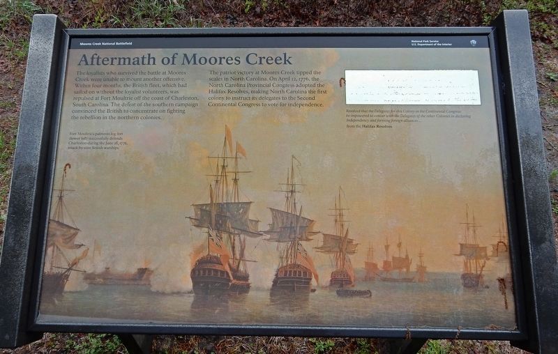
The patriot victory at Moores Creek tipped the scales in North Carolina. On April 12, 1776, the North Carolina Provincial Congress adopted the Halifax Resolves, making North Carolina the first colony to instruct its delegates to the Second Continental Congress to vote for independence.
[Captions]
Left: Fort Moultrie's palmetto log fort (lower left) successfully defends Charleston during the June 28 1776, attack by nine British warships.
Right: “Resolved that the Delegates for this Colony in the Continental Congress be impowered to concur with the Delegates of the other Colonies in declaring Independency and forming foreign alliances …” – from the Halifax Resolves
Erected by National Park Service.
Topics. This historical marker is listed in these topic lists: Patriots & Patriotism • War, US Revolutionary. A significant historical date for this entry is April 12, 1776.
Location. 34° 27.481′ N, 78° 6.755′ W. Marker is near Currie, North Carolina, in Pender County. Marker can be reached from Moores Creek Drive, 0.2 miles west of North Carolina Route 210. Marker is on the Moores Creek National Battlefield History Trail. Touch for map. Marker is in this post office area: Currie NC 28435, United States of America. Touch for directions.
Other nearby markers. At least 8 other markers are within walking distance of this marker. Old Wilmington and Fayetteville Stage Road (within shouting distance of this marker); Decisive Victory (within shouting distance of this marker); John Grady Memorial (within shouting distance of this marker); Commemorating the Battle (within shouting distance of this marker); Stunning Defeat (within shouting distance of this marker); A Very Bad Swamp ... (about 400 feet away, measured in a direct line); Wisely Chosen Ground (about 400 feet away); Road to the Sea (about 600 feet away). Touch for a list and map of all markers in Currie.
Credits. This page was last revised on June 24, 2023. It was originally submitted on March 20, 2023, by Duane and Tracy Marsteller of Murfreesboro, Tennessee. This page has been viewed 77 times since then and 15 times this year. Photos: 1. submitted on March 20, 2023, by Duane and Tracy Marsteller of Murfreesboro, Tennessee. 2. submitted on June 23, 2023, by Dave W of Co, Colorado.

