Old Town in College Park in Prince George's County, Maryland — The American Northeast (Mid-Atlantic)
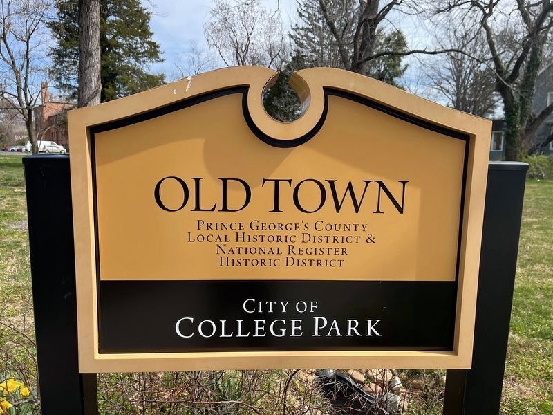
Old Town
City of College Park
— [Old Town College Park] —
Local Historic District &
National Register [of Historic Places]
Historic District
Erected by City of College Park, Maryland.
Topics. This historical marker is listed in these topic lists: Architecture • Education • Settlements & Settlers.
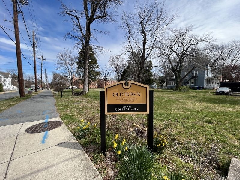
Location. 38° 58.739′ N, 76° 55.946′ W. Marker is in College Park, Maryland, in Prince George's County. It is in Old Town. Marker is at the intersection of Rhode Island Avenue and Calvert Road, on the right when traveling north on Rhode Island Avenue. Touch for map. Marker is at or near this postal address: 7302 Rhode Island Ave, College Park MD 20740, United States of America. Touch for directions.
Other nearby markers. At least 8 other markers are within walking distance of this marker. Trolley Trail (a few steps from this marker); In Recognition of Rose Greene Colby (within shouting distance of this marker); Old Parish House (about 400 feet away, measured in a direct line); McDonnell House (about 500 feet away); Harrison Store (about 700 feet away); Holbrook House (about 700 feet away); Cory House (about 800 feet away); Taliaferro House (approx. 0.2 miles away). Touch for a list and map of all markers in College Park.
Also see . . .
1. Old Town College Park. Wikipedia article about the historic district (Submitted on March 22, 2023, by Devry Becker Jones of Washington, District of Columbia.)
2. National Register of Historic Places Nomination Form for Old Town College Park.
This form was prepared in 2011 by Laura V. Trieschmann, Architectural Historian, and Anna Stillner Chiriboga, Historic Preservationist of EHT Traceries, Inc. A statement of the historical significance of the district can be found on pages 40-41:
Old Town College Park, a cohesive residential subdivision that developed in the late nineteenth century through the mid-twentieth century, exemplifies the railroad, streetcar, and early automobile suburbs that emerged in the Washington metropolitan area during this time. The neighborhood's evolution illustrates the gradual transformation of Prince George’s County from a semi-rural landscape dominated by farms in the late nineteenth century into a thriving commuter suburb of Washington, D.C., in the twentieth century. Platted in 1889 by real estate developers John O. Johnson and Samuel W. Curriden on farmland historically associated with the wealthy and influential Stier and Calvert families, the 125-aere neighborhood of College Park was laid out specifically to attract middle- and upper-middle-income residents, and persons associated with the nearby Maryland Agricultural College (later University of Maryland). The development of the subdivision,(Submitted on January 9, 2024, by Devry Becker Jones of Washington, District of Columbia.)inextricably tied to its strategic location between the Baltimore & Ohio (B&O) Railroad to the east and the Washington and Baltimore Turnpike to the west, rapidly grew with the introduction of the streetcar line that traversed the neighborhood at the beginning of the twentieth century and heightened with the marked expansion of the University of Maryland in the second quarter ofthe twentieth century. As the principle subdivision planned and developed near the college. Old Town College Park exists today as one ofthe first successful commuter suburbs located along the B&O Railroad and Washington and Baltimore Turnpike in Prince George’s County. With the period of greatest residential development beginning in the 1920s and subsiding with the end of World War II, Old Town College Park consists of buildings that reflect the periods in which they were erected, illustrating fashionable styles, forms, and materials. The variety of architectural styles found within the neighborhood included Queen Anne and Colonial Revival, as well as later designs and forms such as the American Foursquare, Cape Cod, and bungalow. To meet the needs of the burgeoning University of Maryland, residential buildings for the school’s fraternal organizations and modestly sized apartment complexes were constructed, further uniting the neighborhood and the university. These university-maintained buildings, generally occupying large lots with landscaped yards, illustrate many of the architectural fashions presented by their single-family residential neighbors, but on a much grander and more imposing scale. Today, Old Town College Park presents a well-defined and singular neighborhood characterized by landscaped streets and well-built, freestanding, single-family dwellings, garden apartments, and university housing. The primary period of significance for Old Town College Park is 1889, when Johnson and Curriden platted the neighborhood, to 1950. This captures the development of the suburban neighborhood from its establishment as a railroad suburb to its greatest period of growth as a streetcar and automobile suburb of Washington, D.C. The second period of significance, extending from 1935 to 1965, captures the contribution of the University of Maryland to the neighborhood. Old Town College Park is recommended for listing in the National Register of Historic Places as a historic district under Criteria A and C, and is significant at the local level under the areas of Architecture and Community Planning/Development. Old Town College Park is nominated under the Multiple Property Document, Historic Residential Suburbs in the United States, 1830-1960 (National Park Service, 2002) as a representative of three of the four subtypes—Railroad and Horsecar Suburbs. Streetcar Suburbs, and Early Automobile Suburbs.
Credits. This page was last revised on January 9, 2024. It was originally submitted on March 22, 2023, by Devry Becker Jones of Washington, District of Columbia. This page has been viewed 59 times since then and 12 times this year. Photos: 1, 2. submitted on March 22, 2023, by Devry Becker Jones of Washington, District of Columbia.

