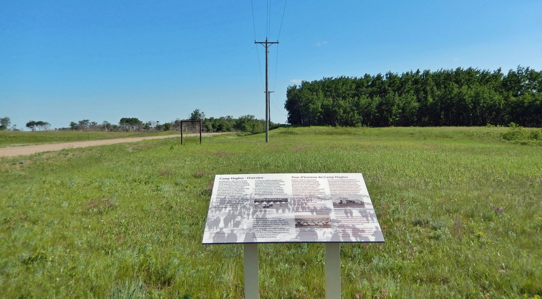
Camp Hughes in North Cypress – Langford Municipality, Manitoba — Canada’s Prairie Region (North America)
Camp Hughes — Overview / Tour d'horizon du Camp Hughes
Inscription.
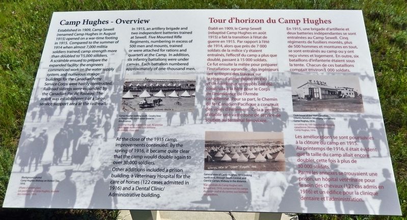
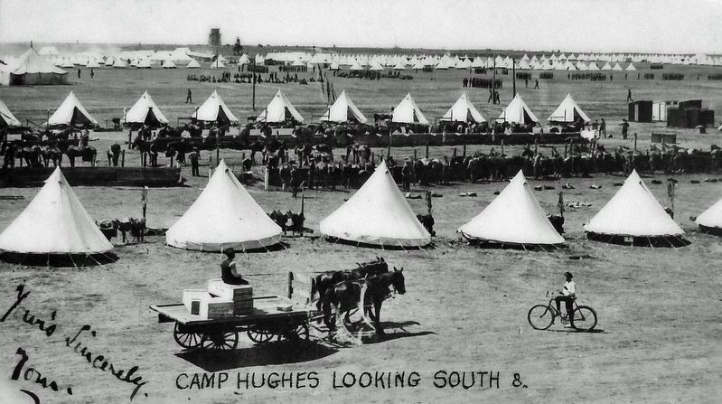
In 1915, an artillery brigade and two independent batteries trained at Sewell. Five Mounted Rifle Regiments, numbering in excess of 500 men and mounts, trained or were attached for rations and quarters at the Camp. In addition, six infantry battalions were under canvas. Each battalion numbered approximately of one-thousand men.
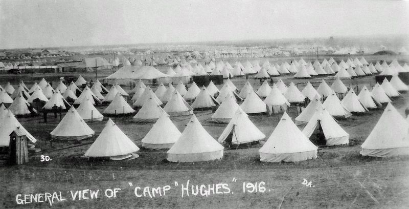
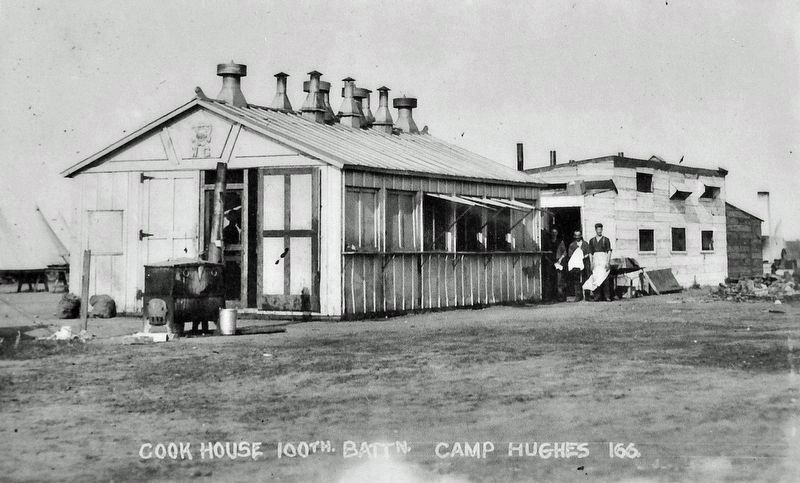
At the close of the 1915 camp, improvements continued. By the spring of 1916, it became quite clear that the camp would double again to over 30,000 soldiers. Other additions included a prison building, a Veterinary Hospital for the care of horses (122 cases admitted in 1916) and a Dental Clinic/ Administrative building.
(Background photo) Camp Hughes Midway on Visitors' Day, 1916.
En 1915, une brigade d'artillerie et deux batteries indépendantes se sont entraînées au Camp Sewell. Cinq régiments de fusiliers montés, plus de 500 hommes et montures en tout, se sont entraînés au camp ou y ont reçu vivres et logement. En outre, six bataillons d'infanterie étaient sous la tente. Chacun de ces bataillons comptait environ 1 000 soldats.
Les améliorations se sont poursuivies à la clôture du camp en 1915. Au printemps de 1916, il était évident
que la taille du camp allait encore doubler, cette fois à plus de 30 000 soldats. Parmi les annexes se trouvaient une prison, un hôpital vétérinaire pour le soin des chevaux (122 cas admis en 1916) et un édifice pour la clinique dentaire et l'administration.
(Photo d'arrière-plan) Les pavillons du Camp Hughes, Journée des visiteurs, 1916.
Topics. This historical marker is listed in these topic lists: Education • Railroads & Streetcars • War, World I. A significant historical year for this entry is 1915.
Location. 49° 53.092′ N, 99° 33.197′ W. Marker is in Camp Hughes, Manitoba, in North Cypress – Langford Municipality. Marker is on Camp Hughes Road (Road 91 W) one kilometer south of Provincial Road 351, on the right when traveling south. Southmost of three Camp Hughes National Historic Site interpretive panels at this location. Touch for map. Marker is in this post office area: Camp Hughes MB R0K 2A0, Canada. Touch for directions.
Other nearby markers. At least 8 other markers are within walking distance of this marker. The Soldier's Recreation / Les moments de loisir des soldats (here, next to this marker); The Parade Ground / La terrain de parade (here, next to this marker); Headquarters, Administration and Logistics Area (within shouting distance of this marker); Camp Hughes Railway Station / Depot / Railhead Area (within shouting distance of this marker); Camp Life / La vie de camp
(approx. 0.6 kilometers away); Training For War / L'entraînement de guerre (approx. 0.6 kilometers away); Camp Hughes National Historic Site of Canada / Le camp Hughes Lieu historique national du Canada (approx. 0.6 kilometers away); Trench Warfare / La guerre de tranchées (approx. 0.6 kilometers away). Touch for a list and map of all markers in Camp Hughes.
Related markers. Click here for a list of markers that are related to this marker. Camp Hughes National Historic Site
Also see . . . Camp Hughes National Historic Site of Canada. Camp Hughes National Historic Site of Canada is located south of the Trans-Canada Highway 10 kilometres west of Carberry, Manitoba. Formerly a First World War military training camp, it is one of the most intact simulated battlefield terrains in Canada. The site consists of rolling open grassy fields, remnants of the military camp consisting of administration and training areas, a cemetery and archaeological vestiges. Official recognition refers to the 420 hectare parcel of land including training trenches, rifle range, grenade training ground, artillery observation posts and a cemetery. (Submitted on March 26, 2023, by Cosmos Mariner of Cape Canaveral, Florida.)
Credits. This page was last revised on March 26, 2023. It was originally submitted on March 23, 2023, by Cosmos Mariner of Cape Canaveral, Florida. This page has been viewed 88 times since then and 21 times this year. Photos: 1, 2, 3, 4, 5. submitted on March 25, 2023, by Cosmos Mariner of Cape Canaveral, Florida.
