Camp Hughes in North Cypress – Langford Municipality, Manitoba — Canada’s Prairie Region (North America)
The Parade Ground / La terrain de parade
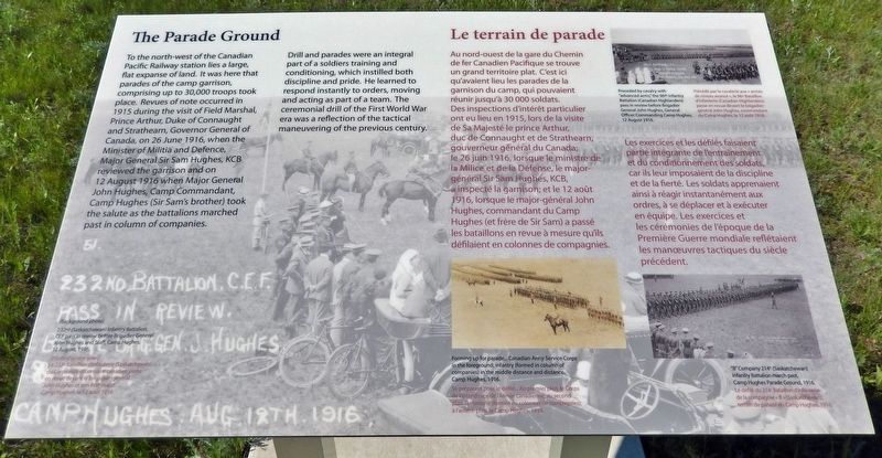
Drill and parades were an integral part of a soldiers training and conditioning, which instilled both discipline and pride. He learned to respond instantly to orders, moving and acting as part of a team. The ceremonial drill of the First World War era was a reflection of the tactical maneuvering of the previous century.
(Background photo) 232nd (Saskatchewan) Infantry Battalion, CEF pass in review before Brigadier General John Hughes and Staff, Camp Hughes, 12 August, 1916.
Les exercices et les défilés faisaient partie intégrante de l'entraînement et du conditionnement des soldats, car ils leur imposaient de la discipline et de la fierté. Les soldats apprenaient ainsi à réagir instantanément aux ordres, à se déplacer et à exécuter en équipe. Les exercices et les cérémonies de l'époque de la Première Guerre mondiale reflétaient les manœuvres tactiques du siècle précédent.
(Photo d'arrière-plan) Le 232e Bataillon d'infanterie (Saskatchewan) du Corps expéditionnaire canadien passe en revue devant le brigadier-général John Hughes et son état-major, Camp Hughes, le 12 août 1916.
Topics. This historical marker is listed in these
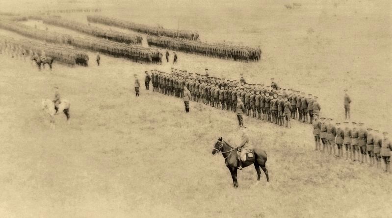
2. Marker detail: Forming up for parade / Se préparant pour le défilé
—————
Au premier plan, le Corps de l'intendance de l'Armée canadienne; au second plan, l’infanterie (formée en colonnes de compagnies); à l'arrière-plan, le Camp Hughes, 1916.
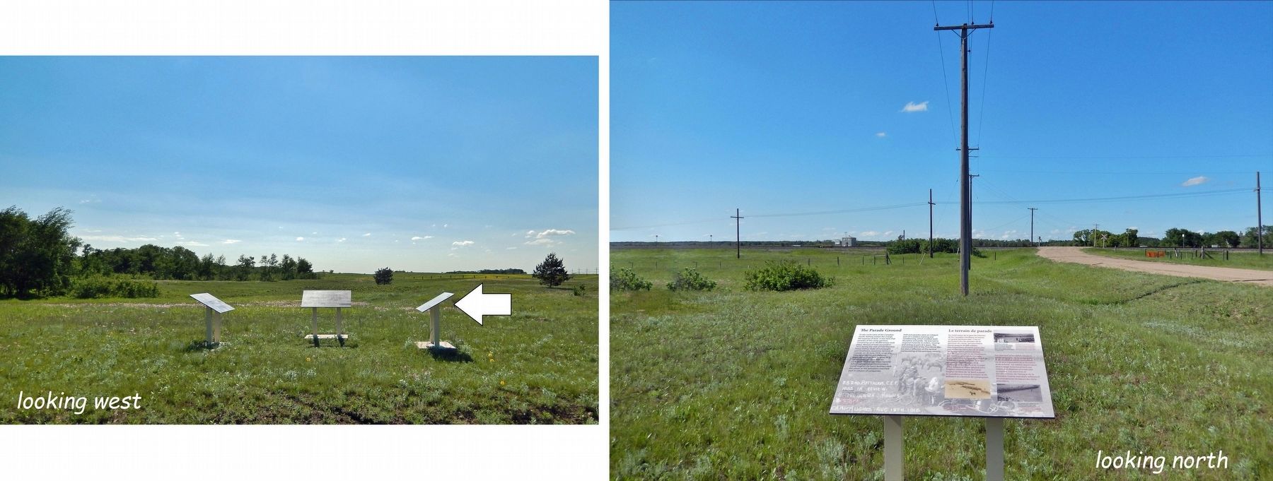
Location. 49° 53.096′ N, 99° 33.198′ W. Marker is in Camp Hughes, Manitoba, in North Cypress – Langford Municipality. Marker is on Camp Hughes Road (Road 91 W) one kilometer south of Provincial Road 351, on the right when traveling south. Northmost of three Camp Hughes National Historic Site interpretive panels at this location. Touch for map. Marker is in this post office area: Camp Hughes MB R0K 2A0, Canada. Touch for directions.
Other nearby markers. At least 8 other markers are within walking distance of this marker. The Soldier's Recreation / Les moments de loisir des soldats (here, next to this marker); Camp Hughes — Overview / Tour d'horizon du Camp Hughes (here, next to this marker); Camp Hughes Railway Station / Depot / Railhead Area (within shouting distance of this marker); Headquarters, Administration and Logistics Area (within shouting distance of this marker); Camp Life / La vie de camp (approx. 0.6 kilometers away); Training For War / L'entraînement de guerre (approx. 0.6 kilometers away); Camp Hughes National Historic Site of Canada / Le camp Hughes Lieu historique national du Canada (approx. 0.6 kilometers away); Trench Warfare / La guerre de tranchées (approx. 0.6 kilometers away). Touch for a list and map of all markers in Camp Hughes.
Related markers.
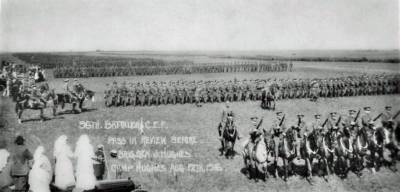
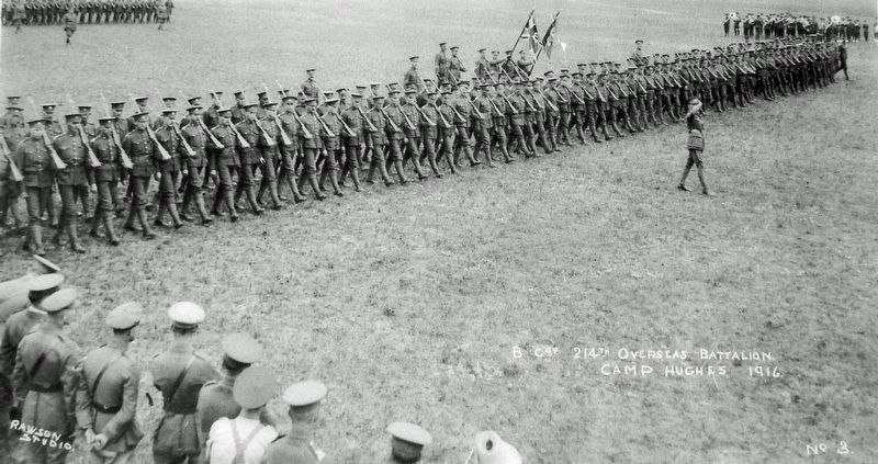
3. Marker detail: Canadian Highlanders
—————
Précédé par la cavalerie aux « armes de niveau avancé », le 96e Bataillon d'infanterie (Canadian Highlanders) passe en revue devant le brigadier-général John Hughes, commandant du Camp Hughes, le 12 août 1916.
Also see . . . Camp Hughes National Historic Site of Canada. Camp Hughes National Historic Site of Canada is located south of the Trans-Canada Highway 10 kilometres west of Carberry, Manitoba. Formerly a First World War military training camp, it is one of the most intact simulated battlefield terrains in Canada. The site consists of rolling open grassy fields, remnants of the military camp consisting of administration and training areas, a cemetery and archaeological vestiges. Official recognition refers to the 420 hectare parcel of land including training trenches, rifle range, grenade training ground, artillery observation posts and a cemetery. (Submitted on March 26, 2023, by Cosmos Mariner of Cape Canaveral, Florida.)
Credits. This page was last revised on March 26, 2023. It was originally submitted on March 23, 2023, by Cosmos Mariner of Cape Canaveral, Florida. This page has been viewed 55 times since then. Photos: 1, 2, 3, 4, 5. submitted on March 26, 2023, by Cosmos Mariner of Cape Canaveral, Florida.
