Camp Hughes in North Cypress – Langford Municipality, Manitoba — Canada’s Prairie Region (North America)
Training For War
⎯⎯⎯
L'entraînement de guerre
Photographed by Cosmos Mariner, June 18, 2022
1. Training For War / L'entraînement de guerre Marker

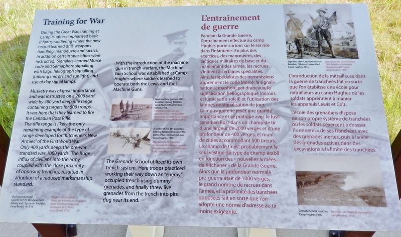
Musketry was of great importance and was instructed on a 2000 yard wide by 400 yard deep rifle range containing targets for 500 troops. It was here that they learned to fire the Canadian Ross Rifle. The rifle range is likely the only remaining example of the type of range developed for "Kitchener's New Armies" of the First World War. Only 400 yards deep, the pre-war standard was 1000 yards. The huge influx of civilians into the army, coupled with the close proximity of opposing trenches, resulted in adoption of a reduced marksmanship standard.
With the introduction of the machine gun in trench warfare, the Machine Gun School was established at Camp Hughes where soldiers learned to operate both the Lewis and Colt Machine Guns.
The Grenade School utilized
this page online
(Background photo)
Gunner, 36th (St. Boniface) Field Battery and 13 pounder field gun, Camp Sewell, 1913-14.
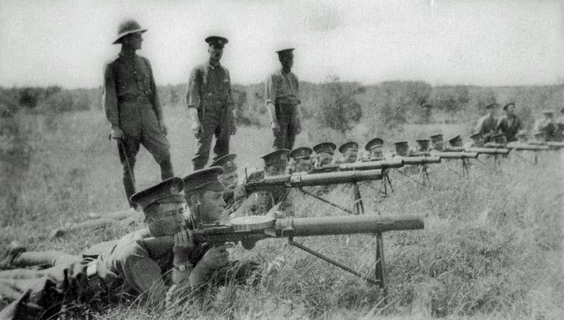
2. Marker detail: Machine Gun School / École de mitrailleurs
Lewis machine gunners, 108th Canadian Infantry Battalion, Camp Hughes Machine Gun School, 1916. ————— Mitrailleurs préposés aux appareils Lewis, 108e Bataillon d'infanterie canadienne, école des mitrailleurs camp Hughes, 1916.
L'introduction de la mitrailleuse dans la guerre de tranchées fait en sorte que l'on établisse une école pour mitrailleurs au camp Hughes où les soldats apprennent à manier les appareils Lewis et Colt.
L'école des grenadiers dispose de son propre système de tranchées où les soldats s'exercent à chasser l'« ennemi » de ses tranchées avec des grenades inertes, puis à lancer des grenades actives dans des excavations à la limite des tranchées.
(Photo à l'arrière-plan)
Tireur, 36e Artillerie de campagne (Saint-Boniface) et pièce de campagne de 13 livres, camp Sewell, 1913-14.
Topics. This historical marker is listed in these topic lists: Education • War, World I. A significant historical year for this entry is 1916.
Location. 49° 52.816′ N, 99° 33.446′ W. Marker is in Camp Hughes, Manitoba, in North Cypress – Langford Municipality. It can be reached from Camp Hughes Road (Road 91 W) 1.6 kilometers south of Provincial Road
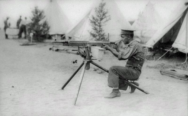
3. Marker detail: Cold Machine Gun / Mitrailleuse Colt
A soldier of the 44th Canadian Infantry Battalion looks over the sights of his Colt machine gun. Camp Hughes, 1915. ————— Un soldat du 44e Bataillon d'infanterie canadienne regarde dans le viseur de sa mitrailleuse Colt, camp Hughes, 1915

Regionally, this marker is in Southwest Manitoba. It is also in the Prairies. Globally, it is in North America, the Western Hemisphere, the Western World, and the Anglosphere. Historically, it finds itself in what was once a British colony, the Viceroyalty of New France, and Rupert’s Land.
Other nearby markers. At least 8 other markers are within walking distance of this marker: Trench Warfare / La guerre de tranchées (here, next to this marker); Camp Life / La vie de camp (here, next to this marker); Camp Hughes National Historic Site of Canada / Le camp Hughes Lieu historique national du Canada (here, next to this marker); Camp Hughes (a few steps from this marker); Camp Hughes / Le Camp Hughes (a few steps from this marker); The Hospital / L'hôpital (approx. 0.4 kilometers away); Camp Hughes — Overview / Tour d'horizon du Camp Hughes (approx. 0.6 kilometers away); The Soldier's Recreation / Les moments de loisir des soldats
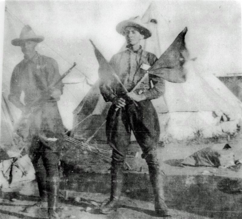
4. Marker detail: Signaler / Spécialiste des transmissions
Signaler, 196th Canadian Infantry Battalion (Western Universities) Camp Hughes, 1916. ————— Spécialiste des transmissions, 196e Bataillon d'infanterie (Universités de l'Ouest), camp Hughes, 1916.
Related markers. Click here for a list of markers that are related to this marker. Camp Hughes National Historic Site
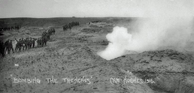
5. Marker detail: Grenade School Trenches /
Tranchées de l'école des grenadiers • Camp Hughes, 1916
Tranchées de l'école des grenadiers • Camp Hughes, 1916
Photographed by Cosmos Mariner, June 18, 2022
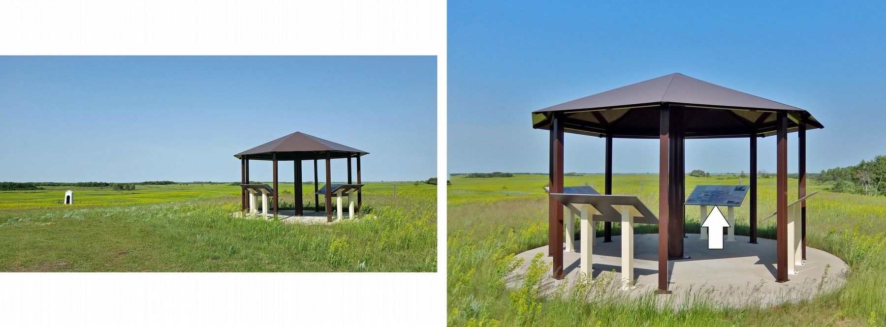
6. Training For War / L'entraînement de guerre Marker
—————
Lieu historique national du Camp Hughes en arrière-plan
Credits. This page was last revised on March 25, 2023. It was originally submitted on March 23, 2023, by Cosmos Mariner of Cape Canaveral, Florida. This page has been viewed 198 times since then and 30 times this year. Photos: 1, 2, 3, 4, 5, 6. submitted on March 25, 2023, by Cosmos Mariner of Cape Canaveral, Florida.
