Haleyville in Winston County, Alabama — The American South (East South Central)
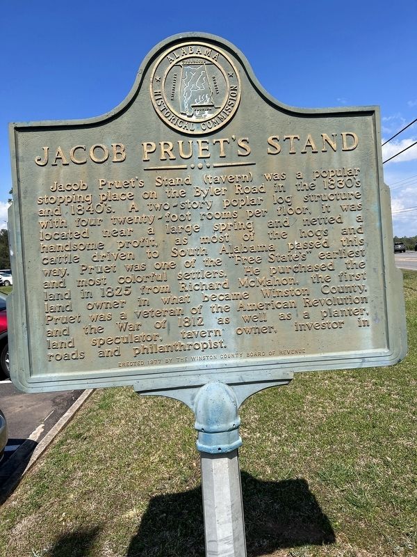
Jacob Pruet’s Stand
Erected 1977 by Winston County Board of Revenue.
Topics. This historical marker is listed in these topic lists: Settlements & Settlers • War of 1812 • War, US Revolutionary. A significant historical year for this entry is 1812.
Location. 34° 14.467′ N, 87° 35.465′ W. Marker is in Haleyville, Alabama, in Winston County. Marker is on Alabama Route 195 near Layne Hill Drive. In front of Lakewood Medical Center. Touch for map. Marker is at or near this postal address: 42024 AL-195, Haleyville AL 35565, United States of America. Touch for directions.
Other nearby markers. At least 8 other markers are within 11 miles of this marker, measured as the crow flies. First 9-1-1 Call (approx. 2 miles away); City of Haleyville, Alabama (approx. 2.1 miles away); The Honorable Frank Minis Johnson, Jr. (approx. 2.1 miles away); The Byler Road (approx. 2.1 miles away); Haleyville Ice Company (approx. 2.6 miles away); Factory Cemetery (approx. 8 miles away); The Free State of Winston / Natural Bridge (approx. 10.3 miles away); Byler Road / History of Natural Bridge (approx. 10.6 miles away). Touch for a list and map of all markers in Haleyville.
Credits. This page was last revised on April 6, 2023. It was originally submitted on April 5, 2023, by Billy Clemmons of Florence, Alabama. This page has been viewed 136 times since then and 42 times this year. Photo 1. submitted on April 5, 2023, by Billy Clemmons of Florence, Alabama. • James Hulse was the editor who published this page.
Editor’s want-list for this marker. Wide shot of marker and its surroundings. • Can you help?
