Fondulac Township in East Peoria in Tazewell County, Illinois — The American Midwest (Great Lakes)
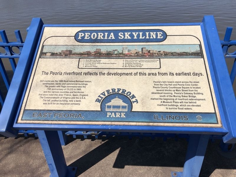
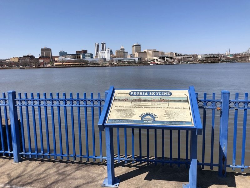
Peoria Skyline
Still visible are the 1899 Rock Island Railroad station, warehouses, banks and commercial buildings. The gazebo with flags commemorates the 75th anniversary of CILCO in 1989, and the various countries and territories that once ruled this area: France, Spain, England, The Commonwealth of Virginia and the U.S.A. The tall, peaked building, now a bank, was built for an insurance company.
Peoria's twin towers stand across the street from the City Hall and Peoria Civic Center. Peoria County Courthouse Square is located several blocks up Main Street from the steamboat mooring. Peoria's Gateway Building, south of the Murray Baker Bridge, marked the beginning of riverfront redevelopment. A Museum Plaza will rise behind riverfront buildings, which are elevated to survive flood waters.
[Legend]
• 1. Bob Michel Bridge
• 2. Gazebo with flags
• 3. Former Rock Island Railroad Station
• 4. Twin Towers
• 5. Museum Plaza
• 6. One of Peoria's oldest bank buildings
• 7. Caterpillar Inc. World Headquarters
• 8. Gateway Building
• 9. St. Mary's Cathedral
• 10. Murray Baker Bridge
Topics. This historical marker is listed in this topic list: Notable Buildings. A significant historical year for this entry is 1899.
Location. 40° 41.089′ N, 89° 35.142′ W. Marker is in East Peoria, Illinois, in Tazewell County. It is in Fondulac Township. Marker can be reached from Riverside Drive, on the right when traveling west. Marker is in East Peoria Riverfront Park. Touch for map. Marker is at or near this postal address: 1201 Riverside Dr, East Peoria IL 61611, United States of America. Touch for directions.
Other nearby markers. At least 8 other markers are within walking distance of this marker. CILCO-Wallace Station (within shouting distance of this marker); Bridges (within shouting distance of this marker); Steamboats (within shouting distance of this marker); Railroads (about 300 feet away, measured in a direct line); East Peoria Veterans Memorial (about 400 feet away); Manitowoc Submarines (approx. 0.3 miles away); Peoria on The Riverfront / Peoria (approx. 0.4 miles away); Schwab - Powell Building (approx. 0.4 miles away). Touch for a list and map of all markers in East Peoria.
Credits. This page was last revised on April 10, 2023. It was originally submitted on April 10, 2023, by Duane and Tracy Marsteller of Murfreesboro, Tennessee. This page has been viewed 85 times since then and 18 times this year. Photos: 1, 2. submitted on April 10, 2023, by Duane and Tracy Marsteller of Murfreesboro, Tennessee.

