Woodbridge in San Joaquin County, California — The American West (Pacific Coastal)
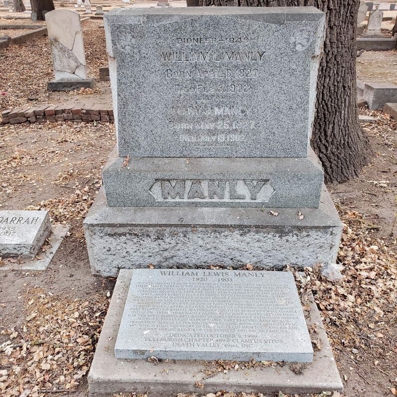
William Lewis Manly
1803-1903
In late 1849 instead of wintering in Salt Lake, many argonauts, in their haste to reach the gold fields, took the Spanish Trail on to California. One large group, following a faulty map of a supposed short cut, left the trail in southern Utah and then went west. Most eventually returned to the Spanish Trail. A few ragtag bands wandered across Nevada and down Furnace Creek Wash into Death Valley during December 1849. Many turned north making it out by way of Towne Pass. The Bennett-Arcan group turned south after a failed attempt at crossing the Panamints. They stopped at a small watering hole south of Bennett's Well unable to go on. From there Manly, along with John Rogers, left on foot for the settlements returning in early February with much-needed supplies. Finally on March 7th, 1850 they reached Rancho San Francisco. Manly later wrote the classic book "Death Valley in '49" which told the story of the ill-fated shortcut and his and Rogers' heroic rescue of the Bennett and Arcan families.
Erected 1999 by Tuleburgh Chapter No. 69 E Clampus Vitus, and Death Valley 49ers Inc.
Topics and series. This historical marker is listed in this topic list: Settlements & Settlers. In addition, it is included in the E Clampus Vitus series list. A significant historical year for this entry is 1849.
Location. 38° 8.973′ N, 121° 18.034′ W. Marker is in Woodbridge, California, in San Joaquin County. Marker is on North Lower Sacramento Road. The marker is located in the southeast corner of Woodbridge Cemetery. Touch for map. Marker is at or near this postal address: 18550 N Lower Sacramento Rd, Woodbridge CA 95258, United States of America. Touch for directions.
Other nearby markers. At least 8 other markers are within 2 miles of this marker, measured as the crow flies. San Joaquin Valley College (approx. ¼ mile away); Salem School Bell (approx. 0.4 miles away); Woman's Club of Lodi (approx. 1.6 miles away); Laura de Force Gordon (approx. 1.6 miles away); The Valley Review (approx. 1.7 miles away); Hotel Lodi (approx. 1.8 miles away); Lodi Opera House (approx. 1.8 miles away); The First A&W Root Beer (approx. 1.8 miles away).
Regarding William Lewis Manly. Rancho San Francisco, located in the Santa Clarita Valley north of Los Angeles, was part of the San Fernando Mission. This is where Rogers and Manly obtained supplies to rescue the others waiting in Death Valley.
Related markers. Click here for a list of markers that are related to this marker. - Rancho San Francisco, and Bennett-Arcan Long Camp.
Credits. This page was last revised on April 26, 2023. It was originally submitted on April 12, 2023, by Brock Wiley of Modesto, California. This page has been viewed 100 times since then and 37 times this year. Photo 1. submitted on April 12, 2023, by Brock Wiley of Modesto, California. • J. Makali Bruton was the editor who published this page.
