Allen in Collin County, Texas — The American South (West South Central)
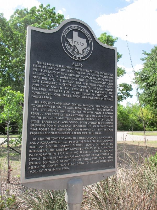
Allen
The Houston and Texas Central Railroad filed documents to create the town of Allen from the James L. Read survey in 1876. The village was named for Ebenezer Allen, a former Republic and State of Texas attorney general and a founder of the Houston and Texas Central Railroad. A dry goods store, barber shop, and school soon opened in the rapidly growing town. Sam Bass reportedly led an outlaw gang that robbed the Allen Depot on February 22, 1878. This was probably the first successful train robbery in Texas.
By 1884 the town of Allen had three churches, a flour mill, and a population of 350. In 1908 the Texas Traction Company built an electric railway through town, calling it the Interurban. The citizenry numbered 550 by 1915. Allen was incorporated in 1953 with 400 residents. Electric railway service ended in 1948 but railway freight service continued. Strong economic growth in the Dallas-Fort Worth area helped the town's population grow to include more than 19,000 citizens in the 1990s.
Erected 1998 by Texas Historical Commission. (Marker Number 11817.)
Topics. This historical marker is listed in this topic list: Settlements & Settlers.
Location. 33° 6.804′ N, 96° 39.882′ W. Marker is in Allen, Texas, in Collin County. Marker is on North Cedar Drive, ¼ mile south of Exchange Parkway, on the left when traveling south. Allen Station Park. Touch for map. Marker is in this post office area: Allen TX 75013, United States of America. Touch for directions.
Other nearby markers. At least 8 other markers are within 4 miles of this marker, measured as the crow flies. Allen Water Station (approx. ¼ mile away); Stone Dam at Allen Station (approx. ¼ mile away); The Allen Station of the Texas Electric Railway (approx. 0.8 miles away); Allen Cemetery (approx. 0.9 miles away); First Methodist Church of Allen (approx. 1.4 miles away); Lovejoy School (approx. 3.2 miles away); Forest Grove Christian Church (approx. 3½ miles away); Williams Cemetery (approx. 4 miles away). Touch for a list and map of all markers in Allen.
Credits. This page was last revised on April 15, 2023. It was originally submitted on April 13, 2023, by Jeff Leichsenring of Garland, Texas. This page has been viewed 94 times since then and 23 times this year. Photos: 1, 2. submitted on April 13, 2023, by Jeff Leichsenring of Garland, Texas. • James Hulse was the editor who published this page.

