Brownsville in Cameron County, Texas — The American South (West South Central)
Resaca de la Palma
Resaca de la Palma Battlefield
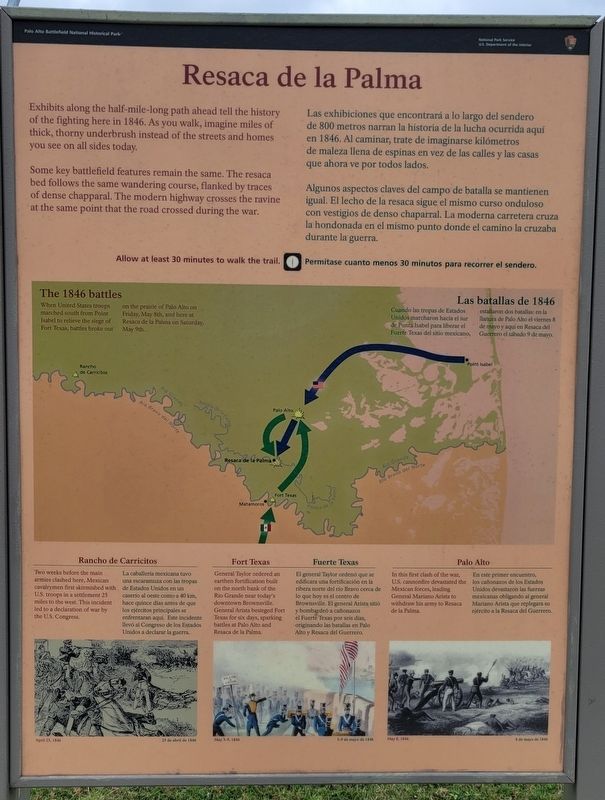
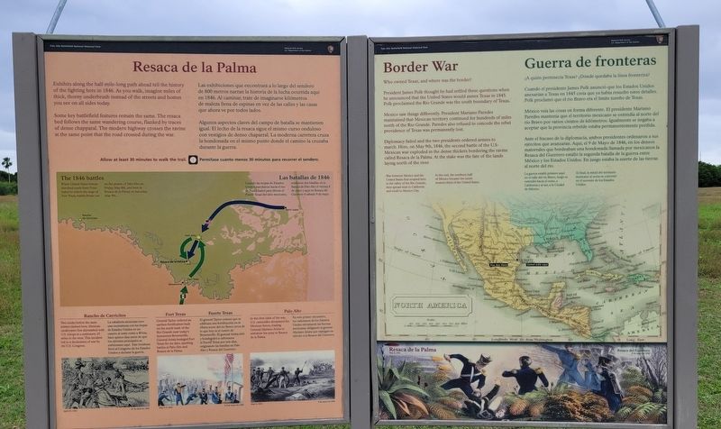
Some key battlefield features remain the same. The resaca bed follows the same wandering course, flanked by traces of dense chapparal. The modern highway crosses the ravine at the same point that the road crossed during the war.
The 1846 battles
When United States troops marched south from Point Isabel to relieve the siege of Fort Texas, battles broke out on the prairie of Palo Alto on Friday, May 8th, and here at Resaca de la Paima on Saturday, May 9th.
Rancho de Carricitos
Two weeks before the main armies clashed here, Mexican cavalrymen first skirmished with U.S. troops in a settlement 25 miles to the west. This incident led to a declaration of war by the U.S. Congress.
Fort Texas
General Taylor ordered an earthen fortification built on the north bank of the Rio Grande near today's downtown Brownsville, General Arista besieged Fort Texas for six days, sparking battles at Palo Alto and Resaca de la Palma.
Palo Alto
In this first clash of the war, U.S. cannonfire devastated the Mexican forces, leading General Mariano Arista to withdraw his army to Resaca de la Palma.
Spanish:
Algunos aspectos claves del campo de batalla se mantienen igual. El lecho de la resaca sigue el mismo curso onduloso con vestigios de denso chaparral. La moderna carretera cruza la hondonada en el mismo punto donde el camino la cruzaba durante la guerra.
Las batallas de 1846
Cuando las tropas de Estados Unidos marcharon hacia el sur de Punta Isabel para liberar el Fuerte Texas del sitio mexicano, estallaron dos batallas: en la llanura de Palo Alto el viernes 8 de mayo y aquí en Resaca del Guerrero el sábado 9 de mayo.
Rancho de Carricitos
La caballería mexicana tuvo una escaramuza con las tropas de Estados Unidos en un caserío al oeste como a 40 km, hace quince días antes de que los ejércitos principales se enfrentaran aquí. Este incidente llevó al Congreso de los Estados
Unidos a declarar la guerra.
Fuerte Texas
El general Taylor ordenó que se edificara una fortificación en la ribera norte del río Bravo cerca de lo que hoy es el centro de Brownsville. El general Arista sitió y bombardeó a cañonazos el Fuerte Texas por seis días, originando las batallas en Palo Alto y Resaca del Guerrero.
Palo Alto
En este primer encuentro, los cañonazos de los Estados Unidos devastaron las fuerzas mexicanas obligando al general Mariano Arista que replegara su ejército a la Resaca del Guerrero.
Erected by National Park Service - U.S. Department of the Interior.
Topics. This historical marker is listed in this topic list: War, Mexican-American. A significant historical date for this entry is May 8, 1846.
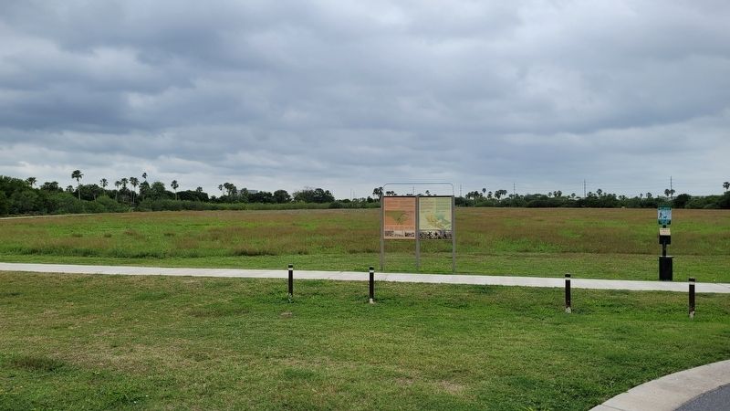
Location. 25° 56.349′ N, 97° 29.239′ W. Marker is in Brownsville, Texas, in Cameron County. Marker can be reached from the intersection of Paredes Line Road and Palo Verde Drive. The marker is located along the northwest section of the Resaca de la Palma trail. Touch for map. Marker is at or near this postal address: 1024 Paredes Line Road, Brownsville TX 78521, United States of America. Touch for directions.
Other nearby markers. At least 8 other markers are within walking distance of this marker. Border War (here, next to this marker); The Resaca de la Palma Battlesite (within shouting distance of this marker); Monumental History (within shouting distance of this marker); A Daunting Defense (about 400 feet away, measured in a direct line); Take the Cannon! (about 500 feet away); The Battle of Resaca de la Palma (about 500 feet away); Into the Mexican Camp (about 700 feet away); Hand-to-Hand (about 800 feet away). Touch for a list and map of all markers in Brownsville.
More about this marker. The battlefield and the markers are located on the grounds of the Resaca de la Palma National Historical Park which is free to access.
Also see . . . Resaca de la Palma Battlefield. National Park Service - Department of the Interior
Resaca de la Palma, also known as Resaca de Guerrero, is an old, dry river channel of the Rio Grande. It is one of many long, water-filled ravines left behind by the shifting course of the winding river. The old pathway was lined with dense brush and its bed was dotted with pools of water. The Mexican Army hoped these natural features would limit any attack against troops positioned there.(Submitted on April 26, 2023, by James Hulse of Medina, Texas.)
Credits. This page was last revised on April 26, 2023. It was originally submitted on April 26, 2023, by James Hulse of Medina, Texas. This page has been viewed 75 times since then and 21 times this year. Photos: 1, 2, 3. submitted on April 26, 2023, by James Hulse of Medina, Texas.


