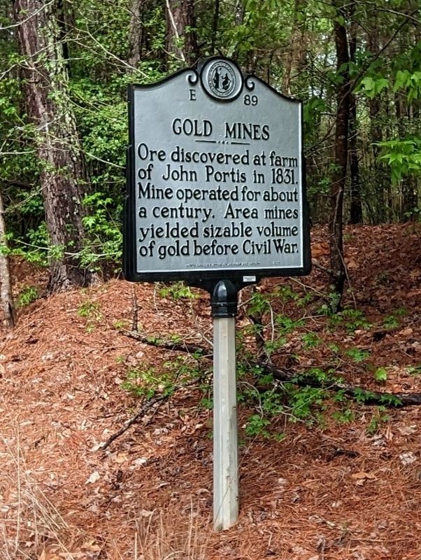
Near Hollister in Franklin County, North Carolina — The American South (South Atlantic)
Gold Mines
Erected 1977 by North Carolina Office of Archives and History. (Marker Number E-89.)
Topics. This historical marker is listed in this topic list: Natural Resources. A significant historical year for this entry is 1831.
Location. 36° 11.772′ N, 78° 0.662′ W. Marker is near Hollister, North Carolina, in Franklin County. Marker is at the intersection of North Carolina Route 561 and Taylor's Store Road, on the left when traveling east on State Route 561. Touch for map. Marker is at or near this postal address: 2895 NC-561, Louisburg NC 27549, United States of America. Touch for directions.
Other nearby markers. At least 8 other markers are within 15 miles of this marker, measured as the crow flies. Sidney Weller (approx. 8.3 miles away); William H. Wills (approx. 10.9 miles away); Bartholomew F. Moore (approx. 11.3 miles away); Walter Clark (approx. 12˝ miles away); British Victory (approx. 14.1 miles away); Bute County (approx. 14˝ miles away); "Bridle Creek" (approx. 14.8 miles away); Shocco Springs (approx. 14.9 miles away).
Also see . . . Gold Mines.
There are six distinct gold belts in North Carolina. The Eastern North Carolina Belt contains fifteen mines in Franklin, Halifax, Nash, and Warren Counties. The first discovery and the most important mine in the Eastern Belt was the Portis Mine in northern Nash County near the community of Wood. The mine was named for John Portis who owned the land and discovered the first nuggets. The surface mines on the Portis property were worked from 1831 until the Civil War, in the 1880’s, and again in the 1930’s.(Submitted on April 29, 2023, by Michael Buckner of Durham, North Carolina.)
Credits. This page was last revised on April 29, 2023. It was originally submitted on April 29, 2023, by Michael Buckner of Durham, North Carolina. This page has been viewed 79 times since then and 43 times this year. Photo 1. submitted on April 29, 2023, by Michael Buckner of Durham, North Carolina. • Bernard Fisher was the editor who published this page.
Editor’s want-list for this marker. Wide shot of marker and its surroundings. • Can you help?
