Oakland Hills in Alameda County, California — The American West (Pacific Coastal)
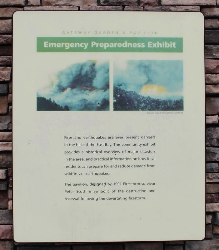
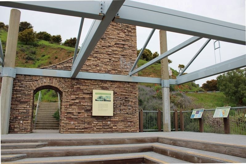
Emergency Preparedness Exhibit
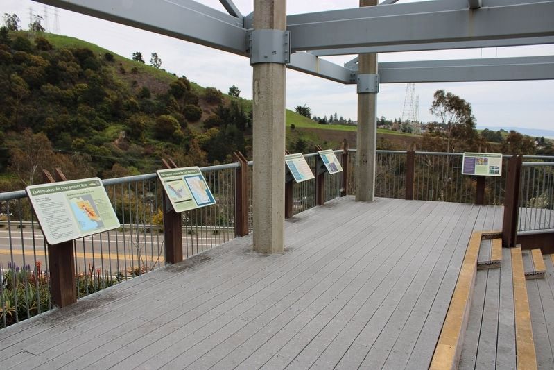
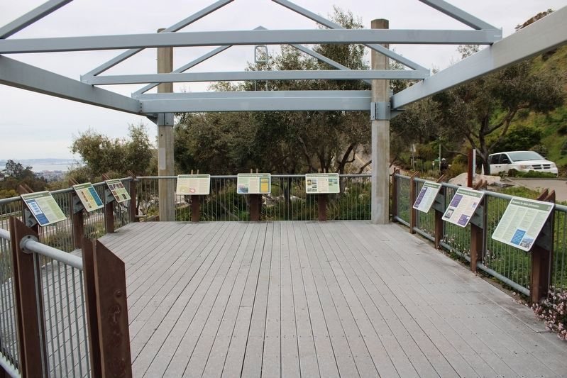
Fires and earthquakes are ever present dangers in the hills of the East Bay. This community exhibit provides a historical overview of major disasters in the area, and practical information on how local residents can prepare for and reduce damage from wildfires and earthquakes.
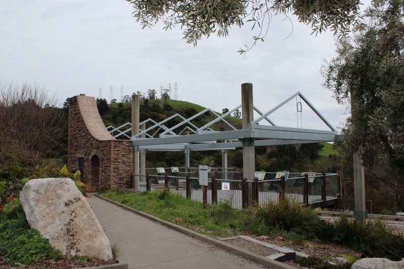
The pavilion, designed by 1991 Firestorm survivor Peter Scott, is symbolic of the destruction and renewal following the devastating firestorm.
Panel Two:
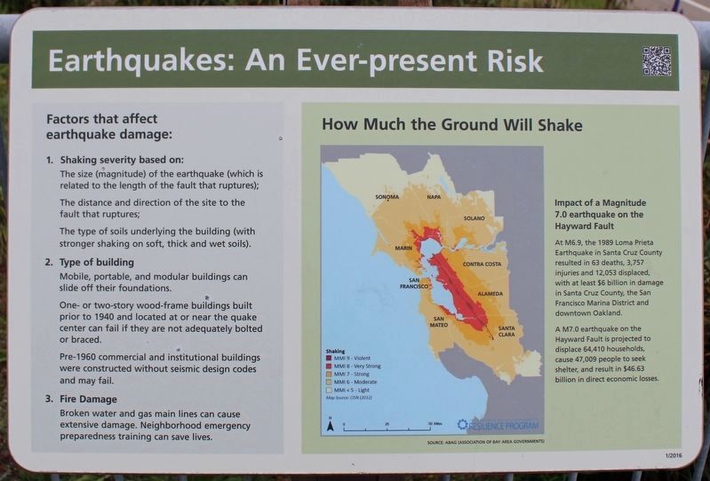
Earthquakes: An Ever-present Risk
How much the ground will shake
Impact of a Magnitude 7.0 earthquake on the Hayward Fault
At M6.9, the 1989 Loma Prieta Earthquake in Santa Cruz County resulted in 63 deaths, 3,757 injuries and 12,053 displaced, with at least $6 billion in damage in Santa Cruz County, the San Francisco Marina District and downtown Oakland.
A M7.0 earthquake on the Hayward Fault is projected to displace 64,410 households, cause 47,009 people to seek shelter, and result in $46.63 billion in direct economic losses.
Factors that affect earthquake damage:
1. Shaking severity based on:
The size (magnitude) of the earthquake (which is related to the length of the fault that ruptures);
The distance and direction of the site to the fault that ruptures;
The type of soils underlying the building (with stronger shaking on soft, thick and wet soils).
2. Type of building
Mobile, portable, and modular buildings can slide off their foundations.
One- and two-story wood-frame buildings built prior to 1940 and located at or near the quake center can fail if they are not adequately bolted or braced.
Pre-1960 commercial and institutional buildings were constructed without seismic design codes and may fail.
3. Fire Damage
Broken water and gas main lines can cause extensive damage. Neighborhood emergence preparedness training can save lives.
Panel Three:
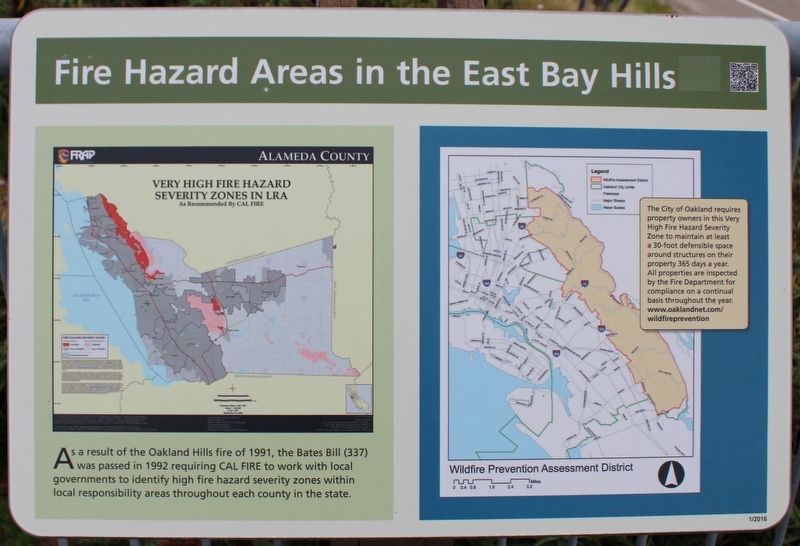
Fire Hazard Areas in the East Bay Hills
As a result of the Oakland Hills fire of 1991, the Bates Bill (337) was passed in 1992 requiring CAL FIRE to work with local governments to identify high fire hazard severity zones within local responsibility areas throughout each county in the state.
The City of Oakland requires property owners in this Very High Fire Hazard Severity Zone to maintain at least a 30-foot defensible space around structures on their property 365 days a year. All properties are inspected by the Fire Department for compliance on a continual basis throughout the year. www.oaklandnet.com/wildfireprevention
Panel Four:
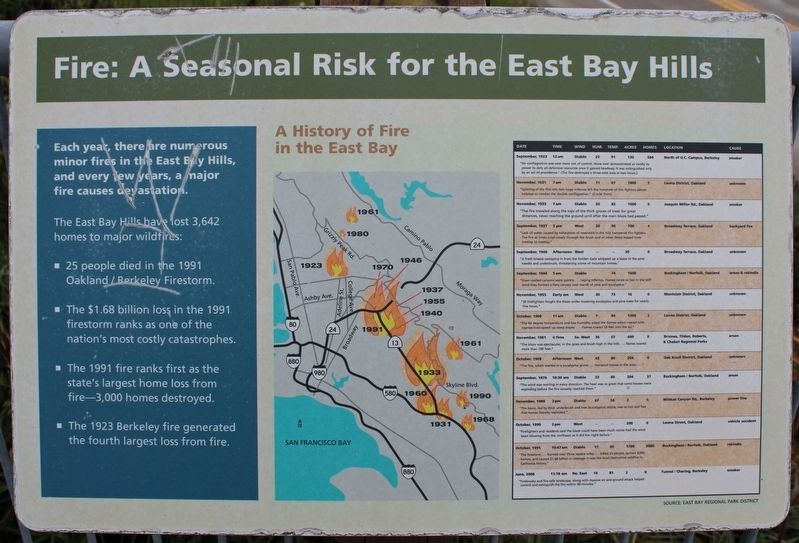
Fire: A Seasonal Risk for the East Bay Hills
A History of Fire in the East Bay
Each year, there are numerous minor fires in the East Bay Hills, and every few years, a major fire causes devastation.
The East Bay Hills have lost 3,642 homes to major wildfires:
• 25 people died in the 1991 Oakland / Berkeley Firestorm.
• The $1.68 billion loss in the 1991 firestorm ranks as one of the nation’s most costly catastrophes.
• The 1991 fire ranks first as the state’s largest home loss from fire – 3,000 homes destroyed.
• The 1923 Berkeley fire generated the fourth largest loss from fire.
Panel Five:
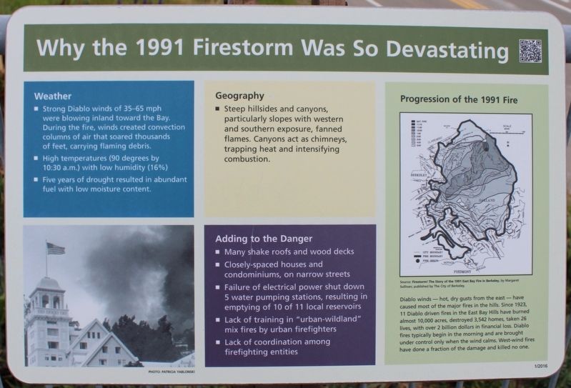
Why the 1991 Firestorm Was So Devastating
Weather
• Strong Diablo winds of 35-65 mph were blowing inland toward the Bay. During the fire, winds created convection columns of air that soared thousands of feet, carrying flaming debris.
• High temperatures (90 degrees by 10:30 a.m.) with low humidity (16%)
• Five years of drought resulted in abundant fuel with low moisture content.
Geography
• Steep hillsides and canyons, particularly slopes with western and southern exposure, fanned flames. Canyons act as chimneys, trapping heat and intensifying combustion.
Adding to the Danger
• Many shake roofs and wood decks
• Closely-spaced houses and condominiums, on narrow streets
• Failure of electrical power shut down 5 water pumping stations, resulting in emptying of 10 of 11 local reservoirs
• Lack of training in “urban-wildland” mix fires by urban firefighters
• Lack of coordination among firefighting entities
Progression of the 1991 Fire
Diablo winds – hot, dry gusts from the east – have caused most of the major fires in the hills. Since 1923, 11 Diablo driven fires in the East Bay Hills have burned almost 10,000 acres, destroyed 3,542 homes, taken 26 lives, with over 2 billion dollars in financial loss. Diablo fires typically begin in the morning and are brought under control only when the wind calms. West-wind fires have done a fraction of the damage and killed no one.
Panel Six:
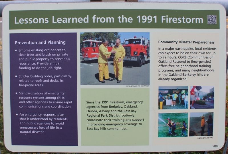
Lesson Learned from the 1991 Firestorm
Since the 1991 Firestorm, emergency agencies from Berkeley, Oakland, Orinda, Albany and the East Bay Regional Park District routinely coordinate their training and support in providing emergency coverage to East Bay hills communities.
Prevention and Planning
• Enforce existing ordinances to clear trees and brush on private and public property to prevent a recurrence. Provide annual funding to do the job right.
• Stricter building codes, particularly related to roofs and decks, in fire-prone areas.
• Standardization of emergency response systems among cities and other agencies to ensure rapid communications and coordination.
• An emergency response plan that is understood by residents and public agencies to avoid unnecessary loss of life in a natural disaster.
Community Disaster Preparedness
In a major earthquake, local residents can expect to be on their own for up to 72 hours. CORE (Communities of Oakland Respond to Emergencies) offers free neighborhood training programs, and many neighborhoods in the Oakland-Berkeley hills are already organized.
Topics. This historical marker is listed in this topic list: Disasters.
Location. 37° 51.004′ N, 122° 13.547′ W. Marker is in Oakland, California, in Alameda County. It is in Oakland Hills. Marker is on Tunnel Road east of Caldecott Lane, on the right when traveling east. The resin markers are mounted around the upper deck railing. Touch for map. Marker is at or near this postal address: 2299 Tunnel Road, Oakland CA 94618, United States of America. Touch for directions.
Other nearby markers. At least 8 other markers are within 2 miles of this marker, measured as the crow flies. The Railroad History of Lake Temescal (approx. 0.3 miles away); Kennedy Tunnel (approx. ¾ mile away); John Muir School (approx. 1.2 miles away); Claremont Court Gate and Street Markers (approx. 1.2 miles away); Claremont Public Improvements (approx. 1.3 miles away); Samuel Merritt, M.D. (approx. 1.3 miles away); Star Grocery (approx. 1.3 miles away); William Taylor (approx. 1.3 miles away). Touch for a list and map of all markers in Oakland.
More about this marker. There are nine additional panels on the lower deck with information about emergency preparedness.
Also see . . .
1. M6.9 October 17, 1989 Loma Prieta Earthquake. United States Geological Survey
"The 1989 Loma Prieta earthquake ended decades of tranquility in the San Francisco Bay region. It was a wakeup call to prepare for the potentially even more devastating shocks that are inevitable in the future."(Submitted on May 4, 2023, by Joseph Alvarado of Livermore, California.)
2. Fire sweeps through Oakland hills. History.com
"Fires had previously raged through the hills in 1923, 1970 and 1980. Each time, the fires occurred during autumn in a year with relatively little precipitation, and, each time, the residents rebuilt and moved back in as soon as possible."(Submitted on May 4, 2023, by Joseph Alvarado of Livermore, California.)
Credits. This page was last revised on May 4, 2023. It was originally submitted on May 4, 2023, by Joseph Alvarado of Livermore, California. This page has been viewed 142 times since then and 23 times this year. Photos: 1, 2, 3, 4, 5, 6, 7, 8, 9, 10. submitted on May 4, 2023, by Joseph Alvarado of Livermore, California.
