Near Briggs in Burnet County, Texas — The American South (West South Central)
The Community of Briggs
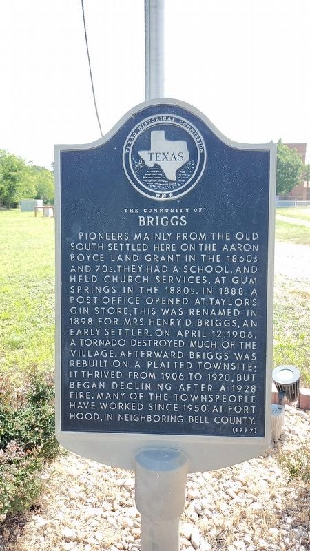
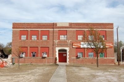
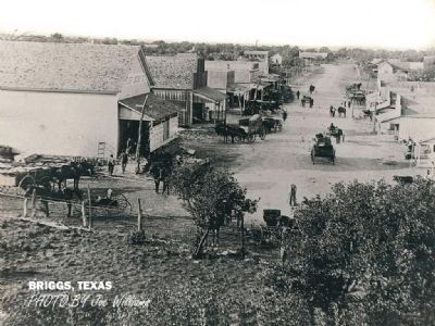
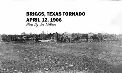
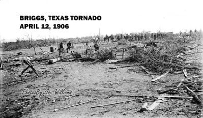
Pioneers mainly from the Old South settled here on the Aaron Boyce land grant in the 1860s and 70s. They had a school, and held church services, at Gum Springs in the 1880s. In 1888 a post office opened at Taylor's Gin Store; this was renamed in 1898 for Mrs. Henry D. Briggs, an early settler. On April 12, 1906, a tornado destroyed much of the village. Afterward Briggs was rebuilt on a platted townsite; it thrived from 1906 to 1920, but began declining after a 1928 fire. Many of the townspeople have worked since 1950 at Fort Hood, in neighboring Bell County.
Erected 1977 by Texas Historical Commission. (Marker Number 9702.)
Topics. This historical marker is listed in this topic list: Settlements & Settlers. A significant historical year for this entry is 1898.
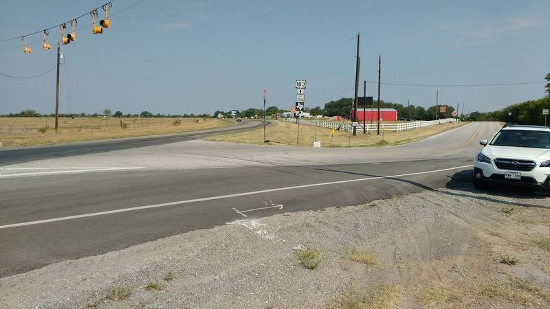
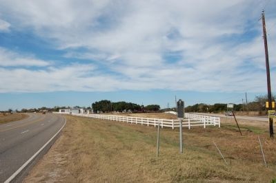
Location. 30° 53.328′ N, 97° 55.468′ W. Marker is near Briggs, Texas, in Burnet County. Marker is on Loop 308 north of Brown Avenue, on the right when traveling north. Touch for map. Marker is at or near this postal address: 185 Loop 308, Briggs, TX 78608, Briggs TX 78608, United States of America. Touch for directions.
Other nearby markers. At least 8 other markers are within 6 miles of this marker, measured as the crow flies. Briggs State Bank (about 300 feet away, measured in a direct line); DeWolfe-Dillingham Community Cemetery (approx. 0.9 miles away); Prairie View Cemetery (approx. 2.1 miles away); Mahomet-Sycamore Springs Community (approx. 4.7 miles away); Mount Horeb Lodge (approx. 4.8 miles away); Mahomet Cemetery (approx. 5 miles away); Gillum Cemetery (approx. 5.3 miles away); Smart-McCormick Home (approx. 5.8 miles away). Touch for a list and map of all markers in Briggs.
Also see . . .
1. Briggs, TX. (Submitted on February 13, 2010, by Keith Peterson of Cedar Park, Texas.)
2. Texas Escapes article about the tornado of 1906. Includes wonderful photos. (Submitted on March 17, 2012, by Richard Denney of Austin, Texas.)
3. Briggs, Brief Annals of the Times and People, From Gum Springs to 1960. The definitive history for Briggs, TX, this book edited by Ernest Langford has long been out of publication, and finding a copy is very difficult. It has now been scanned and is available on-line. (Submitted on March 17, 2012, by Richard Denney of Austin, Texas.)
Additional commentary.
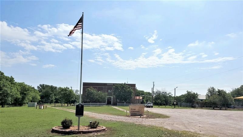
1. The marker is now located in front of the Briggs Community Center, Inc.
— Submitted February 12, 2022, by Crystal Kinsey of Briggs, Texas.
Photographed By Richard Denney
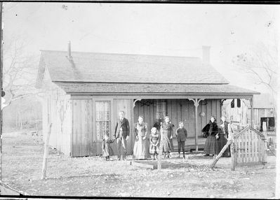
10. Goodloe home, Briggs, Texas
Goodloe home in Briggs, Texas.
Left to right: Bryan Goodloe (little boy wearing cap and "dress"), John Goodloe and wife Margaret Jane (Montgomery) Goodloe, Madeline Goodloe (Richard Denney’s grandmother), Beulah and Ernest Goodloe.
Two ladies to right may be Miss Alice Harta (sp?) and Pearl Hale.
Photo is probably late 1800s. Margaret died in 1901 of the "white plague" (TB) that swept the country in the late 19th century, including Briggs. John and Margaret are both buried in the Mount Moriah Cemetery, Briggs.
Photographed By Richard Denney
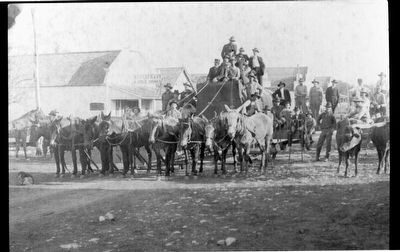
11. Main Street Briggs, "boiler" being moved, circa 1908
This picture shows a boiler being moved from the G.E. West Gin to Briggs in about 1908. It was bought by Lloyd and John Ellison. In the picture are John Ellison and his team of oxen, Lloyd Ellison, Sid Jordan, Jim Jordan, Homer Jordan, Jim Presslar, A.W. Horne, J.T. Harton, Jim Harton, Edwin Harton (age 3), J.M. West driver (right), W.M. Hall driving team (left), Charlie O. West, Hill DeWolf, John E. Moore (on crutches), Doyle Moore, and Bryan Goodloe (wearing cap with wagon being drawn by cows to right). Sign on building on left reads “RESTAURANT & Cold Drinks”. Another sign in back reads “GROCERY".
Credits. This page was last revised on May 7, 2023. It was originally submitted on February 13, 2010, by Keith Peterson of Cedar Park, Texas. This page has been viewed 1,941 times since then and 64 times this year. Last updated on May 7, 2023, by Richard Denney of Austin, Texas. Photos: 1. submitted on May 7, 2023, by Richard Denney of Austin, Texas. 2. submitted on February 13, 2010, by Keith Peterson of Cedar Park, Texas. 3. submitted on May 7, 2023, by Richard Denney of Austin, Texas. 4. submitted on July 30, 2018, by Richard Denney of Austin, Texas. 5, 6. submitted on February 13, 2010, by Keith Peterson of Cedar Park, Texas. 7, 8, 9. submitted on November 21, 2011, by Richard Denney of Austin, Texas. 10. submitted on December 11, 2011, by Richard Denney of Austin, Texas. 11. submitted on December 15, 2011, by Richard Denney of Austin, Texas. • J. Makali Bruton was the editor who published this page.
