Central in Denver in Denver County, Colorado — The American Mountains (Southwest)
Sugar Building
1906
— Lower Downtown Walking Tour —
Inscription.
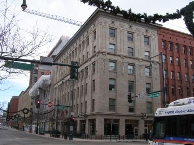
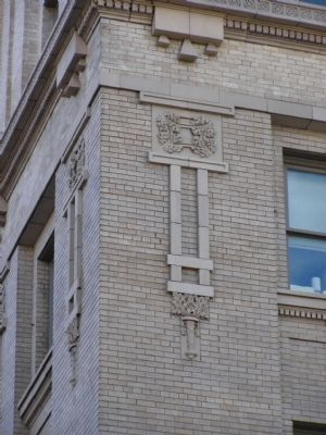
The sweet smell of success pervaded the Sugar Building from 1906, when it was constructed by the Great Western Sugar Company. During the 1920's, GW became the largest producer of sugar beets in the country. The original building was four stories high and designed by Gove & Walsh Architects. A two-story addition was made to the building in 1912. Located in the heart of Denver's Warehouse District, the sugar building is functional in design and notable for its Sullivanesque arrangement of windows between vertical piers as well as for its use of terra cotta decoration based on geometric and foliage forms. Inside, two original Otis Elevators with iron cages and gates remain as surviving examples of this vintage. the Wazee Street side of the building extends three bays to where it is joined to the warehouse, a red brick building of the same height. A testament to the substantial influence of the Great Western Sugar Company on the economy of Colorado, and to the men who founded it and led its empire, the Sugar Building stands tall and proud and sweet.
Topics. This historical marker is listed in this topic list: Industry & Commerce. A significant historical year for this entry is 1906.
Location. 39° 45.066′ N, 105° 0.001′ W. Marker is in Denver, Colorado, in Denver County. It is in Central. Marker is at the intersection of 16th Street and Wazee Street on 16th Street. Touch for map. Marker is in this post office area: Denver CO 80202, United States of America. Touch for directions.
Other nearby markers. At least 8 other markers are within walking distance of this marker. Henry Lee Building (within shouting distance of this marker); Barteldes, Hartig Building (about 400 feet away, measured in a direct line); C. S. Morey Mercantile Building (about 400 feet away); Local Transit Through the Ages (about 500 feet away); Oxford Hotel and Annex (about 500 feet away); Barney Ford Building (about 500 feet away); 15th / Wazee Street (about 500 feet away); Constitution Hall (about 500 feet away). Touch for a list and map of all markers in Denver.
Credits. This page was last revised on February 7, 2023. It was originally submitted on March 27, 2008, by Christopher Light of Valparaiso, Indiana. This page has been viewed 4,404 times since then and 101 times this year. Last updated on September 8, 2009, by Christopher Light of Valparaiso, Indiana. Photos: 1, 2, 3. submitted on March 27, 2008, by Christopher Light of Valparaiso, Indiana. • Kevin W. was the editor who published this page.


