Christchurch in Dorset, England, United Kingdom — Northwestern Europe (the British Isles)
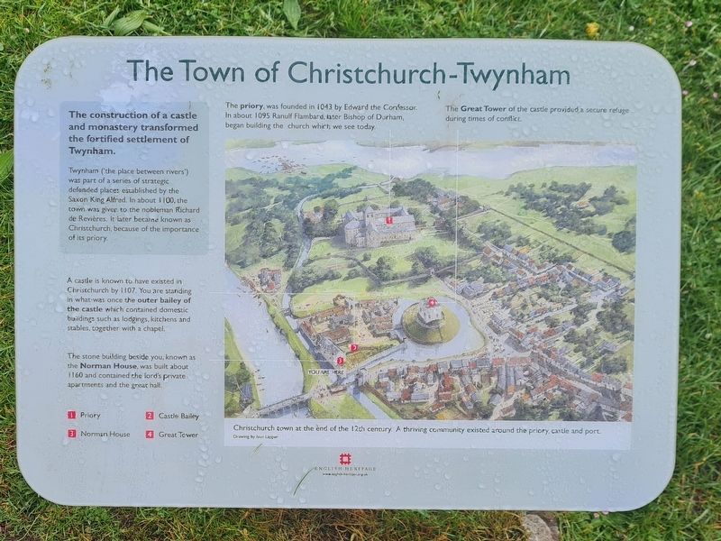
The Town of Christchurch-Twynham
The construction of a castle and monastery transformed the fortified settlement of Twynham.
Twynham (the place between rivers') was part of a series of strategic defended places established by the Saxon King Alfred. In about 1100, the town was given to the nobleman Richard-de Revières, it later became known as Christchurch, because of the importance of its priory.
A castle is known to have existed in Christchurch by 1107. You are standing in what was once the outer bailey of the castle which contained domestic buildings such as lodgings, kitchens and stables, together with a chapel.
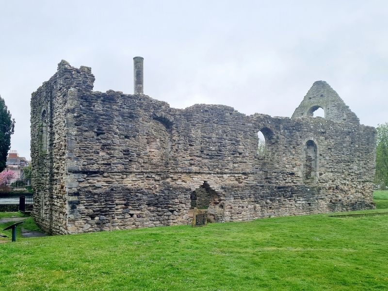
The stone building beside you, known as the Norman House, was built about 1160 and contained the lord's private apartments and the great hall.
The priory, was founded in 1043 by Edward the Confessor. In about 1095 Ranulf Flambard, later Bishop of Durham, began building the church which we see today.
The Great Tower of the castle provided a secure refuge during times of conflict.
Erected by English Heritage.
Topics. This historical marker is listed in these topic lists: Churches & Religion • Forts and Castles • Settlements & Settlers.
Location. 50° 44.029′ N, 1° 46.447′ W. Marker is in Christchurch, England, in Dorset. Marker is on Castle Street, on the right when traveling east. Opposite The Kings Arms hotel and the right of the "Norman House". Touch for map. Marker is at or near this postal address: 18 Castle Street, Christchurch, England BH23 1DT, United Kingdom. Touch for directions.
Other nearby markers. At least 4 other markers are within walking distance of this marker. Christchurch Castle and Norman House (within shouting distance of this marker); The Ducking Stool (about 90 meters away, measured in a direct line); Priory Church (about 150 meters away); World War II Memorial (approx. 0.3 kilometers away).
Credits. This page was last revised on May 15, 2023. It was originally submitted on May 13, 2023, by Stephen Palmer of Ascot, England. This page has been viewed 101 times since then and 30 times this year. Photos: 1, 2. submitted on May 13, 2023, by Stephen Palmer of Ascot, England. • Andrew Ruppenstein was the editor who published this page.

