Sullivan's Island in Charleston County, South Carolina — The American South (South Atlantic)
Parade Ground and Flagpole Area
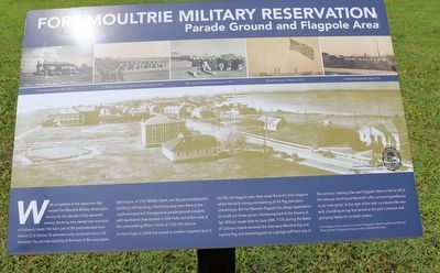
Fort Moultrie Military Reservation
With completion of the expansion that created Fort Moultrie Military Reservation during the first decade of the twentieth century, the Army now owned over one-third of Sullivanís Island. The main part of the post extended from Station 12 to Station 18 and eventually comprised some 250 structures. You are now standing at the heart of the reservation.
Behind you, at 1701 Middle Street, was the post headquarters building (still standing.) Stretching away from there to the south and west was the expansive parade ground complete with bandstand (now located in Stith Park) and within view of the commanding officerís homes at 1702 IíOn Avenue.
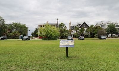
In front of you is a field that served another important part of fort life, the flagpole area. Here stood the postís main flagpole where the daily raising and lowering of the flag took place. Interestingly, the Fort Moultrie flagpole has always appeared to be made out of two pieces, hearkening back to the bravery of Sgt. William Jasper who on June 28th, 1776, during the Battle of Sullivanís Island retrieved the shot-away Moultrie flag and tied the flag and remaining pole to a sponge staff from one of the cannons, creating a two-part flagpole. Here on the far left of the field was the Provost Marshallís office and post guardhouse or jail (now gone). To the right of the field is a mound-like area with a building on top that served as the postís reservoir and pumping station for its water system.
Erected by Town of Sullivan's Island.
Topics. This historical marker is listed in this topic list: Military.
Location. 32° 45.566′ N, 79° 50.987′ W. Marker is on Sullivan's Island, South Carolina, in Charleston County. Marker is at the intersection of Thompson Avenue and Station 17 Street, on the left when traveling west on Thompson Avenue. Touch for map. Marker is at or near this postal address: 1656 Thompson Ave, Sullivans Island SC 29482, United States of America. Touch for directions.
Other nearby markers. At least 8 other markers are within walking distance of this marker. Rear Gate & Second Post Chapel (approx. ľ mile away); Fort Moultrie (approx. ľ mile away); Battery Commander's Station (approx. 0.3 miles away); Projectile Delivery Table (approx. 0.3 miles away); Communications (approx. 0.3 miles away); In The Days Before Computers (approx. 0.3 miles away); Disappearing Rifle: The Endicott System (approx. 0.3 miles away); Sullivan's Island Life-Saving Station (approx. 0.4 miles away). Touch for a list and map of all markers in Sullivan's Island.
Credits. This page was last revised on June 5, 2023. It was originally submitted on May 22, 2023, by Dave W of Co, Colorado. This page has been viewed 114 times since then and 42 times this year. Photos: 1, 2. submitted on May 22, 2023, by Dave W of Co, Colorado. • Bernard Fisher was the editor who published this page.

