Near Fayetteville in Washington County, Arkansas — The American South (West South Central)
Son's Chapel
Photographed by Duane and Tracy Marsteller, May 20, 2023
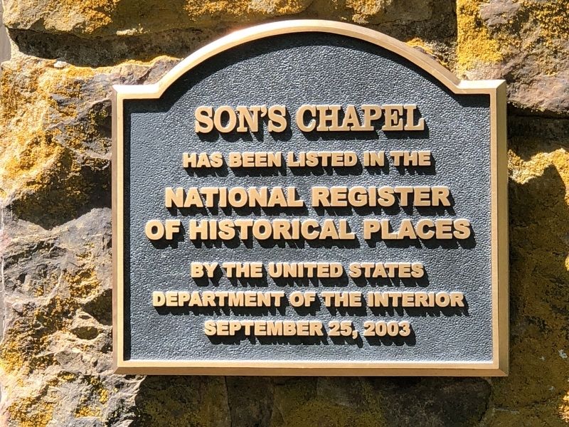
1. Son's Chapel Marker
National Register
of Historical Places
by the United States
Department of the Interior
September 25, 2003
Topics. This historical marker is listed in these topic lists: Architecture • Religion & Religious Structures. A significant historical date for this entry is August 23, 1842.
Location. 36° 6.115′ N, 94° 4.949′ W. Marker is near Fayetteville, Arkansas, in Washington County. It is on East Mission Boulevard (Arkansas Route 45) 0.1 miles west of North Chapel View Road, on the right when traveling west. Touch for map. Marker is at or near this postal address: 5480 E Mission Blvd, Fayetteville AR 72703, United States of America. Touch for directions.

Regionally, this marker is in Northwest Arkansas, on the Ozark Plateau, in the Cherokee Heritage Region, and in Osage Territory. It is also in the American South, specifically in the Upper South, and in the Ozarks. Globally, it is in North America, the Western Hemisphere, the Western World, and the Anglosphere. Historically, it finds itself in what was once the territory of the Mississippian Culture, the Louisiana Purchase, one of the Confederate
this page online
Other nearby markers. At least 8 other markers are within 5 miles of this marker, measured as the crow flies: Son's Chapel School (within shouting distance of this marker); Replica of the Statue of Liberty (approx. 4.4 miles away); Purple Heart Memorial (approx. 4½ miles away); Wade-Heerwagen House (approx. 4.7 miles away); David Walker (approx. 4.8 miles away); Walker Family Plot (approx. 4.8 miles away); Wilson Park History (approx. 4.8 miles away); Founding Ladies of the Southern Memorial Association (approx. 4.8 miles away). Touch for a list and map of all markers in Fayetteville.
Regarding Son's Chapel. Excerpt from the National Register nomination:
Son's Chapel sits on land that was once part of the original 160-acre tract of Indian lands granted under the Treaty of Dancing Rabbit Creek (August 23, 1842). By 1848, 40 acres of this tract was patented to early settler Michael Son and his wife Nancy. Michael Son had settled on the land the year before. The Sons conveyed property for a church and, in time, a cemetery. The area became known as "Son's Chapel". …
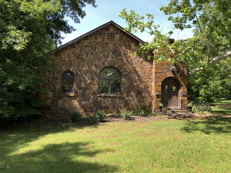
The construction ofSon's Chapel was merely a dream of local community women who, on October 19, 1922, organized for the purpose of erecting a new community building.…Photographed by Duane and Tracy Marsteller, May 20, 20232. Son's Chapel Marker
On June 3, 1933, W. R. and Grace Reed Porter, who owned a portion of the original Michael Son land, donated the land on which to erect the new building.…
Sometime between 1936 and 1937, the outer stone walls, roof, and windows were in place. However, the interior was not furnished. … Completion of the interior began in 1937 with the design assistance of Thayer Shelton, prominent Fayetteville architect. On May 26, 1940, Son's Chapel was dedicated as a community Protestant church.
Also see . . .
1. Son's Chapel. Wikipedia entry (Submitted on July 10, 2024, by Larry Gertner of New York, New York.)
2. Son's Chapel (PDF). National Register nomination (with photographs) submitted for the building. (National Archives) (Submitted on May 31, 2023, by Duane and Tracy Marsteller of Murfreesboro, Tennessee.)
Credits. This page was last revised on July 10, 2024. It was originally submitted on May 31, 2023, by Duane and Tracy Marsteller of Murfreesboro, Tennessee. This page has been viewed 173 times since then and 32 times this year. Photos: 1, 2. submitted on May 31, 2023, by Duane and Tracy Marsteller of Murfreesboro, Tennessee.
