Sulphur Springs in Benton County, Arkansas — The American South (West South Central)
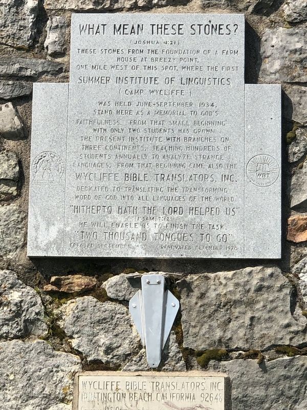
What Mean These Stones?
(Joshua 4:21)
(1 Sam: 7:12)
He will enable us to finish the task.
“Two thousand tongues to go”
Erected 1959 by Wycliffe Bible Translators, Inc.
Topics. This historical marker is listed in these topic lists: Arts, Letters, Music • Churches & Religion. A significant historical month for this entry is June 1934.
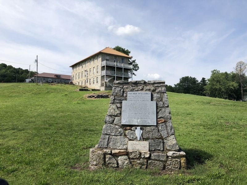
Location. 36° 28.838′ N, 94° 27.419′ W. Marker is in Sulphur Springs, Arkansas, in Benton County. Marker is at the intersection of State Highway 59 and East Patterson Street, on the right when traveling south on State Highway 59. Touch for map. Marker is in this post office area: Gravette AR 72736, United States of America. Touch for directions.
Other nearby markers. At least 8 other markers are within 10 miles of this marker, measured as the crow flies. Sulphur Springs Park Reserve (about 500 feet away, measured in a direct line); Kansas City Southern Railway Caboose #383 (approx. 4.1 miles away); Arkansas & Oklahoma Railroad (approx. 4.1 miles away); Camp Jackson / Confederate Dead (approx. 5.8 miles away); Georgia Cemetery (approx. 5.9 miles away); Camp Walker (approx. 7.9 miles away); McDonald County (approx. 8.2 miles away in Missouri); The Battle of Maysville (approx. 9.7 miles away).
Also see . . .
1. William Cameron "Uncle Cam" Townsend (1896–1982). In June 1934, William Cameron Townsend, along with Leonard Livingston Legters, founded a linguistic training program for the purpose of promoting Bible translation among minority language groups. (Matt Petersen and Borghy Holm, Encyclopedia of Arkansas) (Submitted on June 2, 2023, by Duane and Tracy Marsteller of Murfreesboro, Tennessee.)
2. Bible translators are Arkansas-grown. Wycliffe Bible Translators, the worldwide ministry bringing the Bible to people in their native languages, got its start right here in Arkansas. (Christie Storm, Arkansas Democrat-Gazette, posted March 29, 2008) (Submitted on June 2, 2023, by Duane and Tracy Marsteller of Murfreesboro, Tennessee.)
Credits. This page was last revised on June 2, 2023. It was originally submitted on June 2, 2023, by Duane and Tracy Marsteller of Murfreesboro, Tennessee. This page has been viewed 124 times since then and 50 times this year. Photos: 1, 2. submitted on June 2, 2023, by Duane and Tracy Marsteller of Murfreesboro, Tennessee.

