Immanuel near Almyra in Arkansas County, Arkansas — The American South (West South Central)
Immanuel High School
School District #73
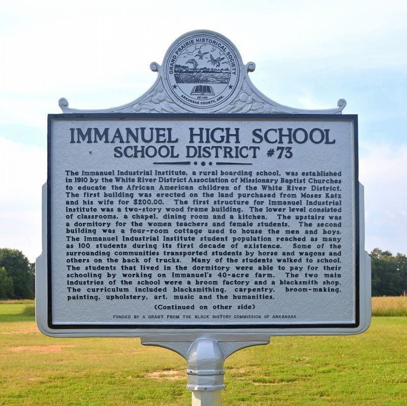
Photographed by Raeann Braithwaite, June 4, 2023
1. Immanuel High School Marker
this page online
In 1923, P. A. Garrison, N. A. Johnson and S. E. Ryan, legal trustees, deeded two acres of the forty to the public school system for an African American public school site on which a Rosenwald building was erected, creating School District Number 70. In 1947, the Arkansas County Court dissolved School Districts No. 61 and No. 72 and annexed their territory to Immanuel. This paved the way for the formation of Arkansas County School District 73, creating Immanuel High School. During the 1950s, Immanuel’s enrollment reached as many as 506 students. In 1966 District No. 73 and the Immanuel High School were dissolved. The administrators of the Immanuel School from opening until closing were: P. A. Garrison, H. Drier, D. B. Marshall, C. C. Butler, Miles Butler, Henry Wright, J. Kent, L. R. McNeil, J. H. Bankhead, O. B. Elders, Sr., Brooks Williams, Jesse Mason, L. G. Standfield, Elijah Coleman, A. Tate, L. Harris, Marie Fowler, J. S. Clemmons, E. E. Bogan, M. C. Arrant, F. W. Smith, P. G. Faison, Timothy Young, Clyde O’Neal, and Johnnie Phillips. In 1978, Immanuel
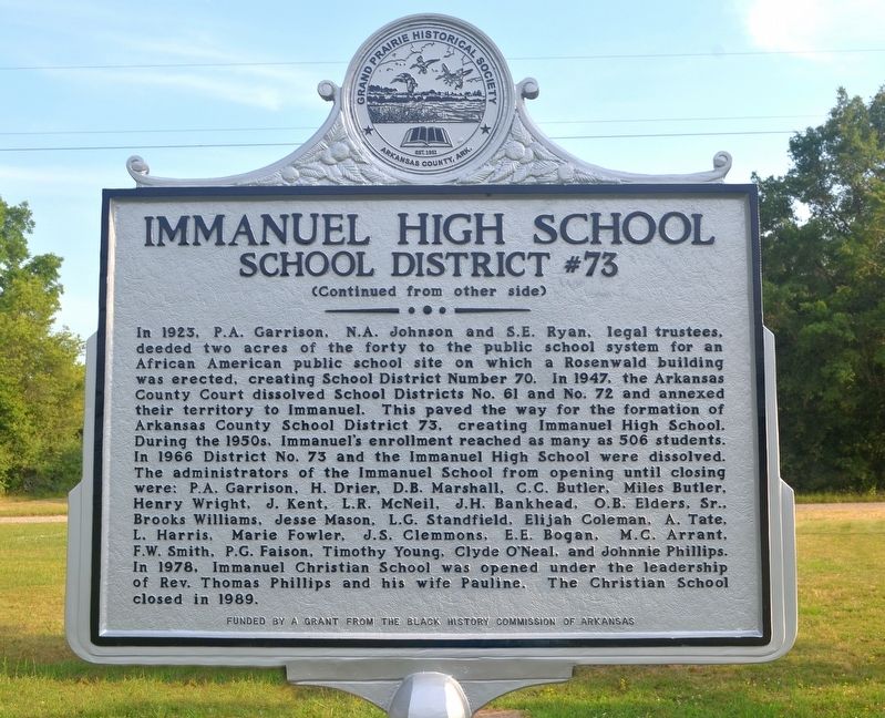
Photographed by Raeann Braithwaite, June 4, 2023
2. Immanuel High School Marker
Erected 2023 by Grand Prairie Historical Society and Black History Commission of Arkansas.
Topics. This historical marker is listed in these topic lists: African Americans • Education. A significant historical year for this entry is 1910.
Location. 34° 24.098′ N, 91° 19.333′ W. Marker is near Almyra, Arkansas, in Arkansas County. It is in Immanuel. It is on Immanuel Road half a mile east of Arkansas Route 33, on the left when traveling east. Touch for map. Marker is at or near this postal address: 68 Immanuel Road, Almyra AR 72003, United States of America. Touch for directions.

Regionally, this marker is in the Arkansas Delta, in the Mississippi Alluvial Plain, and in the Quapaw Homeland. It is also in the American South, specifically in the Upper South, and in the Mississippi Delta. Globally, it is in North America, the Western Hemisphere, the Western World, and the Anglosphere. Historically, it finds itself in what was once the Viceroyalty of New France, the territory of the Mississippian Culture, the Louisiana Purchase, one of the Confederate States of America, and the Antebellum South.
Other nearby markers. At least 8 other markers are within 17 miles of this marker, measured as the crow flies: Captain Alf Johnson's Spy Company (approx. 5.7 miles away); a different marker also named Crocketts Bluff (approx. 6½ miles away); St. Charles Battle Monument (approx. 10.8 miles away); J. Deane & Sons Hardware Store (approx. 11 miles away); Engagement at St. Charles (approx. 11.3 miles away); Bayou Meto Schoolhouse (approx. 16.4 miles away); Bayou Meto Cemetery (approx. 16.6 miles away); Bayou Meto United Methodist Church (approx. 16.7 miles away).
Another marker is no longer nearby. Crocketts Bluff (was approx. 6½ miles away but has been replaced with another marker now near it).
Also see . . . Historical marker dedicated at Immanuel High School (Stuttgart Daily Leader, May 31, 2023).
Excerpt: The dedication ceremony for a new historical marker for Immanuel High School was held Saturday, May 27, with about 75 persons in attendance. The mistress of ceremonies was Janice Streeter of the Citizens for Immanuel (CFI) Board of Directors.(Submitted on June 5, 2023.)
Credits. This page was last revised on June 5, 2023. It was originally submitted on June 5, 2023, by Glenn Mosenthin of Searcy, Arkansas. This page has been viewed 447 times since then and 46 times this year. Photos: 1, 2. submitted on June 5, 2023, by Glenn Mosenthin of Searcy, Arkansas. • Andrew Ruppenstein was the editor who published this page.
